Sandwiched between Glenrothes and Markinch in Fife, Balbirnie Park is a great destination for a spot of healthy outdoor exercise with some lovely woodland trails weaving through the rich mix of trees and rhododendrons and across well-tended swathes of grassland
The former estate grounds of Balbirnie House, now a hotel, are popular with locals and visitors and, to escape the crowds, I decided to use the park as a starting point for an exploration of some quieter countryside to the east, my itinerary including Star Moss, one of those special out of the way places where you can be at one with nature.
From a car park at the southern end of the drive leading to the hotel, I set off over grass bounded by trees, the path leading me into woodland where, after crossing a wee stone bridge, I negotiated a route out to the park’s East Lodge.
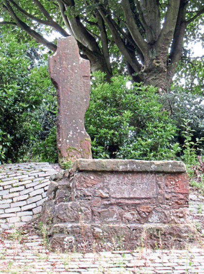
Heading up the road into Markinch, I passed medieval Stob Cross, a very heavily weathered stone slab cross sitting above the road, a small plaque opposite outlining a little of its history.
Markinch Hill, with its curious terraces, rises to the east, a path crossing the southern flank, descending to Northall Road where I left town, passed under the railway, and briefly joined Braes Loan Trail.
This tree-lined path climbs steadily between fields, gaps in the leafy branches and boughs offering views north to the Lomond Hills and west over Markinch.
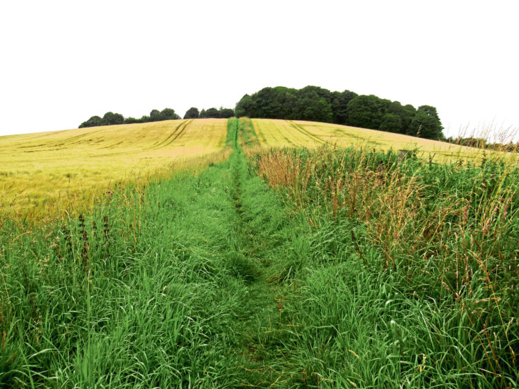
Higher up, the trail swings right and, hopping over a stone stile, I tramped up and over wooded Cuinin Hill, emerging into arable land, a path descending by wheat fields towards Star.
The moss lies to the north of the village and is accessed by a lane that leads to Broomfield Farm from where a track continues between plantations to an old signpost and a small information board almost concealed by vegetation.
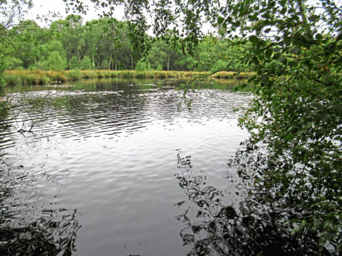
After rain, the onward track is muddy and rutted in places, but it is a very pleasant wander through birch woodland, fen, marsh and swamp, past a small pool where ducks gather.
Designated a Site of Special Scientific Interest, Star Moss is a wooded raised bog, once a well-used source of peat for heating, now a peaceful place to wander and enjoy the lush flora and fauna.
Game birds scattered as I left the moss and hiked up between fields to the next track junction where I turned west, track and then minor road cutting a straight course through farmland to Lochmuir Wood.
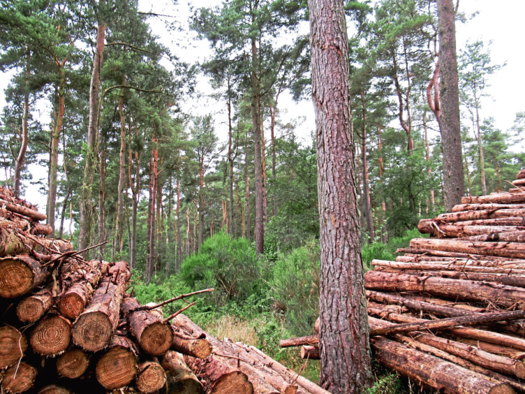
A good track runs south through this established plantation of Scots pine, passing bands of more recent and more diverse tree planting and, stepping quietly, I spotted a pair of energetic red squirrels chasing each other up and down one of the tall pines.
Their animated antics put my tiring legs to shame as I tramped out of the trees, crossed the railway (where a well-preserved wartime pillbox abuts the bridge) and, after a brief stint of road walking, re-entered Balbirnie Park.
Initially muddy, an otherwise excellent path leads west, curving left close to the North Lodge from where it rises gently to a fork where I dipped right to the ancient Balbirnie Stone Circle.
Accompanied by the lively Balbirnie Burn, a sturdy trail strikes south, a chance to explore the delights of Balbirnie Park before heading home.
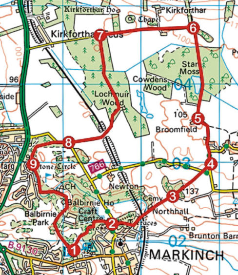
ROUTE
1. Cross driveway and follow path across grass. Entering trees, cross stone bridge, go right at next junction then left to crossroads. Go right to East Lodge.
2. Cross Stob Cross Road, go right up to Markinch sign then left, through gate, following path over Markinch Hill to Northall Road. Turn left, pass below railway and ascend track (signed Star) then path to right of houses.
3. Cross stone stile in wall and ascend path over Cuinin Hill, descending to minor road. Cross and continue to next road.
4. Go left along road. Entering Star, fork left to Broomfield Farm.
5. Bear right at farm entrance, following track north through Star Moss. Leaving woodland, continue north between fields to next junction.
6. Go left along track to house then continue for 750m along road.
7. Turn left and follow forest track south to cottage. Bear right and continue over railway to meet road.
8. Proceed ahead along road, go through gate and follow woodland path to stone circle.
9. Follow path south to golf clubhouse then driveway, passing hotel, back to car park.
INFO
Distance: 10km/6¼ miles
Ascent: 170m/560ft
Time: 3 hours
Grading: Moderate route through parkland, woodland and across farmland following good tracks and paths. Some sections can be muddy underfoot, so stout footwear recommended. Keep dogs on lead where signs request
Start/finish: Balbirnie Park car park, signed off B9130, Markinch, at southern end of Balbirnie House driveway (Grid ref: NO 292018)
Map: Ordnance Survey 1:50,000 Landranger sheet 59; Ordnance Survey 1:25,000 Explorer sheet 370
Tourist Information: St Andrews iCentre, 70 Market Street, St Andrews KY16 9NU (Tel 01334 472021)
Public transport: Stagecoach bus services 43 and 44 and Moffat and Williamson bus services 5, 67 and M4. Markinch railway station is 15 minutes’ walk from the park