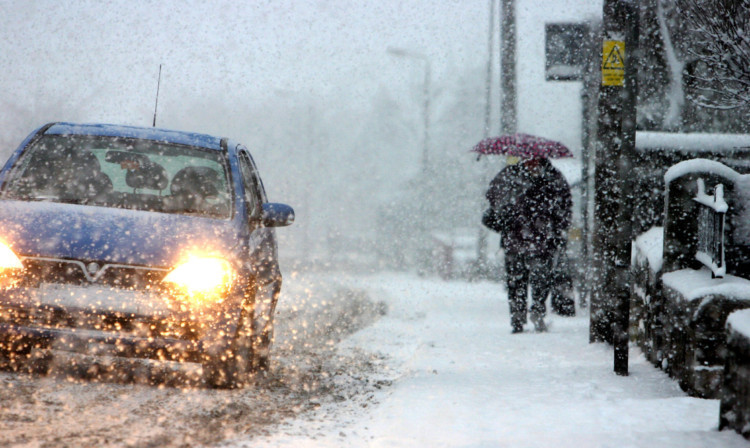
Blizzards and winds of up to 90mph could hit Scotland on Thursday.
Gusts of 70-80mph are predicted across much of the country and could reach 90mph in the north and west.
An “Arctic air mass” is expected to bring snow, with 5-10cm possible across the north and a dusting likely in the south, according to MeteoGroup, the weather division of the Press Association.
The Met Office has issued yellow “be aware” warnings of snow for all areas of the country on Thursday, apart from Lothian and Borders and the south-west.
Amber “be prepared” warnings of wind have been issued for all areas of Scotland apart from Grampian which has the less severe yellow warning.
Icy roads are possible and speed restrictions are likely on some bridges.Click here for live updatesHigh winds are likely to disrupt ferry services, while Network Rail and ScotRail say some lines will have fewer trains and speed restrictions.
Chief Superintendent Iain Murray, head of road policing for Police Scotland, said: “The weather in Scotland can change very quickly and it’s vital drivers are prepared. In recent years we have seen high winds, blizzards, snow and freezing conditions.
“The next few days is expected to bring with it some strong winds and severe cold weather and I would advise motorists to take care. Allow extra time for your journey and a keep a few emergency supplies such as water and food in your vehicle to cover any eventualities.”
The Multi Agency Response Team, which comprises representatives from Traffic Scotland, Transport Scotland, the police, rail operators, road operating companies and the Met Office, will be activated this evening.
Martin Thomson, winter resilience manager for Transport Scotland, said: “Traffic Scotland are already informing the travelling public about the expected difficult conditions on Thursday morning. The Scottish Government is also monitoring the situation to assess what impact these warnings will have and stand ready to respond.
“I would also urge the travelling public to consider the conditions before they set off on their journeys. They should listen to radio reports, visit the Traffic Scotland website or twitter feed, and carefully consider police advice.”
The cold snap is not expected to last long with the worst of the weather tomorrow.
MeteoGroup forecaster Billy Payne said: “An area of low pressure is going to bring stormy conditions for a time tonight and into tomorrow morning. Heavy rain coming south through the morning will leave Scotland in an Arctic air mass with snow showers following behind.
“The winds will ease through the afternoon though remaining quite brisk and it’s possible that the north could see some blizzard-like conditions with strong winds and snow showers.”
The weather should then ease off, although temperatures are likely to stay below freezing on Thursday night and could be as low as minus 6C in some places.
Friday is likely to be very cold as temperatures struggle to rise above freezing.
Forecasters predicted that it will warm up over the weekend, with temperatures reaching double digits by Sunday.