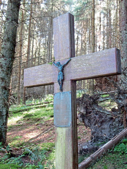
Hidden away in woodland overlooking the Angus village of Newtyle, a lone wooden cross stands amongst the trees.
Known as the Polish Priest’s Cross, the simple yet sturdy oak memorial marks the spot where a wartime chaplain died while out walking in the forest, a peaceful tragedy commemorated by the soldiers, far from home, whose spiritual needs he tended to.
On a previous hike up Newtyle Hill, I passed signs for the cross but did not make the half mile detour to it so decided to return on a route that would visit this sombre, out of the way spot.
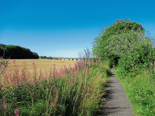
The memorial stands in High Bannatyne Plantation, on the northern slopes of Newtyle Hill, but before climbing to it, I set out to explore the well-established village path network, which makes excellent use of long abandoned local railway lines.
The first of these led me north out of Newtyle, the leafy old embankment a popular route through arable fields and then woodland, a bench or two along the way offering places to pause and enjoy the outlook.
Curving west by the remains of an old stone platform, I carefully crossed the B954 – the railway bridge here is long gone – before re-joining the trackbed and puffing on towards Camno Crossing, spotting roe deer lurking amid wheat in the field to my left.
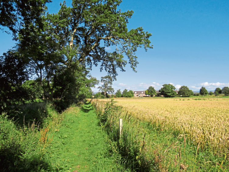
Descending steps to meet the road, quiet country lanes guided me from Camno Crossing up to cottages at Newbigging from where a good path cuts between fields, running alongside a wee stream, to meet another section of the dismantled railway.
Steps ascend the embankment to the trackbed which arcs south, this the line that ran from Newtyle to Dundee until its closure in 1967. My journey was somewhat shorter – just to the next path junction where I branched off, crossing a stone bridge spanning the line before heading up the side of the adjacent field towards High Bannatyne Plantation.
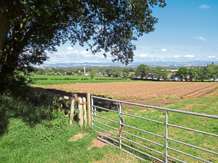
Pausing for a breather on the edge of the forest, my gaze was drawn north over the wide vale of Strathmore towards the hills of the Angus Glens and east to Kinpurney Hill, one of the Sidlaw peaks, with its landmark summit tower.
Delving into the woods above me, I soon spotted a small wooden stile on the left side of the track, easy access to the plantation, a slim grassy path, muddy in places, running east through trees and bushes.
Approaching a field with another excellent view of Kinpurney Hill, the path curves right, rising a little before it swings left, continuing below tall conifers where I kept my eyes peeled for the cross, which stands on the bank to the right of the trail.
Arriving in Scotland in June 1940, Father Karol Bik was initially stationed in Arbroath, where Polish troops maintained and strengthened coastal defences, building pillboxes and anti-tank blocks, but later moved inland to Newtyle.
When not ministering to the soldiers of the 14th Lancers Polish Forces, the 54-year-old enjoyed walking in the hills and woods around the village. On August 28, 1941, however, he did not return from his outing. It is believed he suffered a heart attack.
The path weaves on through the plantation, descending a wooden staircase known as Jacob’s Ladder to meet up once again with the old railway, the route back to Newtyle.
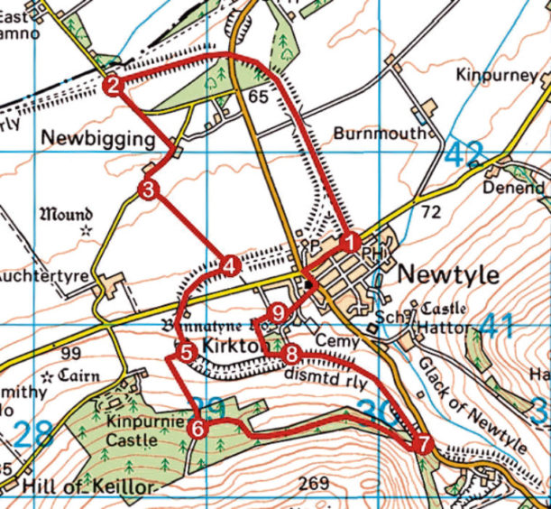
ROUTE
1. Follow trackbed path (signed Railway Walk) north, crossing B954, then west to Camno Crossing.
2. Go left (signed Water Backie) up road, then right and right again to Newbigging.
3. Beyond cottages, go left (signed Water Backie) through gate and along path to meet former railway line.
4. Ascend steps (signed Railway Loop Path), turn right and follow trackbed path over road and on to next junction.
5. Go left (signed Bannatyne Path) up steps, then right over bridge and proceed to metal gate. Turn left and ascend field-edge track to gate by shed. Go through and ascend track to stile on left.
6. Cross stile and follow woodland path east, past cross, to Jacob’s Ladder steps. Descend to trackbed.
7. Go left, pass through wooden gate, and follow trackbed path to next signed junction.
8. Fork right (signed Village) along track, go right down field edge then right to meet lane.
9. Bear right then left, proceed along Kirkton Road, past church. Go left, along Dundee Road, then right, along North Street, to car park.
INFO
Distance: 8km/5 miles
Ascent: 180m/600ft
Time: 2-3 hours
Grading: Easy low-level route following well-signed former railway trackbeds, minor roads and paths through farmland and forestry, where some parts can be muddy underfoot. Stout footwear recommended and keep dogs under close control where livestock is encountered
Start/finish: Car park next to park on North Street, Newtyle (Grid ref: NO 298415)
Map: Ordnance Survey 1:50,000 Landranger sheet 53; Ordnance Survey 1:25,000 Explorer sheet 380
Tourist Information: Dundee iCentre, 16 City Square, Dundee DD1 3BG (Tel 01382 527527)
Public transport: Stagecoach bus service 57 from Dundee stops in Newtyle