It was a day for staying low, the winds whipping across the higher ground, the sun taking its time to make a promised appearance.
The small woodland car park at Freuchies provided a sanctuary of sorts but as soon I left its confines heading north on the forestry road which weaves its way round the tree-clad hill of Crock, I knew I had made the right decision.
My plan for the day involved a circuit taking in the man-made fishing lochs of Shandra and Auchintaple, using sections of the Cateran Trail for a good part of the route.
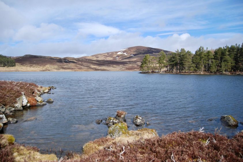
The first sighting of Loch Shandra came after about a kilometre, a flat, pale sheet reflecting the early grey above, but as I neared the end of the western shore the first real bursts of sunshine spilling over the treeline produced some sparkles of silver.
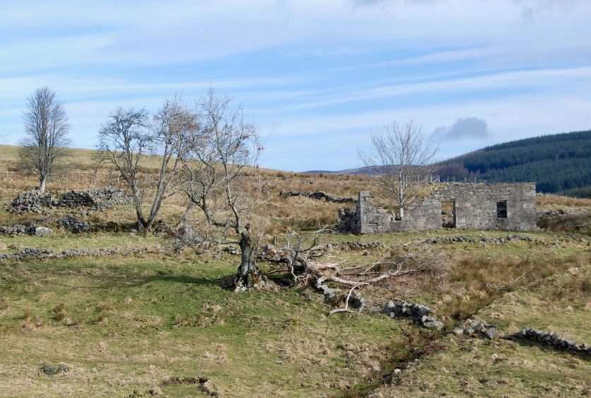
Just beyond some sheilings and after a crossing a stream, I left the Cateran as it twisted to the left and instead followed a faint line straight ahead over wet ground. The underfoot conditions improved on the rise to the old ruin of Craignity.
I made the short diversion to take a closer look, then returned to the grassy track which crossed a field to a drystone wall and parallel fence which I followed north to the entrance to Craighead. The farm buildings here were more recently abandoned, but the end result was the same.
The track went through the farmyard and up to the right, passing a branch on the left which leads to another ruin, to reach a metal gate. The path continued on open ground between two small plantations, but it was hard to follow at times, the ground churned to a quagmire by cattle.
The going improved as the terrain opened out, Mount Blair now in full view to the west, the snow-topped Glen Doll hills in the distance and the beginnings of Badandun Hill dead ahead.
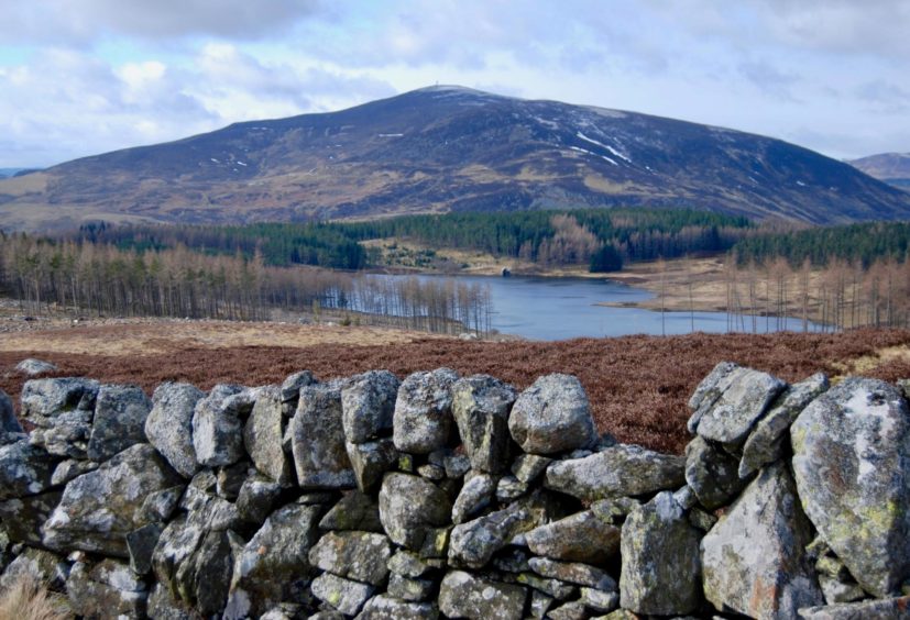
I passed a prominent boulder with a smaller one balanced on top, staying with the much-improved path as it led through an entrance in a drystone dyke and then down to the left to rejoin the Cateran Trail.
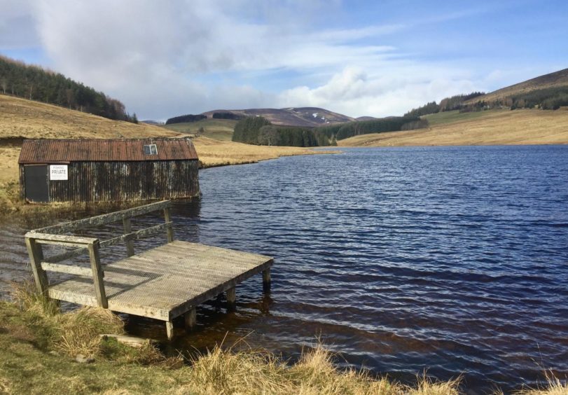
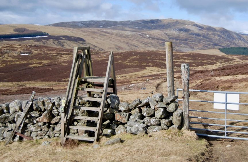
The weather had also taken a turn for the better: Auchintaple Loch was a blue oasis in a clear line of sight over a swathe of felled forestry. I crossed a high wooden stile and stuck with the trail as it twisted north-west then south-west.
I left it at the next junction, heading left towards the loch. The track past the boathouse was waterlogged and muddy, and there were two high wooden gates and one metal one to go through. When the track started swinging off to the right, I took a path which stuck with the shoreline and led to the dam embankment.
The weather had also taken a turn for the better: Auchintaple Loch was a blue oasis in a clear line of sight over a swathe of felled forestry.”
This was the perfect spot for a lunch stop, the waters lapping the ragged shore, ducks and geese floating in and out of view, birdsong ringing through the silence in the trees.
I continued on the path along the edge of the loch, through the tree cover and over the outflow on stepping stones to emerge once again on the Cateran.
Regular marker posts mean the return is mostly straightforward. There is one section where the path becomes a little vague, although it’s hard to go wrong and the trail soon becomes obvious again.
By the time I made it back to Loch Shandra, the waters had defaulted to a brighter blue. Staying beneath the summits had paid off handsomely.
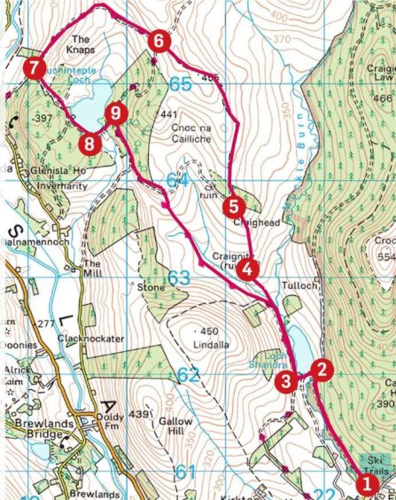 Route
Route
1. Take forestry road north-west (signed for Forter and circular route around Crock) for just over 1km until reaching wooden signpost and pedestrian gate on left.
2. Go through gate, then another over wooden bridge, and follow grassy track along loch embankment.
3. Turn right on track (Cateran Trail) following western shore, but leave it after crossing stream to take vague path right which then rises towards Craignity.
4. Stick with grassy track through gate gap in wall, continue to drystone dyke and wire fence and follow uphill to metal gate on left for track to Craighead.
5. Walk through abandoned farm and follow track uphill to right (ignore branch on left en route) to emerge on open ground between trees. Head north then north-west over moorland to track junction.
6. Cross high stile over stone wall and follow line of Cateran Trail as it turns south-west. Leave it at next junction, taking track on left.
7. Follow track through series of gates alongside Auchintaple Loch until it starts to swing away from shoreline then branch left on path leading round southern end.
8. Cross embankment dam into trees, cross outflow on stepping stones, and climb to link again with Cateran Trail.
9. Turn south-east on track, ignoring first branch going off right, and stay right at next junction (Cateran marker) to follow trail back to Loch Shandra and rejoin inward route.
Information
Distance: 13km/8mls
Ascent: 300m/985ft
Time: 4-5 hours
Grading: Estate and moorland tracks and paths. Some short ascents, suitable for most levels of fitness. A few wet and boggy sections, good footwear advised. Dogs under close control due to grazing sheep and cattle and to protect ground nesting birds.
Start/finish: Woodland car park at Freuchies (Grid ref: NO 063628), turn off B951 just before Kirkton of Glenisla.
Map: Ordnance Survey 1:50,000 Landranger Map 43 (Braemar & Blair Atholl) and 44 (Ballater & Glen Clova); Ordnance Survey 1:25,000 Explorer sheet OL53.
Tourist Information: VisitScotland, Dundee iCentre, 16 City Square, Dundee, DD1 3BG (Tel 01382 527527).
Public transport: None.


