Sandy Hillock, Glen Doll, Angus
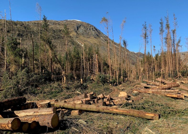
The storms at the tail end of last year caused enormous damage to the forests of Glen Doll. Many of the popular walking routes remain impassable and may do for some time to come.
Access to the area’s Munros was quickly restored, but most tend to be linear rather than circular for the time being. One walk that still offers a satisfying circuit is the high-level anti-clockwise route above Bachnagairn.
This involves using the Capel Mounth path to its highest point, then turning west on rougher, pathless ground over a series of minor tops and past the deep cleft known as The Gourock, before climbing to Sandy Hillock. The fine Munro summit of Broad Cairn lies just one more ascent away with a fine path offering swift passage.
At time of writing, the Capel Mounth remains blocked in its lower reaches: it starts well enough, but the walker is then met with a wall of toppled timber, impenetrable and dangerously unstable. This turns out to be a minor problem in the greater scheme of things, however, as it can quickly and easily bypassed.
After scouting out the forest trail, I returned to the main track and continued along a short distance further before taking a direct line uphill by the Capel Burn and a drystone wall to pick up the zig-zags of the main coming out of the trees higher up.
I parted company with the path as it started its gradual drop down the other side, crossed the Moulzie Burn and made the short push over rough terrain to reach the cairn on Dog Hillock where the views immediately opened up.
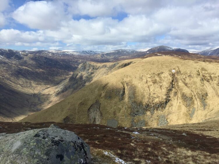
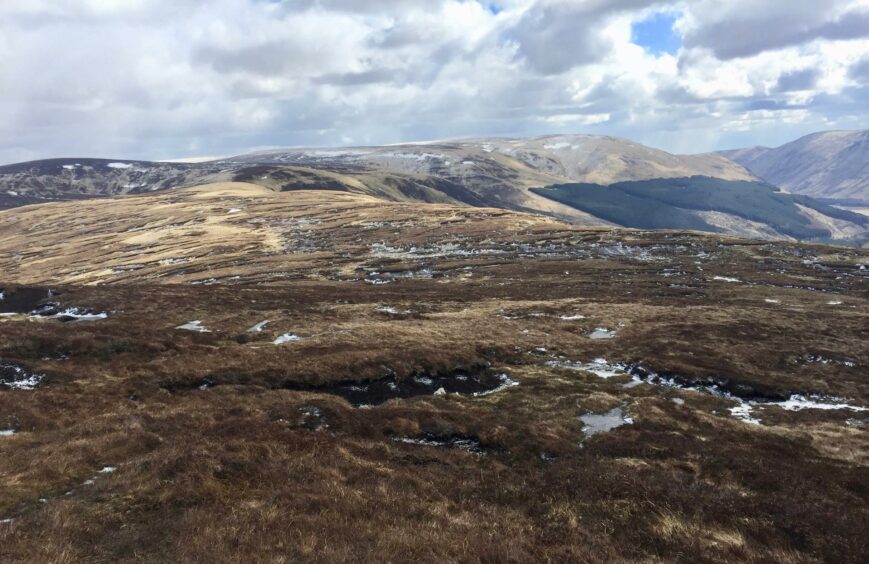
As you work your way onward above the ridge line, there’s a real feeling of depth. The ascents and descents are steep but short-lived and mostly on grass, but the long view is superb, soaring edges and craggy faces spilling off into the distance.
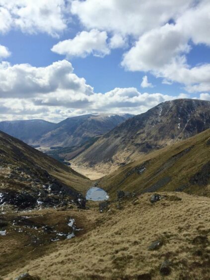
The first deep gully is The Gourock, which contains an inkwell of blue cradled in its folds, perfect in symmetry and beauty. On a sunshine day this captured body of water sparkles like a freshly discovered jewel, rather aptly as its charms are invisible to those walking obliviously up the glen floor, a real hidden gem.
After passing over the summit of Broom Hill, the ground ahead becomes less friendly, a mixture of black bog, tussocks and a curious bare looking strip containing huge, random boulders, that looks to have been teleported in from a foreign desert.
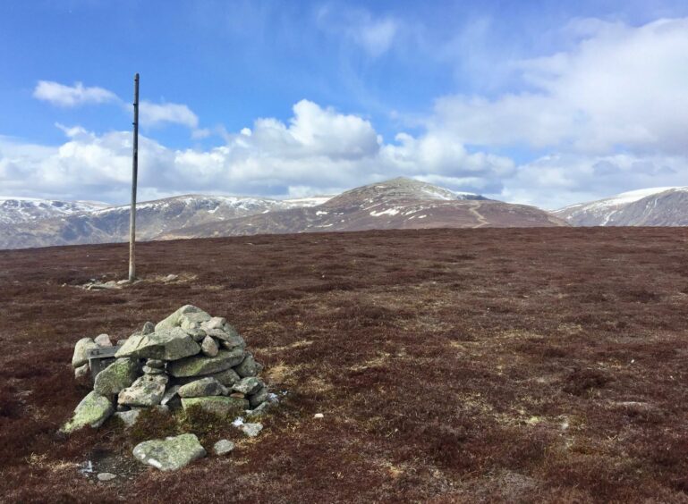
Those who wish to extend the eagle’s eye view can stick to the edge and peer over the ramparts of Moulnie Craig and Juanjorge before making the heather-clad push up to the top of Sandy Hillock. The name of this Corbett Top may not inspire too much excitement but there are grand open views over to its parent, Broad Cairn, and to the magnificent sprawl of Lochnagar.
I decided to leave the Munro for another day and instead turned left at the pony shed to head down to the Roy Tait bridge at Bachnagairn and then follow the tumbling waters of the South Esk down the glen.
When the track split, I remembered to go left over the more recently replaced wooden bridge leading back via Moulzie rather taking the right-hand branch ‘short-cut’ which would have meant a humiliating retreat from the tree blocked path up ahead.
As it was, the return alongside the hundreds of split, snapped and torn-up trees was an all-too graphic reminder of the terrible destruction wreaked in those few days of mayhem, and the massive clean-up operation which could take years.
ROUTE
1. Exit car park to south-east, turn left to cross bridge then turn left again past gate on track heading north. The Capel Mounth path is currently blocked by fallen trees, so ignore signpost and continue a little further along track.
2. Turn right alongside stream and wall on open ground, climbing until meeting the Capel path rising out of the trees and follow its steep climb to its high point.
3. Leave the path about 1km further on, dropping to cross the Moulzie Burn then climbing again to cairned summit of Dog Hillock.
4. Follow the faint path along the ridge line as it curves around the steep gully known as The Gourock to reach top of Broom Hill.
5. Continue over pathless and rough terrain, drifting away from edge of the crags and then up heather slopes to Sandy Hillock.
6. Leave summit and head west-north-west picking up obvious broad path. The Munro Broad Cairn is dead ahead and can be included if wished, otherwise turn left at path junction beside stables.
7. Follow path south and then steeply down to Tait Bridge at Bachnagairn.
8. Cross and turn left on path through trees, then continue on track down beside River South Esk until reaching split in track. Take left-hand branch, crossing bridge and passing Moulzie and head back to car park on inward route.
INFORMATION
Distance: 16.5km/10.5miles
Ascent: 750m/2460ft
Time: 4.5-6 hours
Grading: Tracks and hill paths, rough pathless ground and exposed high terrain, great care needed in adverse weather. A route for well-equipped mountain walkers with good level of fitness, relevant experience and navigation skills.
Start/finish: Glen Doll pay and display parking (Grid ref: NN 913610).
Map: Ordnance Survey 1:50,000 Landranger Maps 44 (Ballater & Glen Clova); Ordnance Survey 1:25,000 Explorer sheet OL 53.
Public transport: None.
Tourist Information: VisitScotland, Ballater iCentre, Station Square, Ballater, AB35 5QB (Tel 01339 755306). Or VisitScotland, Dundee iCentre, V&A Dundee, 1 Riverside Esplanade, Dundee DD1 4EZ (Tel 01382 527527).


