Dundee is getting six new cycle routes. Take a look at our maps and decide for yourself where they should go.
It’s an exciting time for cyclists in Dundee.
Dundee City Council is planning to build segregated routes to connect communities and make walking and cycling safer.
Engineering consultants have come up with options for creating six “active freeways”, as officials have badged them.
The aim is to encourage people to walk, wheel and cycle for everyday journeys.
And you have until Monday December 5 to have your say on the plans.
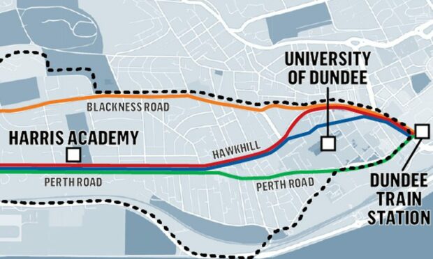
Perth Road
The most direct route along this corridor, option B, passes along the Nethergate.
However, to accommodate cyclists, on street parking would probably have to be sacrificed.
Option A is less direct and takes in Hawkhill, which has wider carriageways making it relatively easy to reconfigure for active travel.
This option has an overall gradient of 2.2% meaning a nice easy run into town.
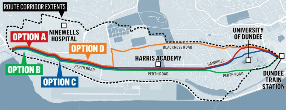
The Old Hawkhill is also being considered as it would tie in with Dundee University.
And there is a fourth option to create a route along Glamis Road and Blackness Road, however the former has a gradient of 8.8% making it less than ideal.
Arbroath Road
There are two options proposed for Arbroath Road.
The most direct one could work well, with grass verges along the route providing opportunities for new segregated cycle lanes in Dundee.
And with a gradient of 1.3%, commuters would not have to pedal too hard to get to work or college.
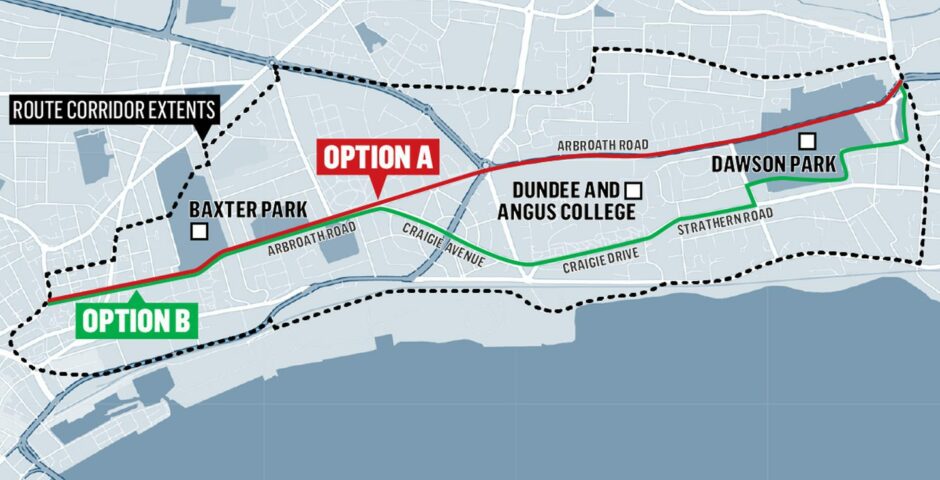
Another idea is to follow Craigie Drive and Strathearn Road.
This would include a scenic trip through Dawson Park and avoid the busy Scott Fyffe Roundabout.
Pitkerro Road
There is potential to provide a very direct route into Stobswell along Pitkerro Road. This option could also include priority bus lanes.
However, the Kingsway East roundabout could be avoided by choosing Fountainbleau Drive. This would also provide more direct travel to Dundee International Sports Centre.
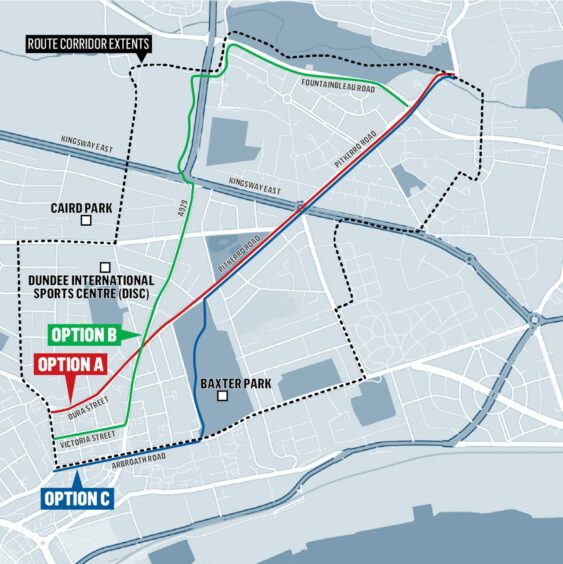
A third option would take cyclists through Baxter Park. This could be popular with novice cyclists who prefer to avoid busy routes.
Strathmartine Road
This route would connect communities north of the Kingsway with the city centre.
All options would require safe crossing points for pedestrians and cyclists at the Kingsway.

And all options have the potential to be a bit hilly.
Option C, which uses Clepington Road, would connect with the Miley Nature Reserve path.
Harefield Road
Two options have been drawn up for this one.
The first would follow Harefield Road and Strathmore Avenue before meeting Dens Road.
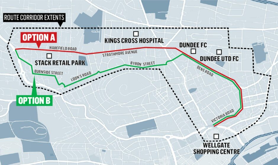
Another option is to divert through Lochee and follow Loon’s Road and Byron Street.
This would involve steeper gradients than option A – up to 5.8% compared to between 1% and 3%
Both options meet Dens Road, which has a maximum gradient of 6.2%.
Coupar Angus Road/Lochee
Whereas consultants Sweco drew up plans for the first five travel corridors, Jacobs were involved in the Coupar Angus Road/Lochee proposals.
And they took a slightly different approach.
They divided the route into four sections, with potential segregated or “quiet routes” identified.
We’ve combined them on one map to give an overview.

A segregated route would see either one-way cycle lanes on each side of the road or two-way cycle lanes on one side.
“Quiet routes” are where cyclists share a carriageway with motorists but on roads with low traffic volumes.
For more detailed information and to respond to the online consultation, you can view the Coupar Angus Road/Lochee plans here.
Plans for the other five routes can be viewed here.

Conversation