Carn Daimh, Glenlivet, Moray
Carn Daimh may be one of the more modest summits in the Cairngorms National Park, but it is a superb centre-point from which to drink in the vast rolling landscape of malt whisky country.
The ‘hill of the stag’ sits at a height of 570 metres in the Glenlivet Estate, but considering nowhere in Glenlivet is lower than 200 metres, the effort to reach this fine top is well within the capabilities of most.
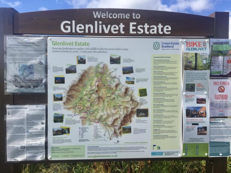
The estate, which lies between the straths of the rivers Avon and Livet, belonged to the Gordon family from the 1500s to the early 20th Century. It was acquired by the Crown Estate in 1937, and today it comprises some 30 let farms, commercial forests, and sporting activities such as fishing and stalking.
More recently, there has been a big increase in supporting and developing recreation and tourism in the area with the creation of an intricate network of walking and cycling trails. The range of walk options is extensive – from gentle strolls to longer hikes; from smugglers’ trails to battlegrounds.
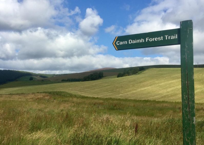
The circuit of Carn Daimh seemed a good place to start. I chose the southern approach over the one from Tomnavoulin round to the east. There’s a small car park at Glenconglas (some maps spell it ‘ss’) a few kilometres north of the village of Tomintoul, accessed from the minor road to Croughly.
There was definitely a welcoming feel, the signage encouraging, the information board comprehensive. Detailed descriptions of 15 walks and trails were laid out, each colour coded relating to the waymarkers found all the way round.
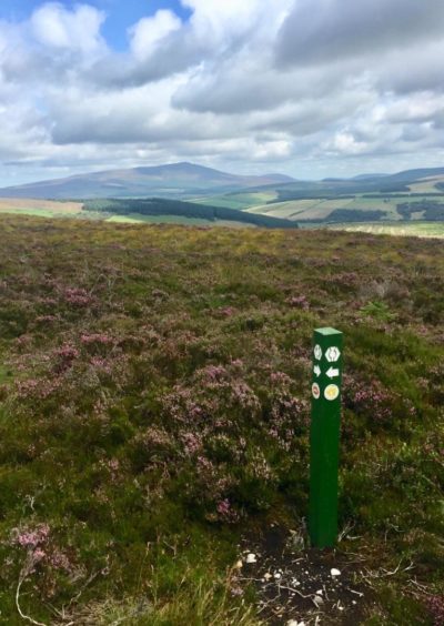
Carn Daimh was visible from the car park, it’s bare head appearing tonsure-like above the treeline. I set off along the track following the orange arrows which appeared at regular intervals. They led me north, then west through the forestry, then north again before swinging to the east, all at a gentle gradient.
En route I was passed by three groups of cyclists – parts of the tracks are shared trails, others are marked for bikes only – but I never saw another walker during this time.
A left turn brought me to three tracks. The orange arrows suggested I took the middle one, then a sharp right to start climbing through a darker and muddier section, before I emerged into a recently felled area where the final steeper rise to Carn Daimh began.
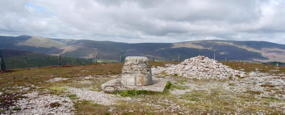
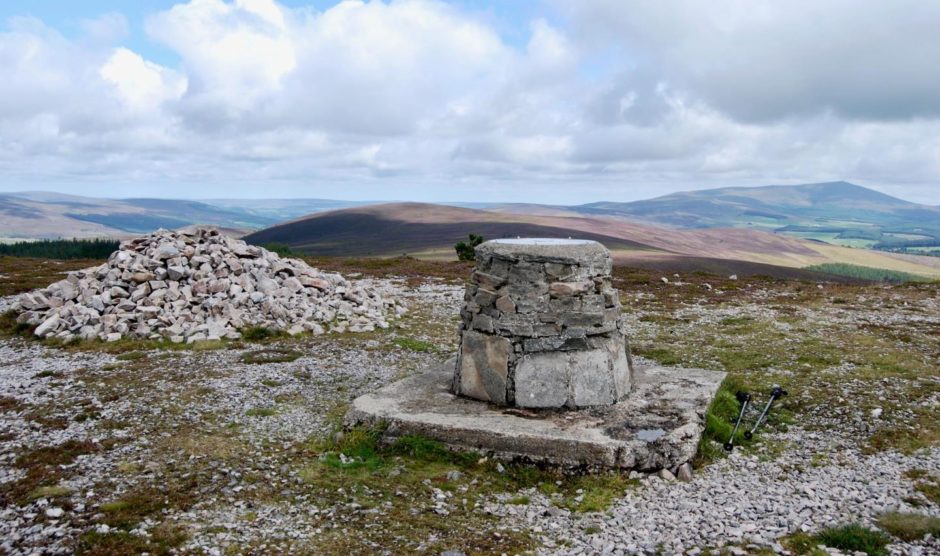
A short step over a stile and I was at the summit – and in the middle of a 360-degree extravaganza. The familiar triangle of Ben Rinnes lay to the north-east, the elongated ridge of the Cromdales to the west. Directly east was The Bochel, with Corryhabbie Hill looming behind, and the Ladders further round. The high Cairngorms filled the distant horizon to the west, cloud caps hiding their finer contours. There’s a viewfinder to help with the geography.
The way down followed the line of the Speyside Way, dropping muddily along the treeline and then taking a darker turn into the forestry until a signed T-junction where I turned right for Tomintoul.
The path continued over moorland until reaching another orange arrow pointing the way west along an overgrown and often faint path. At one point it seemed to come to a halt but the trick is to ignore any suggested offshoots and stick with the line of travel to reach a high gate leading into a felled area.
There’s some more wet ground, then another gate, then more wet ground, but it’s all signed, and eventually there’s a stile on the left which takes you over a wall and on to even boggier ground where duckboards lead to dry land. The car park is a short walk beyond the farmyard.
ROUTE
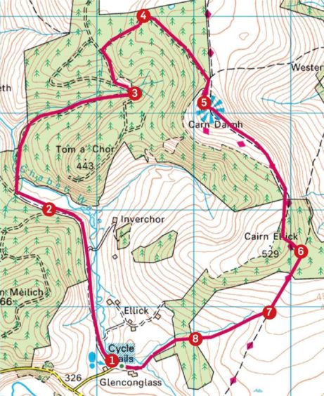
1. Head north on track from parking along edge of fields (signed Carn Daimh Forest Trail) to reach plantation which track curving to left. This is Walk No.6 on Glenlivet Estate notice board, following orange arrows.
2. Stay on main track ignoring branch on left, then at junction veer right (signed) down to bridge. Cross and follow track north at first then swinging east.
3. Leave track before it starts heading uphill to right, and turn left to reach three tracks. Take middle one (arrow) and turn right again, as it climbs through trees to reach felled area.
4. Track now turns south-east: keep left higher up (right branch is for cyclists only) to reach fence, which is crossed by stile to summit cairn and view indicator.
5. Follow markers south-east (this is part of Speyside Way) and after muddier section, enter forest at marked point and stay on main track down to T-junction (signpost).
6. Turn right for Tomintoul and once out of trees keep following path until orange arrow marker.
7. Head right on overgrown path, faint in places, sticking with the line (ignoring various paths running west) until reaching felled area.
8. Go through two high gates over grassy ground, then cross stile on left over wall and follow boggy path with duckboards to farm gate and follow track through farmyard to car park.
INFORMATION
Distance: 11.5km/7miles
Ascent: 385m/1270ft
Time: 3-4 hours
Grading: Suitable for most abilities on well-signed route along forestry tracks, hill and moorland paths. Steady gradients, one short steeper ascent to Carn Daimh. Wet and muddy in places, sturdy footwear recommended. Watch out for bikes – parts of tracks are shared cycle trails. Dogs under close control due to farm livestock and ground nesting birds.
Start/finish: Glenconglas car park (Grid ref: NJ 171223) off minor road to Croughly, 3km north of Tomintoul.
Map: Ordnance Survey 1:50,000 Landranger Map 36 (Grantown & Aviemore); Ordnance Survey 1:25,000 Explorer sheet OL61.
Tourist Information: VisitScotland, Aviemore iCentre, 7 Grampian Road, Aviemore, PH22 1RH (Tel 01479 810930).
Public transport: None to start of walk. Nearest bus service to Tomintoul (link from Grantown and Aviemore).


