During the two world wars, the batteries of the Forth Coastal Defences were established to protect shipping on what was a strategically important yet potentially vulnerable estuary.
Based along the shoreline and on the islands of the River Forth, large calibre guns were manned around the clock, poised to repel enemy attack.
A century on, relics of this well guarded line remain scattered along the Fife coast and some of the best preserved are to be found at Braefoot Point, between Aberdour and Dalgety Bay.
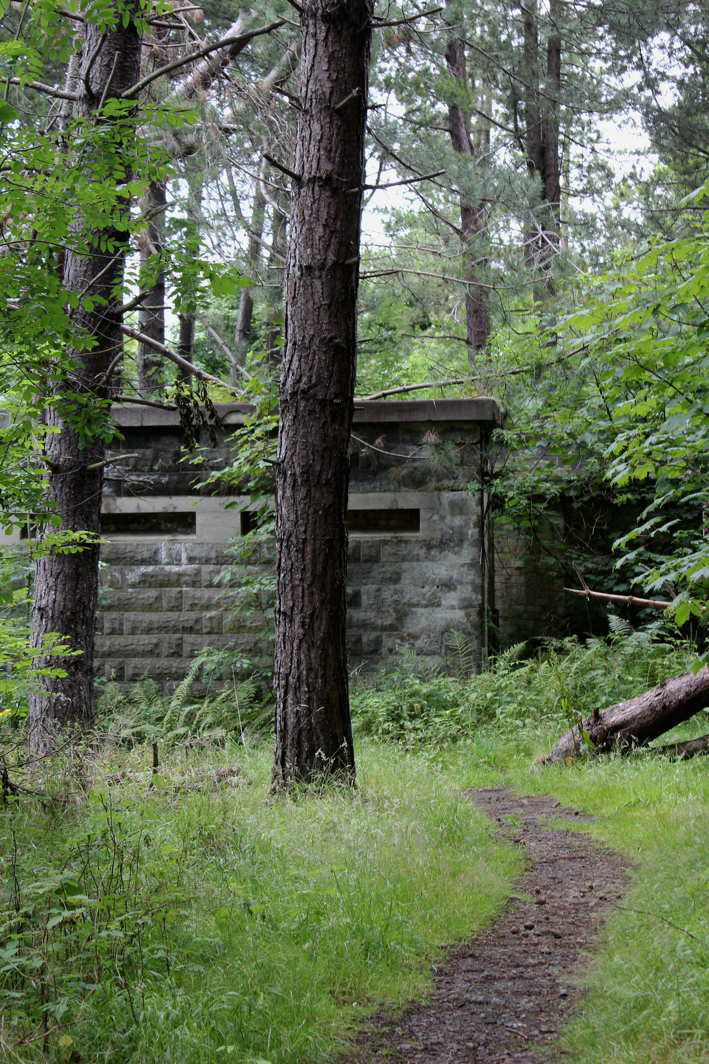
Hidden away amongst the trees of Braefoot Plantation, a complex of gun emplacements, observation posts, barracks, workshops and magazines dating from 1914 has survived the passage of time remarkably well.

Much of the equipment and supplies for the camp arrived by rail at Aberdour Station and that seemed an appropriate place to start my exploration.
Passing the old village clock tower, I headed west along High Street, picking up a few supplies of my own, before leaving the busy thoroughfare at Donibristle Gates, an ornate entrance to the former Donibristle Estate, to join the Fife Coastal Path.
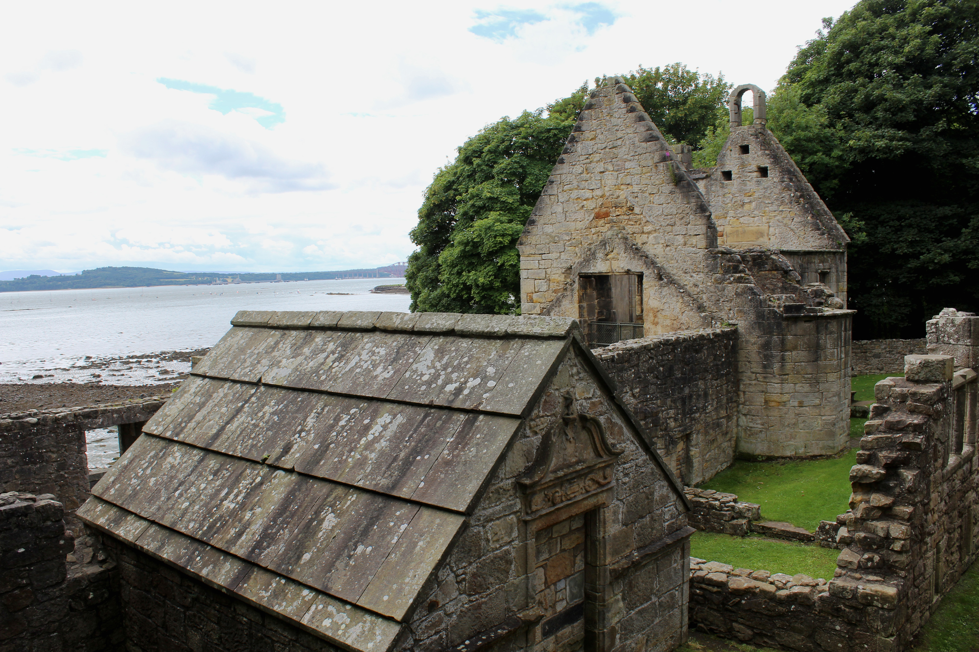
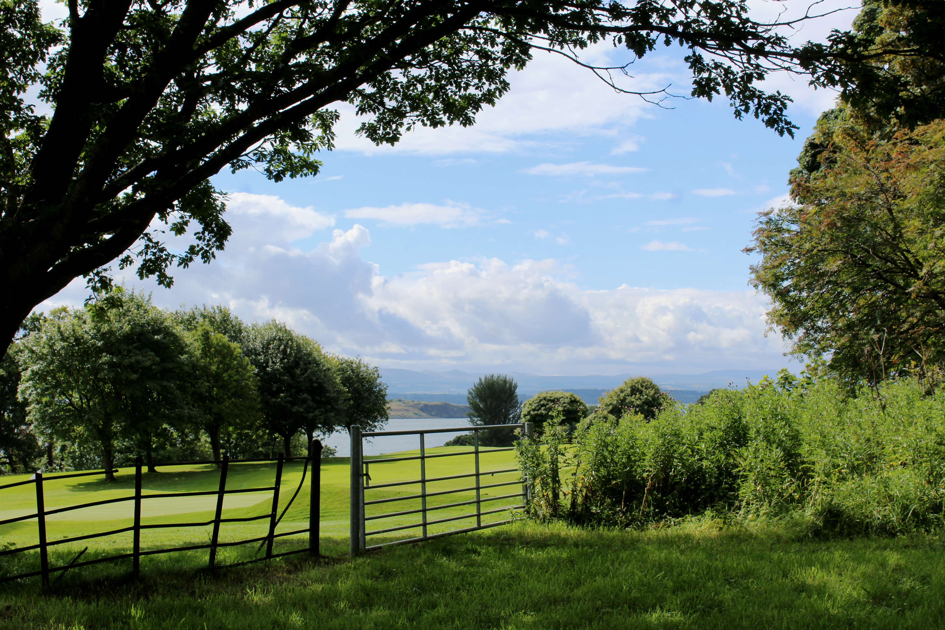
The waymarked trail skirts along the top of the local golf course, entering woodland where gaps in the shrubbery revealed a view south across the River Forth to the island of Inchcolm, home to 12th century Inchcolm Abbey and a variety of wartime fortifications.
Hiking on past the wooded policies of St Colme House, an underpass led me below the access road to Braefoot Bay Marine Terminal, the way continuing above grazing land beyond.
The link to Braefoot Plantation is signed, a path descending between fields to meet a track at the north-east corner of the woodland.
From a crossing point in the fence opposite, a path ascends the eastern edge of the plantation, running parallel with the boundary fence of the marine terminal, where gas from the North Sea is pumped into tankers for export.
At the top of the slope, the way passes below rocky outcrops atop which sits a squat observation post that would, prior to the post-1945 planting of trees, have enjoyed a commanding view across the Forth.
Below it, the path dips to a smaller brick lookout before running along the top of the slope to another observation post, this one embedded into the hillside.
A third brick bunker beyond a hump in the path marks the start of the descent through Scots pine and gorse to the battery pier, a pleasant spot to pause on a sunny day and view the Forth bridges.
Initially slightly obscured by bracken, a path follows the line of a former track from here up to the barrack block, a solid stone structure where the men manning the guns ate and slept between shifts.
The guns themselves, installed in 1915, occupied the higher ground above and they were linked to an ammunition store and workshops by a wee tramway, sections of which can still found embedded in the ground.
The heavy artillery was removed before the end of the conflict and while there was activity here during the Second World War, it appears to have been on a much smaller scale.
The windows and doors of most of the buildings were, at some point, bricked up, helping to preserve what is not only an important piece of wartime history but also a fascinating place to explore.

ROUTE
1. Exit station on to A921, turn left and walk west along High Street.
2. Turn left opposite Woodside Hotel (signed Dalgety Bay), pass through Donibristle Gates and follow road to metal gate. Go through and progress along Fife Coastal Path.
3. Bear left through underpass then left again along Beech Avenue.
4. Turn left (signed Braefoot) and descend path.
5. Cross track and ascend path along edge of plantation. Descend to brick observation post and bear right along top of slope. Bear left after second observation post and descend to Braefoot Point.
6. Ascend path to first group of wartime buildings.
7. Bear right and loop up to second cluster of buildings. Continue north on path.
8. Turn left and follow surfaced track to St Bridget’s Kirk.
9. Turn right, ascend track to junction then turn right, following Beech Avenue to point 4. Retrace steps to Aberdour.
INFORMATION
Distance: 8km/5 miles
Ascent: 170m/560ft
Time: 3 hours
Grading: Easy, low level route following good tracks and paths through farmland and woodland with some short sections of ascent. Stout footwear recommended
Start/finish: Aberdour railway station, Aberdour (Grid ref: NT 192854). Free parking at station
Map: Ordnance Survey 1:50,000 Landranger sheet 66; Ordnance Survey 1:25,000 Explorer sheet 367
Tourist Information: Dunfermline iCentre, 1 High Street, Dunfermline KY12 7DL (Tel 01383 720999)
Public transport: Travel by train or Stagecoach bus service 7, which stops in Aberdour


