Calendar An icon of a desk calendar. Cancel An icon of a circle with a diagonal line across. Caret An icon of a block arrow pointing to the right. Email An icon of a paper envelope. Facebook An icon of the Facebook "f" mark. Google An icon of the Google "G" mark. Linked In An icon of the Linked In "in" mark. Logout An icon representing logout. Profile An icon that resembles human head and shoulders. Telephone An icon of a traditional telephone receiver. Tick An icon of a tick mark. Is Public An icon of a human eye and eyelashes. Is Not Public An icon of a human eye and eyelashes with a diagonal line through it. Pause Icon A two-lined pause icon for stopping interactions. Quote Mark A opening quote mark. Quote Mark A closing quote mark. Arrow An icon of an arrow. Folder An icon of a paper folder. Breaking An icon of an exclamation mark on a circular background. Camera An icon of a digital camera. Caret An icon of a caret arrow. Clock An icon of a clock face. Close An icon of the an X shape. Close Icon An icon used to represent where to interact to collapse or dismiss a component Comment An icon of a speech bubble. Comments An icon of a speech bubble, denoting user comments. Comments An icon of a speech bubble, denoting user comments. Ellipsis An icon of 3 horizontal dots. Envelope An icon of a paper envelope. Facebook An icon of a facebook f logo. Camera An icon of a digital camera. Home An icon of a house. Instagram An icon of the Instagram logo. LinkedIn An icon of the LinkedIn logo. Magnifying Glass An icon of a magnifying glass. Search Icon A magnifying glass icon that is used to represent the function of searching. Menu An icon of 3 horizontal lines. Hamburger Menu Icon An icon used to represent a collapsed menu. Next An icon of an arrow pointing to the right. Notice An explanation mark centred inside a circle. Previous An icon of an arrow pointing to the left. Rating An icon of a star. Tag An icon of a tag. Twitter An icon of the Twitter logo. Video Camera An icon of a video camera shape. Speech Bubble Icon A icon displaying a speech bubble WhatsApp An icon of the WhatsApp logo. Information An icon of an information logo. Plus A mathematical 'plus' symbol. Duration An icon indicating Time. Success Tick An icon of a green tick. Success Tick Timeout An icon of a greyed out success tick. Loading Spinner An icon of a loading spinner. Facebook Messenger An icon of the facebook messenger app logo. Facebook An icon of a facebook f logo. Facebook Messenger An icon of the Twitter app logo. LinkedIn An icon of the LinkedIn logo. WhatsApp Messenger An icon of the Whatsapp messenger app logo. Email An icon of an mail envelope. Copy link A decentered black square over a white square.

Police tell motorists to prepare for worst as 75mph wind forecast prompts weather warning

Stormy weather is predicted across Fife. Image: Supplied.

Police have told drivers to prepare for the worst as Tayside and Fife prepares to be battered by gusts of up to 75mph.

The Met Office has issued an amber warning for wind, effective across Angus, Dundee, north-east Fife, the north-east, and the Highlands and islands. It is in place from Monday until 6am on Tuesday.

Police Scotland said drivers taking to the roads in the affected regions should be “adequately prepared” for the severe conditions – with people being told to bring supplies and warm clothes in their vehicles, and to fully charge their phones.

The Met Office yellow warning.

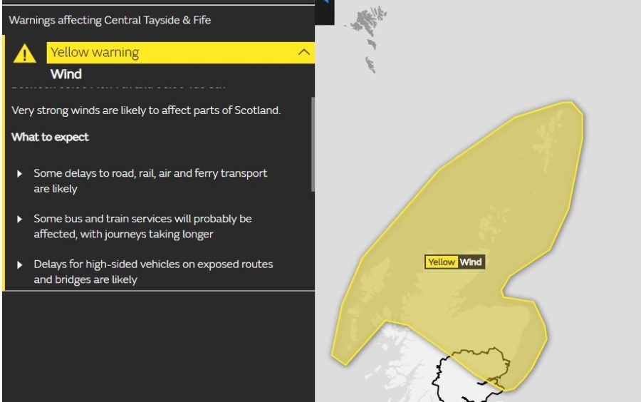
Angus, Dundee and Fife have been named among the “most affected areas” and Chief Inspector Stewart Mackie, of the force’s road policing division, said drivers should not ignore the yellow warning when taking to the roads.

He added: “Very strong winds are expected to affect northern and eastern Scotland with gusts of 65-75 mph likely, particularly in the far north and north-east, before winds gradually ease from the west during Tuesday morning.

“The areas most affected are Angus, Dundee, Fife, Aberdeen, Aberdeenshire, Moray, Na h-Eileanan Siar, Highland, Orkney Islands and the Shetland Islands.

“Police Scotland is advising all drivers to travel with extra caution and ensure you and your vehicle are adequately prepared for the conditions making sure you have sufficient fuel and supplies such as warm clothing, food and water in the event you are delayed for several hours.

“Charge your mobile phone and plan your route as well as alternative routes.

“If you are driving a vehicle which may be vulnerable to being blown over in such conditions along exposed routes including bridges, please exercise additional caution and plan your route to avoid exposed areas or consider cancelling your journey until conditions improve.

“Previous incidents have clearly shown the dangers of driving such vehicles and the subsequent danger created for other road users, emergency services and recovery operatives where incidents have occurred due to drivers ignoring warnings.

“Winter driving is a question of common sense and all drivers should ask themselves if they really need to travel when conditions are poor. No-one should ever place themselves at risk on the road and it may be worth making alternative arrangements such as delaying travel until conditions improve or using public transport.”

The Met Office weather warning states: “Very strong winds are expected to affect northern and parts of eastern Scotland on Monday and Monday night. Gusts of 65 to 75 mph are likely, particularly in the far north and northeast, before winds gradually ease from the west during Tuesday.”