The names of the hills sitting above Glen Ogil hint at intrigue and a touch of mischief; Auld Darkney, Naked Tam and, of course, St Arnold’s Seat, with its massive, mysterious cairn, writes Alan Rowan.
This rocky prominence can be seen for miles around although its purpose, along with the identity of the person whose name the hill bears, remains lost in the mists of time.
The gentle, rolling nature of the high land around Glen Moy and Glen Ogil means there are plenty of options to string together a few tops depending on time and mood.
The combination of woodland and water swung it for me. I would walk in by Glenogil Reservoir before swinging round on to the open moorland. It meant I would be sheltered from the cold west wind by the trees early on, then have the wind at my back later in the day as the sun began to lose its power.
A warren of B-roads had to be negotiated on the route via Forfar and Tannadice, but after passing the mountain animal sanctuary, I reached my goal. There is room for a couple of cars beside a large beech tree just below Redheugh but this felt a little intrusive so I went with the local advice and parked alongside a high hedge just before the buildings at Glenogil.
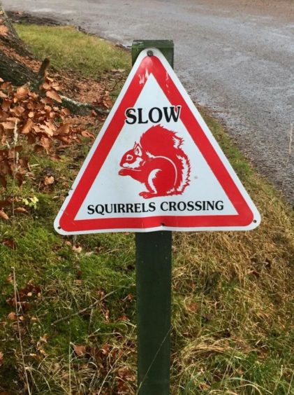
One of a number of triangular red warning signs to watch out for red squirrels sits here and just to emphasise the point that it wasn’t false advertising, a squirrel crossed my path before heading up the nearest tree just as I set off walking.
The tarred road dissolves to a track and skirts the house at Redheugh to reach a gate which gives access to the woods. A little further on, I branched right and made my way down to the head of the reservoir.
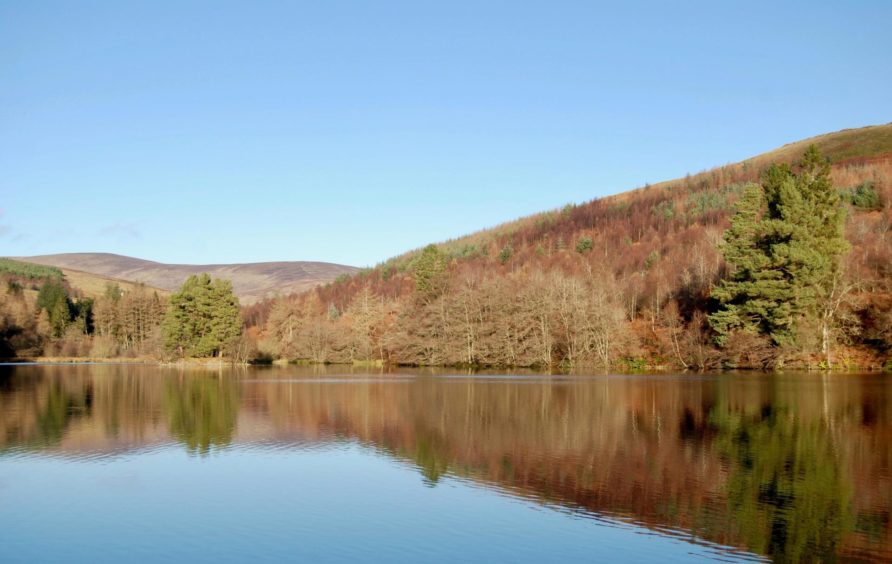
The water lay like glass, highlighting a perfect reflection of the enclosing circle of trees in their late autumn attire. Even the large contingent of noisy ducks hardly raising a ripple as they glided over the surface.
I crossed the dam and followed the track up the east shore, eventually running out of trees to emerge on more open ground, crossing a couple of small bridges en route. Soon after passing through a metal gate beside an information board I reached a more substantial bridge, this one crossing the Noran Water.
The track went south on the other side of the water then made a quick turn west, dropping and rising again to Auld Darkney, also known more soberly as Craig Hill. The highest point lies off the track where the view north showcases a horizon of rolling, gentle contours.
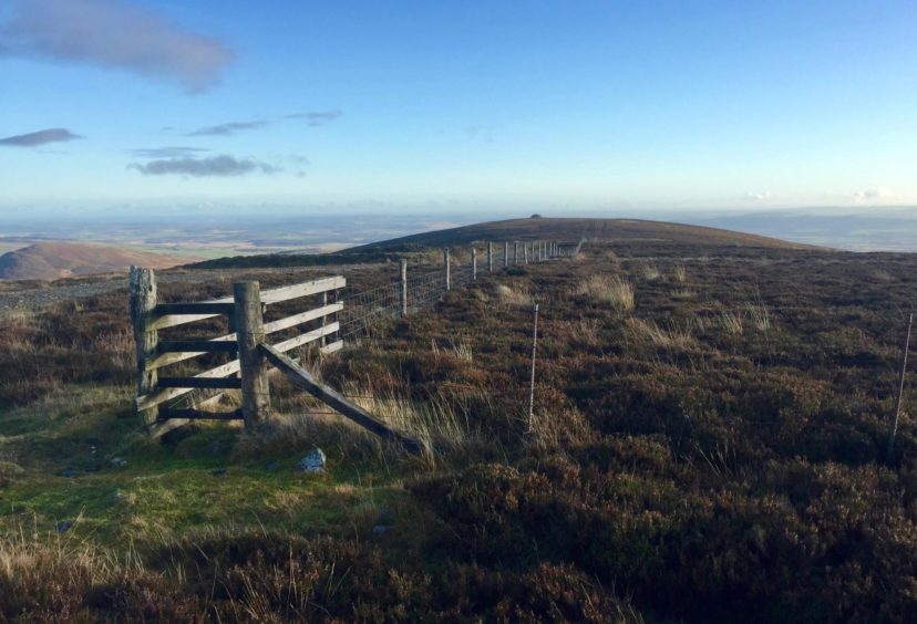
I returned to the track and headed south. At one point I thought I spotted a more direct way ahead on a path through the heather, but all it gave me was a bit of bog dodging before it regained the next loop of the track to ascend the slopes of Naked Tam.
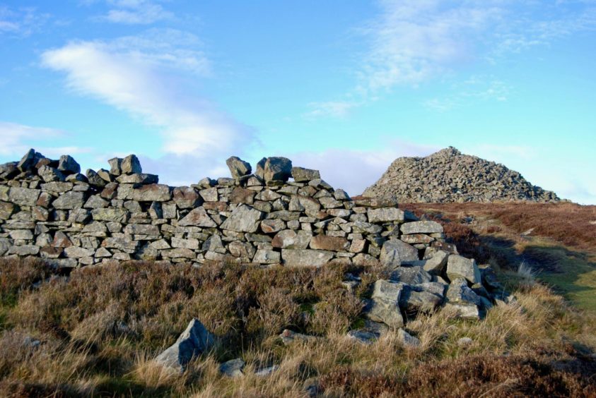
The cairn of St Arnold’s Seat looms larger, but it is not the highest point on the wide ridge. This is said to be in the centre of the track to the left of a fence junction.
This anomaly just adds to the mystery of the original purpose of the cairn. It’s known that it was in place in 1744, and that the hill had various names such as St Ennan’s, St Anne’s and St Euand’s before becoming known as St Arnold’s Seat. The cairn is around eight metres high and around 30 metres in diameter, and a ruined dyke nearby suggests a source for the stones that helped the construction.
To complete the circuit, I headed back towards the high point and at the col crossed the fence to drop left to find the line of a path. This is vague at first, but quickly becomes more obvious as it runs all the way down past Baikies where it makes a sharp turn east for the final push out.
As I passed some shielings, I noticed a buzzard circling overhead, checking out this lone intruder. Watching its languid, graceful spirals provided a fitting finale to the day.
Route:
1. Head north from parking on minor road to reach Redheugh, passing house by track on right to go through gate into trees.
2. Leave main track on first branch right which leads round to reservoir and cross to the east side.
3. Walk north by the water, ignoring track going off right, and emerge from trees to arrive at a metal gate where there is a “Welcome to the Moor” sign. Continue a little further on the track until you spot a bridge on the left over the Noran Water.
4. Cross the bridge and take track, south at first then when it swings west and follow it all the way to the top of Auld Darkney (highest point is mapped Craig Hill, just off track, no cairn).
5. Head south on track as it turns south-east up Naked Tom, follow it past a fence junction then leave it when it starts to swing east to take direct line through heather to wooden gate which gives access to the massive cairn of St Arnold’s Seat.
6. Head back on left of fence towards the 507m summit and watch for a track which heads off south-west.
7. Just beyond Baikies turn sharp left for 3km track walk back east to Glenogil.
The Lowdown:
Distance: 14.5km/9 miles
Ascent: 390m/1280 ft
Time: 4-5 hours
Grading: Estate and forest tracks. Two easy, steady ascents, suitable for most abilities and fitness levels. Dogs under close control near livestock.
Start/finish: Parking by hedge on left-hand side of road south of Redheugh and just before entrance to Glenogil (Grid ref: NO 448637).
Map: Ordnance Survey 1:50,000 Landranger Map 44 (Ballater & Glen Clova); Ordnance Survey 1:25,000 Explorer sheet OL 53.
Tourist Information: VisitScotland, Dundee iCentre, 16 City Square, Dundee, DD1 3BG (Tel 01382 527527).
Public transport: None.