Peter Hill, Forest of Birse, Deeside
Peter Hill is the prominent pyramid rising from the moorland to the south of the Water of Feugh. It’s a close neighbour of the popular Clachnaben, but a better bet if you are looking for a quieter walk.
The unclassified road which heads east from the B976 into the Forest of Birse provides starting points for a wide range of treks on a network of forestry tracks.
My journey north was one of shadows, the contours of the landscape blurred by the gauze of the early mist. Despite the hour, however, the car park for Clachnaben was already full. It was a different story when I arrived at my destination, just one other car in place at Finzean sawmill.

This is one of two water mills which have been preserved in working condition thanks to the work of the Birse Community Trust. At one time there were more than 40 mills in the area used for a variety of purposes such as woodworking, threshing and electricity generation. Some of the oak timber floorboards in the Scottish Parliament building came from here.
Back in the 10th Century, the area was designated as a hunting forest by royal decree, and over the centuries the land has changed hands many times due to debt, dispute and conflict. There is also evidence of Bronze and Iron Age settlements in the shape of cairns and stone circles.
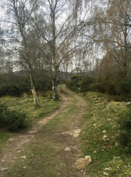
I crossed the road and dropped downhill to a wooden bridge, then followed the well signposted track south as it weaved its way gently through birch and gorse, passing through the occasional gate, to reach the start of the moorland.
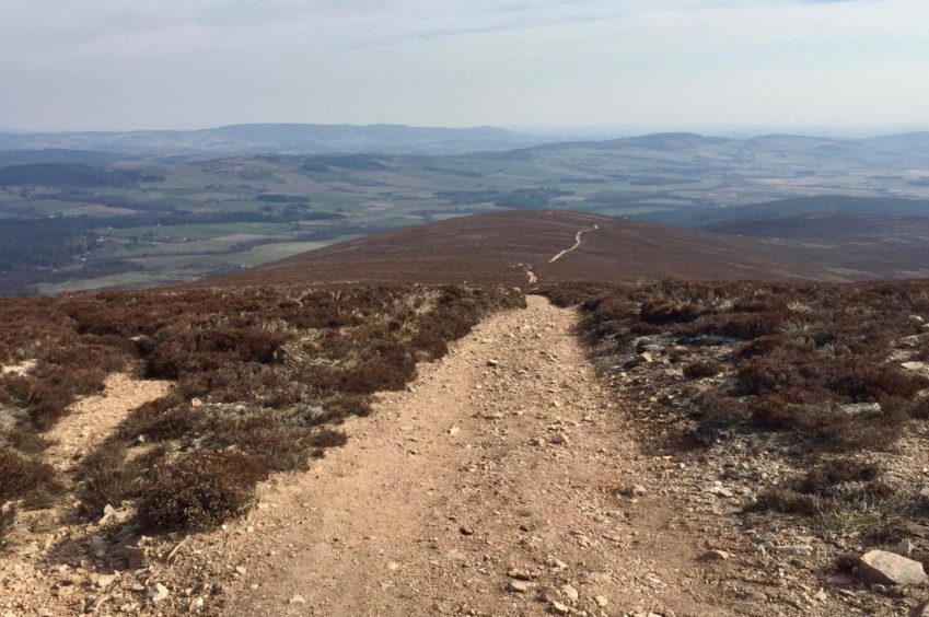
The track turned stony on the other side of a metal gate where sheep grazed. It angled across the shoulder of the hill before twisting to the right to rise more steeply. The granite tor of Clachnaben came into view as I followed the track round a sharp right turn then past a large cairn to the final steepening.
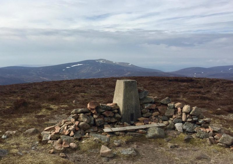
The summit is topped by a trig pillar and a low wall but they were little comfort or shelter as the wind whipped viciously across the open ground.
Mount Battock dominated the horizon to the south, white streaks still clinging to its flanks. My next target, Baudnacauner, lay to the west, a rounded heather lump which appeared to offer no real struggle. But appearances can be deceptive, and the direct line after leaving the track before it dropped too far turned out to be boggier and rougher than expected, even with the occasional help from faint trails through the heather.
I suspected the couple I had met descending from Peter Hill were locals as they settled for a there-and-back route rather than continue with the traverse.
Once I was convinced I had reached the highest point, I decided to explore the curious series of peaty mini-canyons that sliced through the terrain running north along the wide shoulder. They were deep but they were dry, easier walking than staying in the heather.
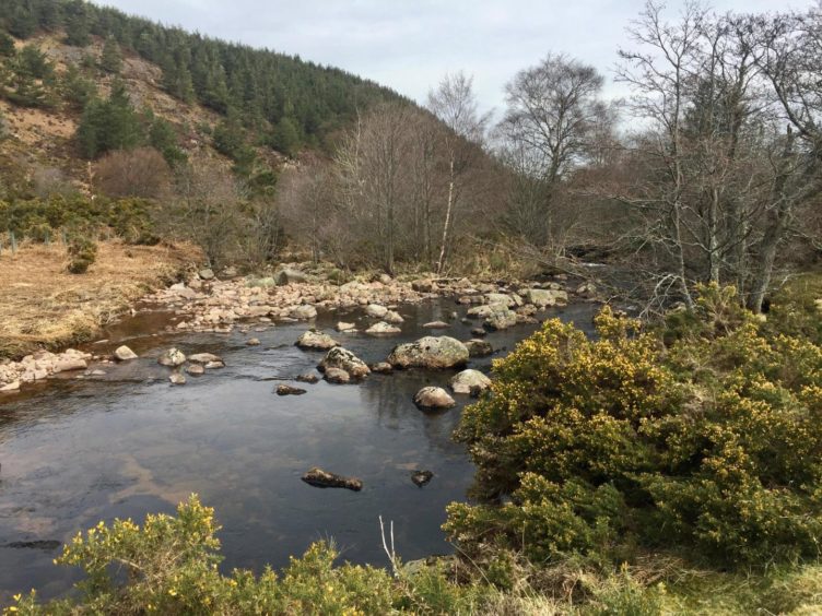
Eventually I dropped to the right to pick up the somewhat neglected track leading north-east along the line of the Glaspits Burn down towards the river. It carves its way into the woods before turning right across a stream by stepping stones and heading east on a delightful path along the line of the Water of Feugh.
There are some impressive Scots pines here: one particularly massive specimen seemed to have claimed its own kingdom, a giant surrounded by a chaos of large boulders and smaller trees. It even had a new, young pretender sprouting out of the split in the centre of its trunk.
The line of the path became wider as it ran parallel to a moss-smothered old wall and I eventually emerged at a gate in a farm lane between houses before turning back to the bridge over the water and the mills.
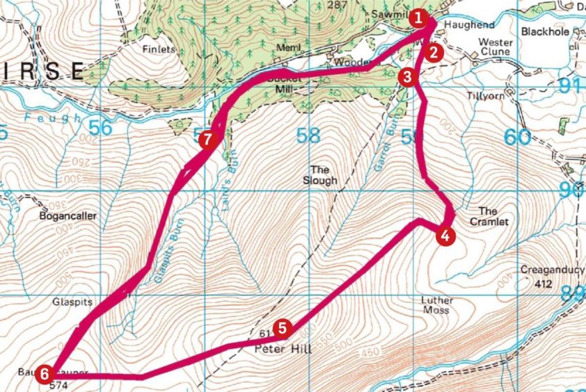
Route
1. From parking at sawmill, head down drive signed for Haughend to wooden bridge over Water of Feugh.
2. Turn right after crossing bridge and follow path marked for Peter Hill south to wooden gate, head up through trees and gorse and go through metal farm gate into open moorland.
3. The track becomes more stony and after passing information board on right, it takes rising line to left across hillside, before gradually curving right for steeper push.
4. After taking sharp right turn, it straightens out again to reach large cairn, before making final push to summit trig pillar.
5. Head west from summit, at first on track then over pathless terrain to reach boggy col and make pathless push to unmarked top of Baudnacauner.
6. Drop north-east to reach track running beside Glaspits Burn and follow down to edge of wood.
7. Cross burn and take path east through mixed woodland, latterly following line of old wall and passing two small weirs (ignore wooden bridge on left), to emerge at gate in farm lane between houses and follow track back round to start.
Information
Distance: 12km/7.5mls
Ascent: 570m/1,870ft
Time: 4-5 hours
Grading: Hill tracks and paths, some rough terrain, woodland path. Steady climb to Peter Hill, boggy pathless continuation to Baudnacauner, suitable for relatively fit walkers and older children. Can be wet underfoot, good footwear recommended. Dogs under close control – farm livestock and ground nesting birds. Please remember to close all gates.
Start/finish: Finzean Sawmill (Grid ref: NO 591916), 3km along minor road to Forest of Birse, reached from B976 to Aboyne. Parking for five or six cars, further spaces over bridge beside Peter Hill signpost.
Map: Ordnance Survey 1:50,000 Landranger Map 44 (Ballater & Glen Clova); Ordnance Survey 1:25,000 Explorer sheet 54.
Tourist Information: VisitScotland, Ballater iCentre, Station Square, Ballater, AB35 5QB (Tel 01339 755306).
Public transport: None to start of walk.