Ben Wyvis, Ross and Cromarty, Highland
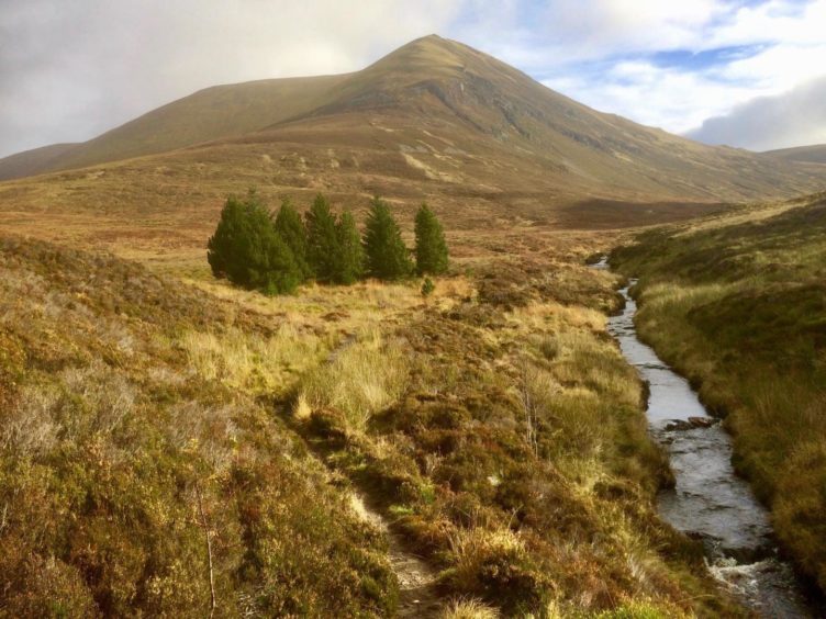
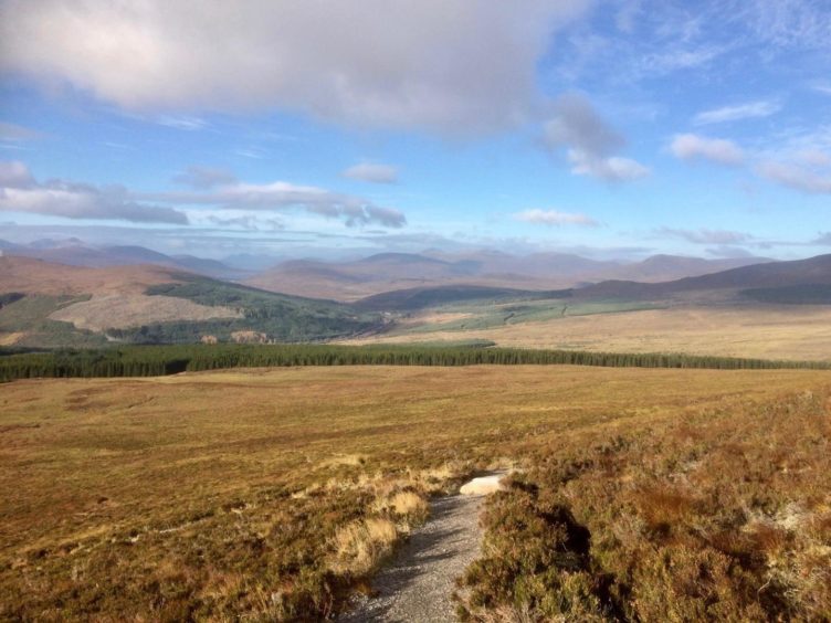
It’s easy to see why Ben Wyvis is the ‘awesome mountain’. The name derives from the Gaelic ‘fuathais’, a now obsolete word which refers to a great quantity, and there is no doubting its dominance over the surrounding landscape.
Its vast bulk fills the skyline on the journey north from Inverness, sprawling across the horizon like a huge, upturned ship. It is a much-loved and popular local hill, as much as Ben Lomond is to Glasgow or Lochnagar to Deeside.
Being an isolated mountain, it does to attract more than its fair share of wild weather, and there have been instances of walkers being avalanched off its wide, summit ridge in winter.
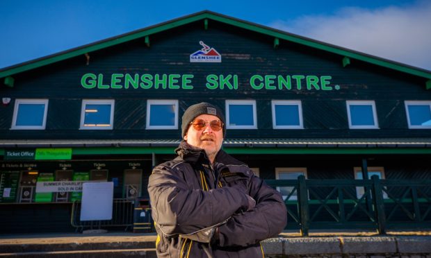
Legend has it that local lairds once held land from the Crown on the condition that they could produce a snowball from its slopes on any day of the year. More recently, there were attempts to locate a ski centre here, but thankfully nothing came of it and the mountain is now the centre of a national nature reserve.
But in fine spring and summer conditions it provides one of the easier Munro days with a relatively straightforward ascent that can be taken at a gentle pace.
The route starts from car park (signed) on the road to Ullapool, but it is small and can fill up quickly. There is a big layby about 400m further up on the left. The nearest stop for buses is at Garve, five miles to the south, but it may be possible to get a request stop. Trains also stop at Garve and there is a path from the rail station, but it does add a fair bit extra to the walk.
It’s a gentle start, the path running north from the car park to a bridge, then turning into mixed woodland of aspen, birch and rowan, home to a wide and noisy variety of birdlife as well as butterflies and dragonflies. Keep following the line of the stream until you emerge from the treeline. A short distance beyond, still by the side of the water, the path splits, the left-hand branch heading uphill to the prominent summit of An Cabar (The Antler).
The restoration work on this path has made this ascent much more comfortable, well-drained, wide lines swinging back and forward, easing the way ahead. This is in stark contrast to the bog trot many of us endured years ago.
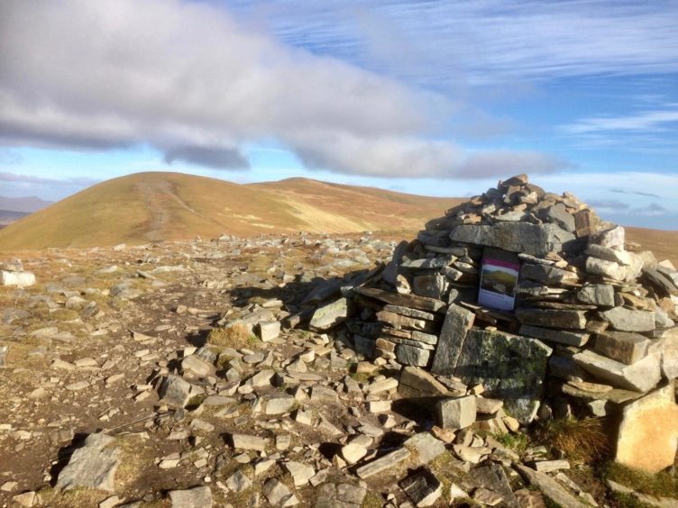
There are big boulder steps on the final push, keeping walkers out of the muddy, badly-worn trenches of the old line. When you finally reach the cairn on this summit, you may notice a sign detailing repair work and asking you to stick to the main path line to the main summit, Glas Leathad Mor, to protect the delicate carpet of woolly hair moss which covers the high parts of this mountain.
There’s a small cairn at the start to set you right and another marker further on. There are also sheets of jute netting to protect and hopefully restore damaged ground, and at some points flagstones have been laid, a rare sight on a Scottish mountain.
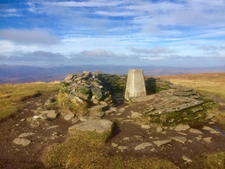
Most of the hard work now done, there are just a few lazy rises to reach Glas Leathad Mor – it means big greenish grey slope – which is marked by a shelter cairn and trig point. On a clear day, the views are extensive.
If you have the time and inclination, it’s worth continuing the journey along the ridge to the next summit, Tom a’ Choinich, which gives fine views into the huge eastern corries and further out to the rarely climbed Munro Top of Glas Leathad Beag. There have been murmurs for many years now that this summit could be re-classified as a separate Munro, so if you are bagging it may be prudent to venture out here in case the list changes again at some future date.
In autumn, the roaring of stags can be heard reverberating around these deep, lonely corries, and you may be lucky enough to catch sight of a golden eagle gliding on the thermals.
The simplest return is to reverse the inward route, sticking to the correct line, hopefully having had an awesome day on this awesome mountain.
Route
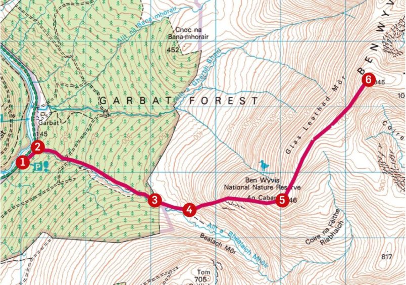
1. Take signed path north out of car park to reach wooden bridge over Allt a’ Bhealaich Mhoir.
2. Cross bridge and go east on path by stream through woods.
3. From edge of wood, continue beside stream over more open ground until path splits (cairn marker).
4. Take left-hand branch heading steeply uphill to summit cairn of An Cabar.
5. Follow path north-east along wide ridge to summit and trig point of Glas Leathad Mor, the main summit of Ben Wyvis.
6. Those who wish to extend the day can head north to the next top, Tom a’ Choinich. Otherwise, leave the main summit and reverse the route back to the start.
Information
Distance: 14.5km/9miles
Ascent: 940m/3,080ft
Time: 5-7 hours
Grading: Hill and woodland paths. Steep, sustained climb to high, exposed summit ridge, best suited for fit and well-equipped walkers with relevant hill and navigation skills.
Start/finish: Forestry Commission car park (Grid ref: NH 410671) off the A835 north of Garve.
Map: Ordnance Survey 1:50,000 Landranger Map 20 (Beinn Dearg & Loch Broom); Ordnance Survey 1:25,000 Explorer sheet 437.
Tourist Information: VisitScotland, Inverness iCentre, 36 High Street, Inverness, IV1 1JQ (Tel 01463 252401).
Public transport: Inverness to Ullapool buses and Inverness-Kyle of Lochalsh trains, but nearest stop in both cases is Garve, some 7km south of starting point.
