SALINE HILL and its conjoined twin Easter Cairn are the fourth and sixth highest summits in Fife, and their ascent, rounded off by a delightful woodland walk, provides a satisfying half-day circuit.
Starting from the small car park in the centre of Saline, I crossed Main Street then turned up Bridge Street past a row of 18th Century cottages, a reminder of the village’s weaving heritage.
After passing Tulohill Cottage, I took a farm track right which rose between sheep fields, and when the track started to turn towards Killernie Farm, I went through a gate to the left and followed a faint path along the edge of a field.
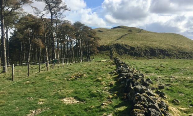
This historic right of way passed through a couple of gates and stiles to reach a stream and soon after crossing, it joins a farm track coming in from the left beside a small quarry.
Ascent
It is possible to make an ascent of Saline Hill a little further on by crossing the wall to the right and heading directly up the north-west shoulder through gorse bushes and sheep fields but this is working farmland and it can be off-limits at certain times of the year.
Instead, I continued on along the track as far as the entrance to Sheardrum. Beyond this, the going got boggier, the ground churned up by cattle, although it improved along the line of an old rail embankment.
The aim now was to reach the track running along the side of Knock Hill which leads to the col with Easter Cairn.
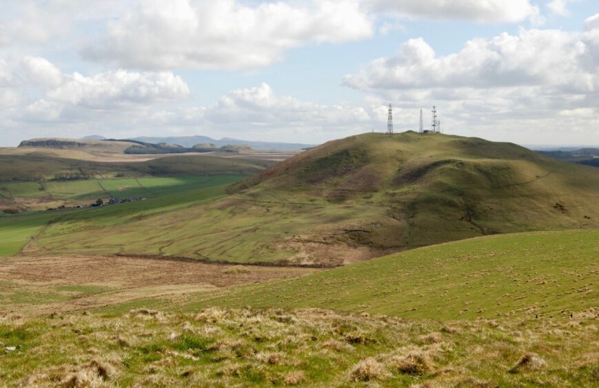
It’s easy enough to add Knock Hill to the day, a short, steep push uphill to a summit festooned with communications masts which won’t take too much extra effort.
The going was rougher and wetter at the col, but once across the fence to the right it became drier for the straightforward ascent on grassy slopes, the only minor barrier a barbed wire fence which was easily squeezed through.
Hill fort
Easter Cairn is the easternmost of three summits which make up Saline Hill, and is the site of an old hill fort.
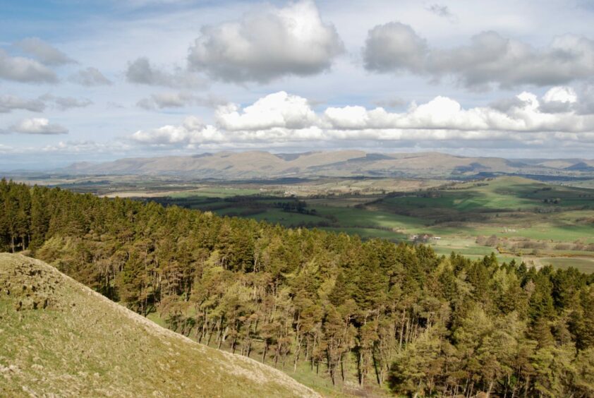
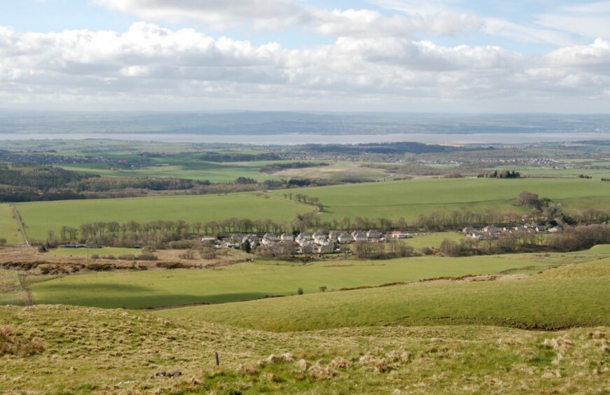
The views from its grassy top were extensive with the Ochils on the north-west horizon, and the Cleish Hills to the north-east. On a clear day, the Pentlands stand out in the view south.
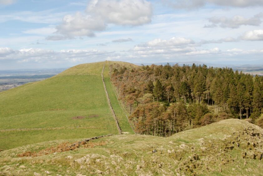
You need to be aware of the small craggy area when making the initial descent, but they are easily outflanked and you are soon following an old wall which rises parallel with a pine plantation towards the large cairn on Saline Hill.
I retraced my steps back to the low point with Easter Cairn then dropped down open ground, aiming for the edge of another plantation. I then followed a fence along to a track which led down to the road just east of Steelend.
The wide grass verge provided safe passage along to this former mining village, until I reached a sign indicating a right turn for Saline Hill.
The route took a slightly convoluted line round some houses and then through a little park before heading into the trees.
The glen path twisted and turned along the top of a steep-sided ravine as the rushing sound of the burn filtered up from far below.
The late sun glinting through the remaining foliage merely added to the feeling of tranquillity as I crossed a series of bridges and finally climbed some steps to emerge back in the centre of Saline.
ROUTE
1. From car park, cross road and turn down Bridge Street past row of cottages, then bending left by cemetery. At Tulohill Cottage, go right on farm track.
2. Turn left through gate where road starts turning towards Killernie Farm, and follow faint path (right of way) along edge of fields, through several gates and crossing burn to join farm track beside small quarry near entrance to Balgonar.
3. Keep following track round to the right past Sheardrum and along to line of old rail embankment.
4. Turn right, crossing to link with track running across Knock Hill (you can easily detour to this summit if you wish) and then follow path south to col.
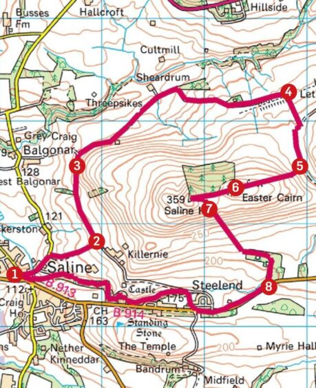
5. Cross fence to head west uphill on grass to Easter Cairn, squeezing through a barbed wire fence just before the final steps.
6. Descend carefully from summit to outflank craggy section then follow old wall with pine plantation to right and climb to big cairn on Saline Hill.
7. Return to col with Easter Cairn then drop south-east over pathless terrain to edge of small plantation and take track which goes into trees heading down to B914 road near Steelend.
8. Turn right and walk along grass verge to reach sign on right for Saline Glen. Follow signs round houses and small park then into woods before emerging back on Main Street.
INFORMATION
Distance: 10.5km/6.5miles
Ascent: 360m/1180ft
Time: 3-4 hours
Grading: Minor roads, farm lanes and tracks, some pathless walking, finishing with woodland path through Saline Glen.
Suitable for most abilities, two short, steeper ascents. Can be rough and muddy in places, good footwear advised.
Dogs under close control due to farm livestock (there may be also be some signed restrictions).
Start/finish: Main Street car park, Saline (Grid ref: NT 024925).
Map: Ordnance Survey 1:50,000 Landranger Map 58 (Perth & Alloa); 1:25,000 Explorer sheet 367.
Tourist Information: VisitScotland, St Andrews iCentre, 70 Market Street, St Andrews, KY16 9NU (Tel 01334 472021).
Public transport: Dunfermline to Oakley bus route (No 6A).