An exhaustive roads management plan aimed at keeping traffic flowing during the Solheim Cup competition will be unveiled to residents next week.
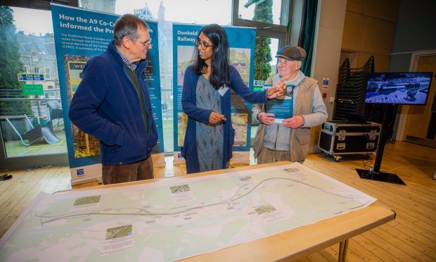
A drop-in session has been arranged to give members of the public the chance to hear proposals for road closures, public transport and parking.
The tournament takes place at Gleneagles from September 9 to 15, and is expected to attract around 100,000 fans.
The information day will be held at Aytoun Hall, High Street, Auchterarder from 12pm to 8pm on Tuesday, July 2.
Presentations will take place at 1.30pm, 3.30pm, 5pm and 6.30pm, while officials will be on hand to answer questions.
David Laing from Transport Scotland said: “We have worked with key partners including Perth and Kinross Council over the past 20 months to develop a transport plan for all of the visitors to the Solheim Cup at Gleneagles.
“This drop in session is a great opportunity for the local community to see how that plan will work, in particular the bus park and ride experience and additional rail services that will be put on for spectators.
“The Solheim Cup will attract around 100,000 spectators to Gleneagles, with an expected TV audience of 600 million, so we want to make sure that the excitement and quality of the event is supported through this plan and everyone is able to enjoy this fantastic competition.”
It is proposed that the following roads will be closed to traffic between September 1 – 30:
1) A823 from its junction with the A91/Yetts o Muckhart to its junction with the A9 (T) Gleneagles southbound off slip to the A823 at Loaning head flyover.
2) A823 from its north junction with the A9(T)/A823 Gleneagles southbound off slip roundabout at Loaninghead flyover to the junction with Orchil Road, Auchterarder.
3) A824 Western Road, Auchterarder from its junction with Orchil Road, Auchterarder to its south junction with the A9(T).
4) B918 Carnbo to Kinross road from its junction with the A91 access road to its junction with the C494 at Burnbrae.
5) U234 Mawhill Road from its junction with the A91 to its junction with the B918.
6) U23 Gleneages Hotel Road from its junction with the A823 for its full length.
Alternative Route for traffic is:
1) A91 – A922 – B996 – A91 – A912 – A93 – A9(T)
2) A824 – A9(T)
3) A824 – A9(T)
4) A977 – A922 – A91
5) A977 – A922 – A91
6) A823 – CALEDONIAN CRESCENT
Loading bans are also required on both sides of the following roads:
1) A822 for its full length from its junction with the B8062 in Crieff to the Greenloaning interchange.
2) A823 from its junction with A9(T)/A823 Gleneagles southbound off slip roundabout at Loaninghead to its junction with the A822 south of Bishop’s Bridge.
3) A824 for its full length from its A9(T) south junction to Auchterarder to its junction with the A9(T) northeast of Aberuthven.
4) C465 for its full length from the junction with the B8062 west of Pairney to the junction with the A824 High street, Auchterarder.
5) B8062 for its full length from its junction with the A822 in Crieff to its junction with the A824 in Auchterarder.
6) B918 for its full length from its junction with the A91 at Carnbo to its junction with the A977 at Turfhills Tollhouse.
7) C466 for its full length from the junction of the A824 in Auchterarder to Auchterarder station.
8) C467 for its full length from the A822 junction north of Braco near Seathaugh to the 30mph signs west of Gleneagles.
9) C494 from its junction with the B918 at Burnbrae to its junction with the A977 at Powmill.
10) U16 for its full length from its junction with the C458 Muthill to Auchterarder Road near Drumness to its junction with the A823 at Drummawhance.
11) U18 Fordun Road for its full length from the junction with the B8062 near Auchterarder house to the junction with the C463 Minnoburn Road at Netherfordun.
12) U20 for its full length from its junction with the A824 at Muirton to its junction with Tullibardine Toll House.
13) U189 Bardrill Road for its full length from the junction with the A9(T) east of Drumlochy to the junction with the B8081 at Moray Street, Blackford.
14) U23 for its full length from its junction with the A9(T) at Gleneagles Station to the junction of the A823 at Gleneagles Hotel.
15) U25 for its full length from its junction with the U26 Duchally Road south of Auchterarder Station to Coulshill.
16) U231 for its full length from its junction with the A977 south of Kinloch Burn to its junction with the C494 near Burnbrae.
17) Orchil Road, Auchterarder, from its junction with Western Road to its junction with the C464 leading to A823.
18) The new Gleneagles Station link road being its full length from the Station to the A823.
19) Tullibardine Road, Auchterarder from its junction with Orchil Road to its junction with the U20.
20) Easthill Road, Auchterarder for its full length to its junction with the U20.
21) Muirton, Auchterarder being its full length from its junction with Orchil Road, Auchterarder to its junction with the A823.
22) New School Lane, Auchterarder being its full length from its junction with High Street, Auchterarder.
23) The access Road leading to St Margaret’s Hospital and the Health Centre being its full length from its junction with Western Road, Auchterarder.
24) The A85 from the Crieff Road, Perth to its junction with the B9993 at the A9(T) slip road, Perth being its full length.
Temporary One Way Orders are also required on the following roads:
1) B918 Carnbo to Kinross Road from its junction with the C494 junction to its junction with the U234
2) C494 Balado Station to Coldrain Road from its junction with the A977 to its junction with the B9097
3) U231 Tillyochie Road from its junction with the A977 to its junction with the B918/C494 junction
Temporary 40mph Speed restrictions are also required on the following roads:
1) The A91 from its junction with the M90 junction 7 Milnathort southbound off slip westwards to its junction with the A823 Yetts o’ Muchart road, a distance of 11.759 kilometres or thereby.
2) The A977 from junction 6, Kinross, northbound off slip road, westwards to its junction with the U231 access road to Tillyochie House, a distance of 4.251 kilometres or thereby.
3) The A823 from its junction with Orchil Road, Auchterarder, to its junction with the U19 Tullibardine Road, a distance of 1.732 kilometres or thereby.
All of the above routes will be subject to a 50, 30, 20, and 10MPH speed restrictions as and when directed.


