Glittering Skellies, Glen Doll, Angus
The Glittering Skellies are the granite slabs on the slopes above Bachnagairn and on a sunny day after the rain storms have moved through it’s easy to see how they got the name, their reflective sheen turning the hillside into a hall of mirrors.
There wasn’t much glitter on my latest visit, but the circuit which links two beautiful glens is always a pleasure. It does cross some high, exposed terrain, and a careful assessment of the weather conditions is vital, especially during the winter months.
My arrival in Glen Doll was greeted by a mini-blizzard, a shock to the system after the benign sunrise skies which had accompanied me most of the way. Even the normal chaffinch flurry was missing, the birds deciding to sit this one out for a bit. I decided to do the same and delay the start of the walk.
Ten minutes later, the snow had switched off and I set off on the woodland path alongside the lively waters of the South Esk, then crossed the bridge into the pines and out on to the track.
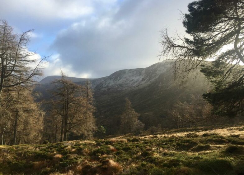
The trees were sighing heavily and the clouds speeding across the sky but there was a clarity in the early winter air which seemed to sharpen every contour, and the constant juxtaposition of light and shadow on the surrounding slopes was a joyful performance of natural theatre.
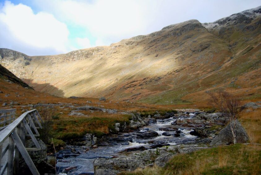
The bridge beyond Moulzie is a replacement for one swept away a few years ago, and the power of the flow here was re-emphasised by the erosion, big chunks of the bank collapsed into the water. The path is slowly being eaten away.
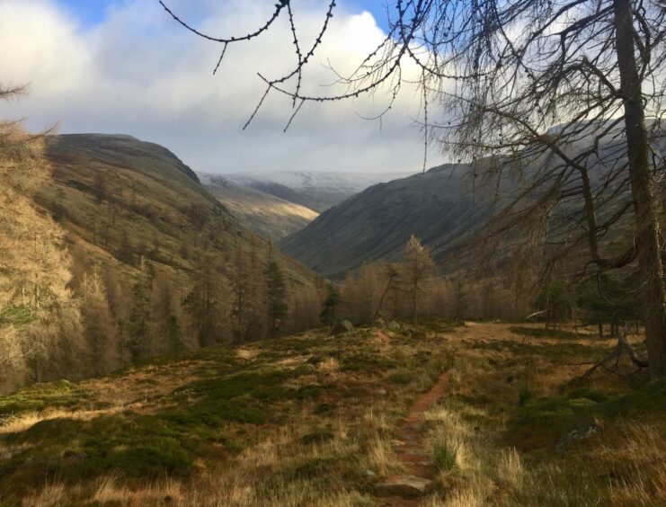
The track that climbs steadily westwards has seen its formerly bouldery surface smoothed over, making for an easier passage up to the edge of the trees at Bachnagairn where a stepped path takes over for the short, snaking rise through the wood.
There was a wonderful silence in this sanctuary, my footsteps cushioned by a russet layer of pine needles, the wind kept at bay.
I managed to avoid the automatic pilot turn to the Tait Bridge – the way up to Broad Cairn – and kept heading straight up to the end of the treeline. The snow swept in again as I exited this sheltered area rendering the high tops invisible, but the path was easy to pick out as it turned over rockier terrain on a steady incline with the occasional crunch of ice underfoot.
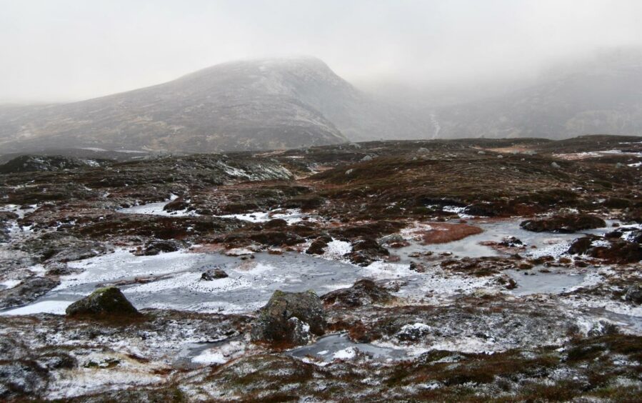
A glance in the rear view mirror revealed denuded trees and autumn colours, while ahead the grey was closing in. My line was through the middle: the only place the snow appeared to be lying was on the path, a helpful guide as it cut across the plateau. Along the way, the odd marker post was there for reassurance.
I passed through a series of pools coated in ice and snow and the gloomy grey puddle of Loch Esk away to the right, then dipped over the edge of Cairn Lunkard, its cairn a piled rocky pimple standing out on the skyline.
A cairn marked the union of the path with that of Jock’s Road, and a left turn led down past the memorial plaque to the lost souls of the tragedy of 1959 when five members of a Glasgow hiking club perished during a New Year crossing from Braemar.
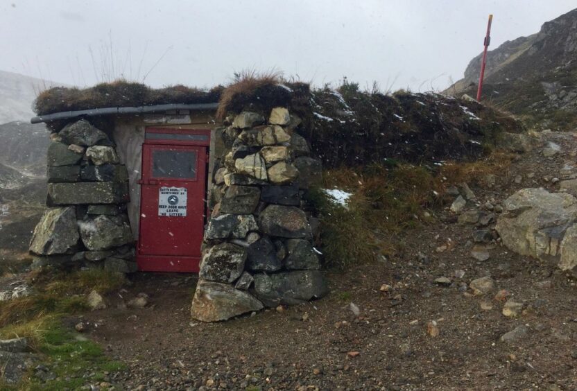
Nearby is the rough shelter of Davy’s Bourach, recently repaired and restored by volunteers from the Forfar club, a refuge which has come to the aid of a few strugglers over the years.
The path dropped fast, down the side of a waterfall, then along the side of Craig Damff, before dipping into Glendoll Forest where the moss seems to have perfected its creeping colonisation of every boulder, every fallen tree. Eventually it emerged to link with the track for the final short leg past the lodge and Acharn Farm back to the car park.
ROUTE
1. Head north from car park past picnic benches and take woodland path alongside river until reaching bridge on right.
2. Cross bridge and follow path through trees and when it meets track, turn left.
3. Skirt buildings at Moulzie on right and when track turns to path, follow alongside river to cross bridge.
4. Stay on track as it turns west and climbs to Bachnagairn, ignoring turn on right down to Tait bridge and continuing to top of treeline.
5. Path now turns south-west over undulating open ground for 2km following line of marker posts, passing Loch Esk on right to link with Jock’s Road path (cairn).
6. Turn left and take path past shelter (Davy’s Bourach) and down to forest.
7. Follow path through trees for around 2.5km until it joins track coming in from right, and head east past Acharn Farm to car park.
INFORMATION
Distance: 15.5km/9.5miles
Ascent: 633m/2076ft
Time: 4.5-6.5 hours
Grading: Tracks and hill paths through woodland and over exposed high terrain, great care needed in adverse weather. A route for well-equipped mountain walkers with good level of fitness, relevant experience and navigation skills.
Start/finish: Glen Doll parking (Grid ref: NN 913610).
Map: Ordnance Survey 1:50,000 Landranger Maps 44 (Ballater & Glen Clova); Ordnance Survey 1:25,000 Explorer sheet OL 53.
Tourist Information: VisitScotland, Ballater iCentre, Station Square, Ballater, AB35 5QB (Tel 01339 755306).
Public transport: None.
