Summer beach holidays may be an increasingly distant memory but, for me, the seductive lure of sea and sand remains as strong as ever.
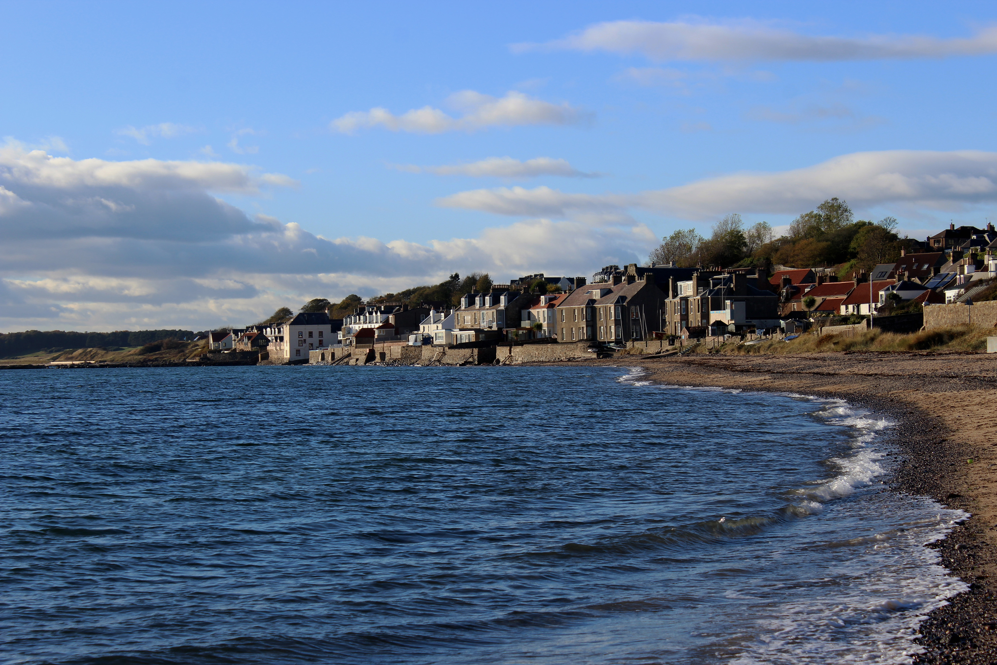
Granted, coastal conditions are more bracing than balmy at this time of year and, while the sky was blue and the sun beaming, I wasn’t tempted to pack bathers and a towel in my rucksack as I set off from the village of Lower Largo.
Wandering through a narrow lane of tightly clustered cottages and houses, I was content to tramp the coastal margins of Largo Bay without poking a toe in the freezing waters of the Forth.
Following the Fife Coastal Path east, I steamed out of the village on the foundations of the old Fife Coast Railway. Weaving up through the East Neuk from Leven in the south to St Andrews, it must have been a wonderfully scenic journey in its day.
The route closed in the 1960s but its ghostly passage conveyed me swiftly to Dumbarnie Links, a tiny dune-based nature reserve overlooking the bay.
Lurking amid the thick tussocks of marram and lyme grass, various scarce species of wildflowers thrive here, enjoying the salty slap of sea air in a constantly shifting, rather precarious environment.
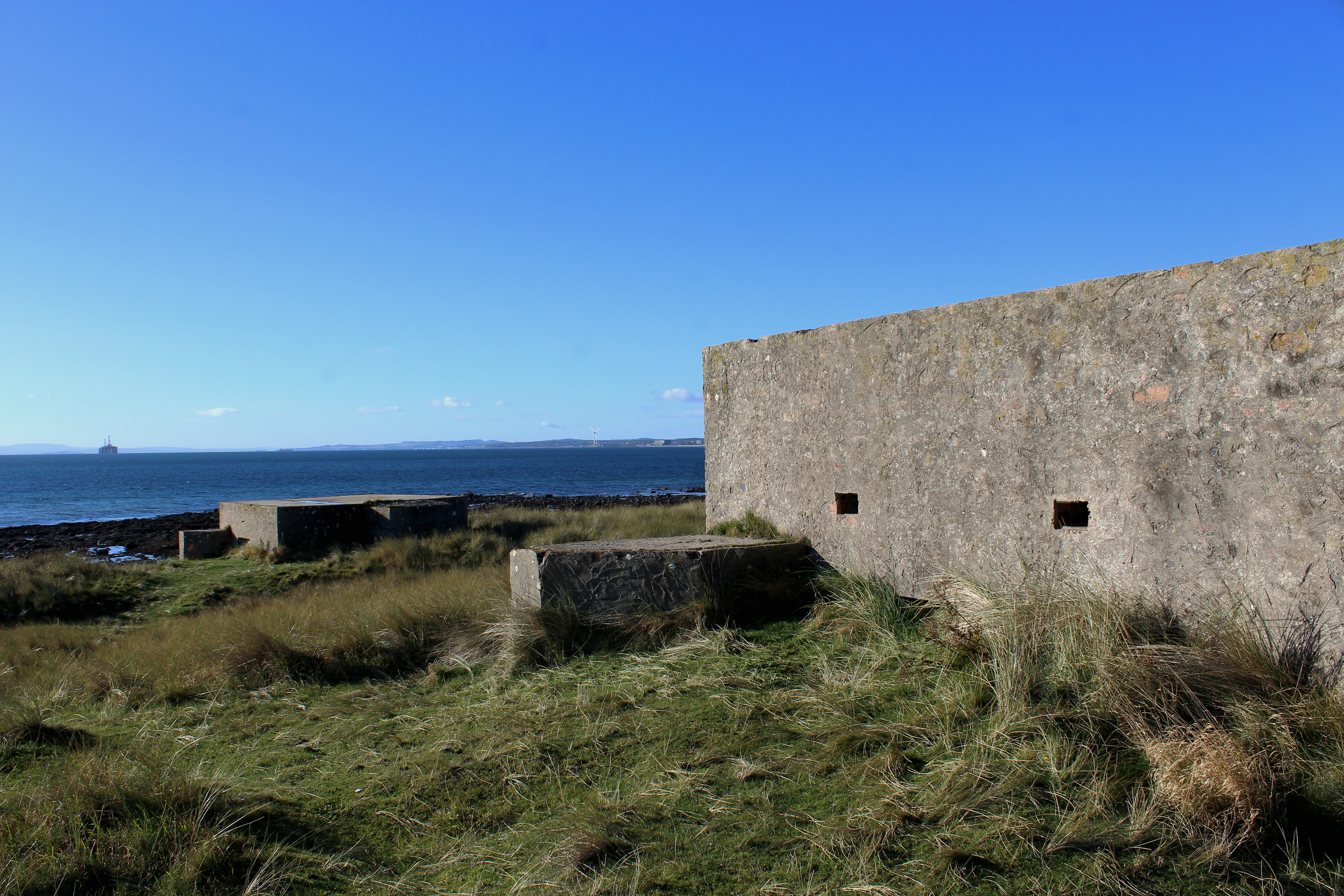
At the eastern end of the reserve, two more robust structures, defensive pill boxes dating from the Second World War, hunker down in the dunes. The one closest to the sea has been sealed off and adapted as a roost for bats while the one behind it is open for exploration.
Emerging from the gloomy bunker into the light, I negotiating a nearby line of anti-tank blocks and then opted to leave the path through the dunes, enjoying instead some time on the sand, dodging the ebb and flow of the incoming tide as I crunched through scattered shells.
At the end of the beach, and depending on conditions, walkers can either paddle over the outflow of the Cocklemill Burn or deviate inland where a pair of bridges guarantee a dry crossing.
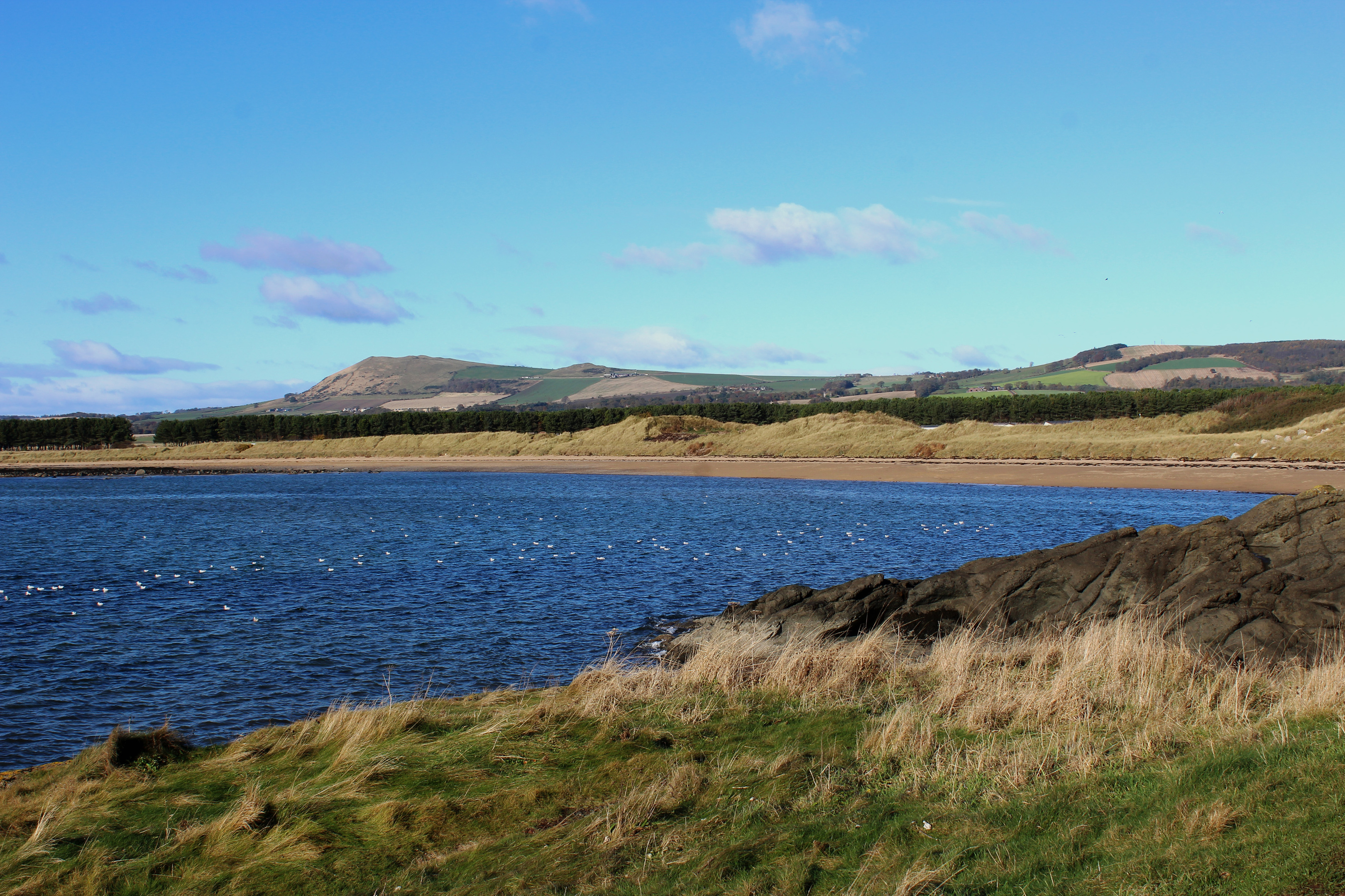
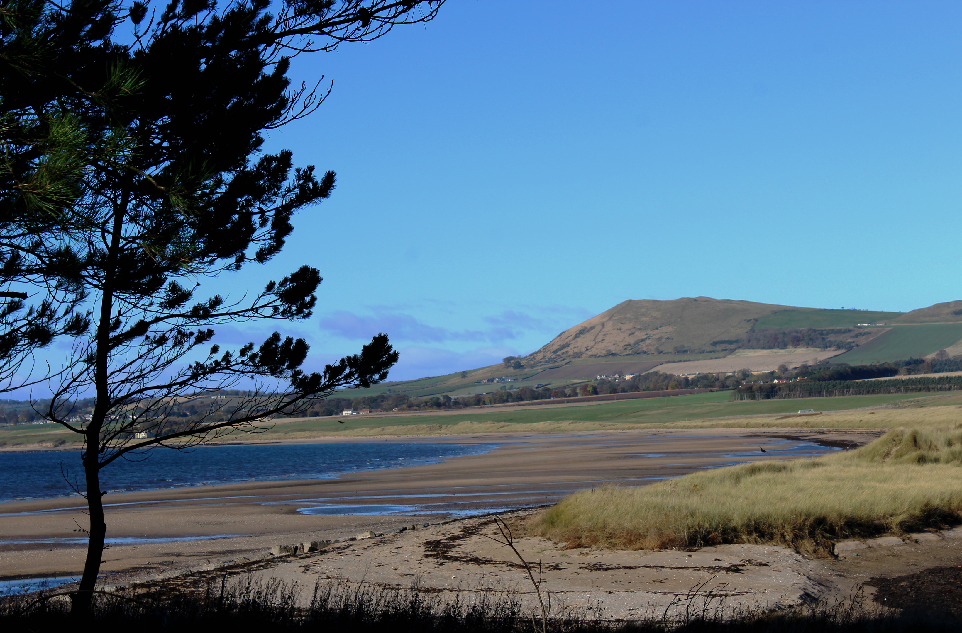
Passing through a band of slender pines beyond, Ruddon’s Point, on the right, demands a detour, a wee hummock the perfect spot to stop and look out over Largo Bay towards the prominent peak of Largo Law, before moving on to Shell Bay.
This sheltered sandy inlet may be small when compared to the vast sweep of its neighbour, but it is perfectly formed, a secluded cove protected on one side by Ruddon’s Point and, on the other, by the sturdy flanks of Kincraig Point. It is a popular spot for seabirds seeking respite from blustery weather.
Re-joining the coastal path at the end of the bay, where refreshments can be found in the adjacent holiday park’s café, I headed out on to the point, the path skirting around the shoreline before climbing on to the brow of the rocky promontory.
Rising above the popular Elie Chain Walk, which negotiates cliffs and crags down to the right using a series of steps and chains, the headland is pitted with the remnants of wartime activity – a battery of big guns stationed here to protect shipping on the Firth of Forth.
The guns long silent, this is now a peaceful place to perch and fire off a few photographs of the spectacular coastal views before making tracks back to Lower Largo on the old railway line.
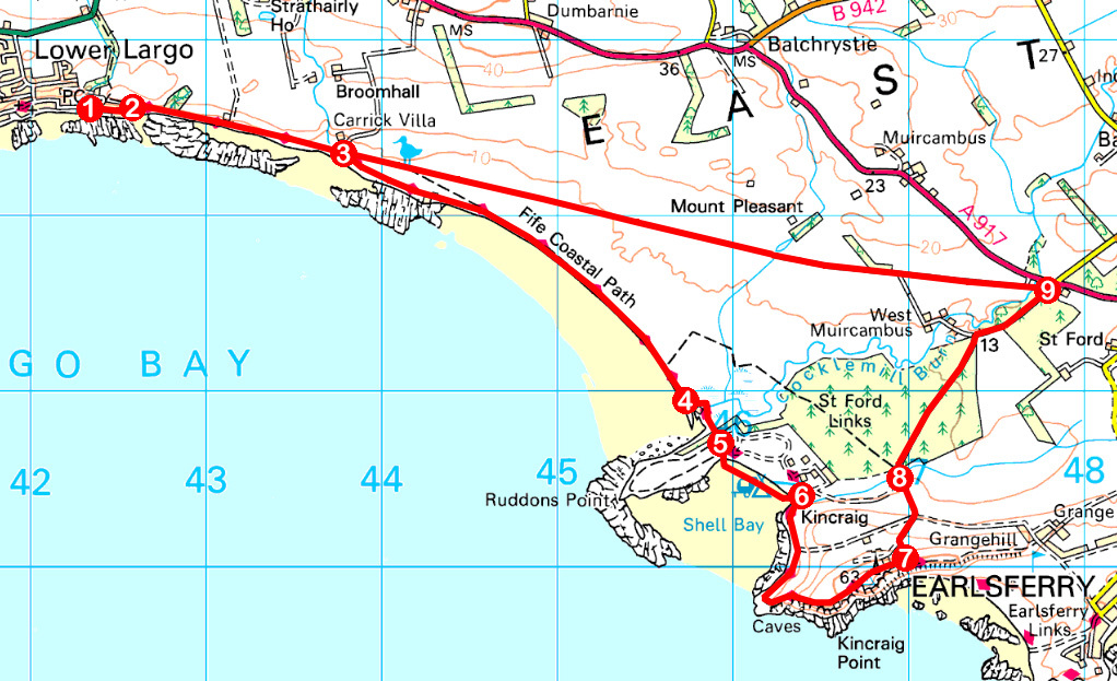
ROUTE
1. Walk east along The Temple to turning circle.
2. Ascend steps on left, cross stile and go right, walking east along former railway line.
3. Below Carrick Villa, descend right and follow signed coastal path south-east, initially through nature reserve, passing pill boxes.
4. Bear left to cross bridges spanning Cocklemill Burn outflow.
5. Cross grassy parking area on corner of holiday park then drop down on to Shell Bay, continuing south-east.
6. Cross stream by bridge below information boards and follow coastal path around and up on to Kincraig Point.
7. Continue to a high metal gate on right side of path then bear left down field edge to meet surfaced track. Descend right to junction beyond metal gate then descend left on gravel track.
8. Turn right and walk 1.4km north-east along holiday park access road.
9. Approaching A917, turn left and follow track west to point 3. Retrace steps to Lower Largo.
INFORMATION
Distance: 14km/8¾ miles
Ascent: 130m/430ft
Time: 3-4 hours
Grading: Moderate, low level route following waymarked coastal path and inland tracks. Take care on Kincraig Point due to steep, unguarded drops and keep dogs under close control return leg due to livestock
Start/finish: Coastal path car park (signed from A915) at eastern end of Main Street, Lower Largo (Grid ref: NO 422026).
Map: Ordnance Survey 1:50,000 Landranger sheet 59; Ordnance Survey 1:25,000 Explorer sheet 371
Tourist Information: St Andrews Information Centre, 70 Market Street, St Andrews KY16 9NU (Tel 01334 472021)
Public transport: Stagecoach service 95 (St Andrews to Leven) stops in Lower Largo