Black Hill, Glen Lethnot, Angus
A beautiful Sunday morning, perfect weather for hillwalking, yet there’s not another soul in sight. Over the years I’ve come to expect that in Glen Lethnot.
It’s the quietest of the five big Angus glens by a long way, and many regard it as the most beautiful. Clova and Esk have their Munros, sometimes Prosen and Isla for a different approach. This is a location far from the bagging crowd, and all the better for it.
Follow the long and winding minor road to its conclusion at Waterhead and you will find a choice of wonderful high-level circuits along with a high probability of solitude.
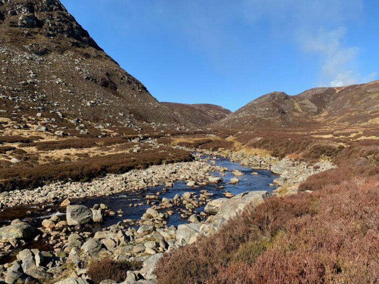
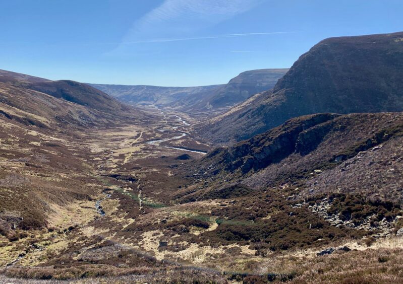
I took the rough track by the twisting blue of the Water of Saughs with the high, craggy faces of the impressive Corrie na Berran to my left. When the main track swung right, I went straight on by the path which continued through the heather then climbed beside the West Burn, every so often turning to drink in the wonderful views back down the glen.
Ascent completed, I regained the original track and travelled along high above the water, passing a branch track going right to Cairn of Meadows – if you prefer a shorter circuit, this will save four kilometres and around 100 metres ascent – then further on ignored a left turn.
This drops to cross the river before turning back over the Shank of Donald Young, a hill named after a local warrior who was badly wounded during a skirmish and whose body was later found on the slopes where he had crawled to die.
After contouring Round Hill, I branched right for the short rise to Cruys, first by track and, when it runs out, over open ground by the fence. From the small cairn there were good views to Mount Keen and the snowy ridge lines of Lochnagar and the Mounth summits. I spotted a bird of prey circling languidly in the distance, the massive wingspan identifying it as a golden eagle scanning its territory.
The route now turned east, following the fence over boggier ground, dipping then rising again until linking with the track coming in from the right. A short diversion to the left leads to the high point of Cairn of Meadows.
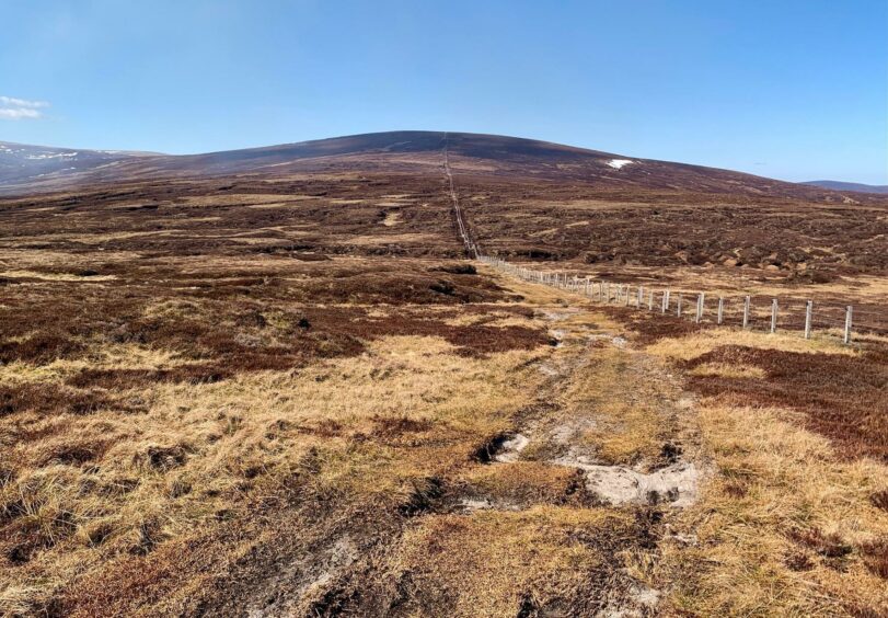
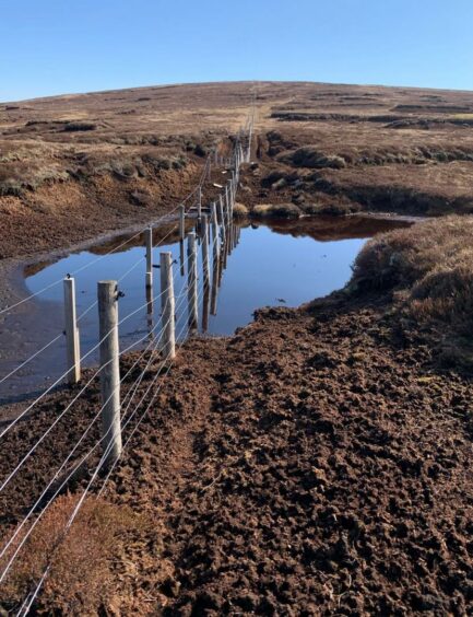
After a brief retracing of steps, I went left and then sharper left at the next junction, proceeding to Black Hill with the echoing calls of skylarks and plovers for company. The ditches and pools along the edges were filled with frogs and spawn. Occasionally, grouse would explode from the heather with their unmistakable machine-gun call.
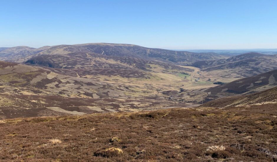
The sprawling Wirrens were now the main attraction to the east as I continued by a line of grouse butts and stands over Little Black Hill and on to Broom Craig where a split just beyond the high point directed me right on a downward curvature.
The track gradually deteriorated to a ribbon of rubble as it descended. On reaching a hairpin turn, it was decision time. Turning left leads down to the road where you pass the bright pink residence of Hunthill Lodge on the walk back round to your car. The alternative is to drop directly south, but it is rough going over heather and boulder-strewn ground.
I arrived to find the car park crowded. Well, there was one other car. Funny how a day spent in splendid isolation can leave you feeling slightly selfish at the slightest intrusion.
ROUTE
1. Take track from parking area north-west up Glen Lethnot with Corrie na Berran on left, passing memorial cairn on right then bridge to left to reach spilt in track.
2. Ignore branch heading uphill to right, go straight ahead through heather on track then path which climbs beside West Burn.
3. From high point, drop to join wider track. Ignore branch going right (this is for shorter option direct to Cairn of Meadows) then another dropping left to Water of Saughs.
4. After track curls past Round Hill, take turn on right heading north then fainter line east by fence to reach summit of Cruys (cairn).
5. Follow fence east over boggy ground (faint paths) dipping then rising again. Join track coming in from right and at split marked by boulder pile, go left to top of Cairn of Meadows.
6. Return to boulders and turn left on track, then sharp turn left at next junction to head up Black Hill.
7. Drop south on track winding over Little Black Hill and then on to Broom Craig. Ignore first right branch and continue to high point. At next split keep right to follow track as it curves right then downhill.
8. When track makes sharp turn at around 450m, head east to reach minor road for short walk back round to parking. You can also take more direct route dropping south over rough slopes.
INFORMATION
Distance: 18km/11.25miles
Ascent: 650m/2132ft
Time: 4.5-6.5 hours
Grading: Estate and hill tracks, some pathless walking. Mostly simple route-finding with steady ascents over high, exposed terrain which could prove challenging in poor conditions: walkers should have good level of fitness and relevant navigation skills. Muddy ground and rough stony tracks, stout footwear recommended. Dogs under close control – farm livestock and ground nesting birds.
Start/finish: Parking area at Waterhead (Grid ref: NO 465717) road end at head of Glen Lethnot.
Map: Ordnance Survey 1:50,000 Landranger Map 44 (Ballater & Glen Clova); Ordnance Survey 1:25,000 Explorer sheet 54.
Tourist Information: VisitScotland, Dundee iCentre, 16 City Square, Dundee DD1 3BG (Tel 01382 527527)
Public transport: None.
INSERT FOR P&J
Tourist Information: VisitScotland, Ballater iCentre, Station Square, Ballater, AB35 5QB (Tel 01339 755306).