Geal-charn Mor, near Aviemore, Inverness-shire
Scotland has no shortage of hills named Geal Charn. Meaning white hill, the epiphet seems particularly prominent around the Strathspey and Laggan areas.
This particular individual sitting to the west of Aviemore has the added boast of Mor (big) to its title which may seem peculiar when you consider it is a relatively minor figure in the greater scheme of the Cairngorms.
Topping out at 824 metres, it is classified as a Corbett, but the starting elevation means the ascent isn’t too taxing and although it’s not the most exciting hill in its own right, on a clear day the views to its massive neighbours across the road are superb.
The start point is the hamlet of Lynwilg, reached from a minor road just off the A9. There are a couple of parking places just before the bridge and a small woodland car park about 500 metres further up the surfaced road.
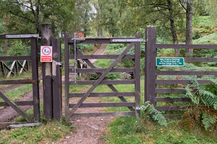
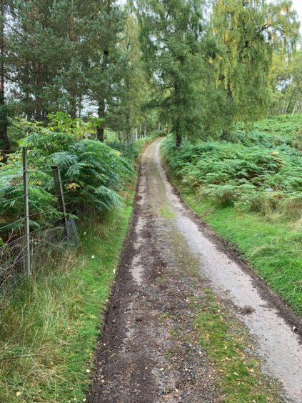
From the car park, a wooden gate gives entry to the signed Burma Road, said to have been constructed by prisoners of war in the 1940s, and which runs for almost 13 miles over the hills to Dulnain Bridge.
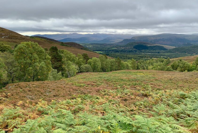
Autumn has been a late starter this year, but the greens were finally beginning to give way to the yellows and browns as I set off, the lively wind dropping leaves like gentle rain.
There was no time for acclimatisation, the gravel track immediately climbing stiffly between the trees. Once the mixed cover started to thin, the views south opened out, revealing the long, dark bulk of the cloud-guillotined Cairngorms filling the horizon.
With height, the remaining greenery gave way to heather moorland until eventually I arrived at a large cairn. This is high point of the track. Another cairn and a lonely memorial sat a few steps further on.
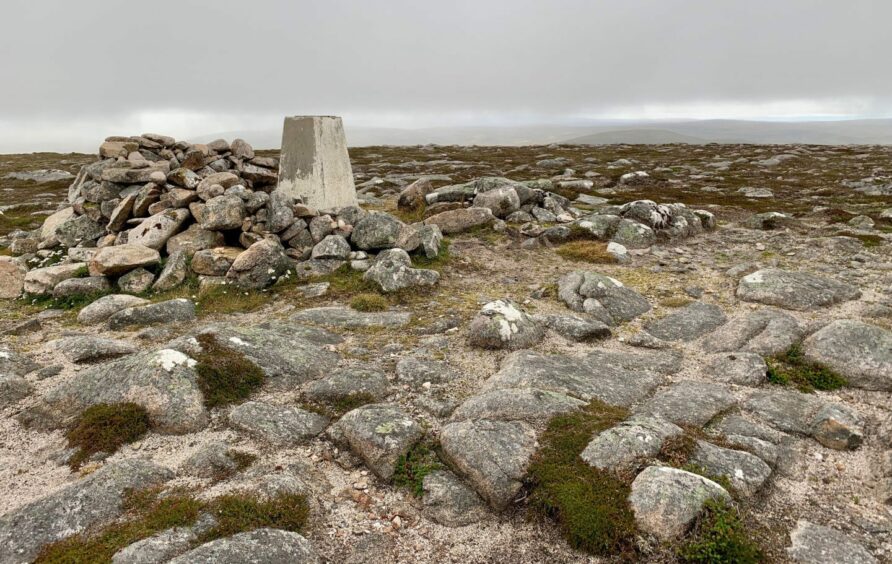
There was a choice of rough paths running off left, all heading to a fence where a stile allowed an easy crossing for the final short walk to the summit where there was a trig point surrounded by a shelter cairn.
The walking may have been easy so far, but it’s worth remembering that this bare and featureless ground can be a hostile habitat when the weather is wild or the cloud is down.
A direct line south-east across open ground led to a low fence and then to a rough path, but unless you are confident in your navigation it may be more prudent to retrace your steps to the track cairns and link up with the path there.
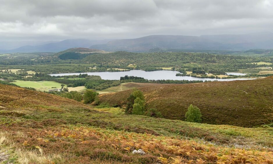
The boulders, mud and water of the path soon gave way to a grassier passage after passing through a gap in a high fence, and the appearance of Loch Alvie dead ahead provided a welcome fixed point.
The lower reaches of the path cut through bracken to reach a pedestrian gate and field, which was crossed to a metal farm gate (there are a lot of gates). Once through, I turned left on the track to reach Ballinluig and then went round the farm buildings to emerge on a surfaced road.
When it started to curve right, I went through another gate to the left and followed the track beside woodland to reach the final gate and the road back to Lynwilg. This passed Kinrara Distillery, a fine opportunity for a pick-me-up after the walk or simply if you are all gated out.
ROUTE
1. If parked at bridge, take minor road north-west to reach gate signed as right of way to Carrbridge via the Burma Road (there is small car park here you can also start from).
2. Climb steadily uphill on gravel track, passing through another gate. Once above treeline, keep following track to highest point to large cairn.
3. Leave track here or little further on at memorial and another cairn. Go south-west on one of paths heading uphill to fence, cross stile for final short walk to summit where is trig point and shelter cairn.
4. Direct descent goes east over open slopes to cross low fence and join path heading south. You can also reach path by returning from summit to track then picking up path, which may be preferable in poor visibility.
5. Path is wet and rough in places, but after passing through fence it becomes grassier as it drops with Loch Alvie straight ahead.
6. Path starts to swing left through bracken before emerging at wooden pedestrian gate. Go through and continue down grass track to larger metal farm gate.
7. Once through, turn left along farm track to reach next gate. Enter and go around farm buildings to swing right to surfaced road.
8. When road starts to curve right towards A9, go through gate on left and follow track along edge of woodland.
9. Go through one final gate passing cottages and then distillery before emerging at start point.
INFORMATION
Distance: 11.5km/7.2miles
Ascent: 605m/1985ft
Time: 3-5 hours
Grading: Short and never too taxing circuit on good tracks and paths. Exposed high terrain, suitable for those with reasonable fitness levels and navigation skills. Can be wet and muddy in places, sturdy footwear essential. Dogs under close control at all times – farm livestock and ground nesting birds. Please remember to close all gates securely.
Start/finish: Lynwilg just off A9 south of Aviemore (Grid ref: NH 882107).
Map: Ordnance Survey 1:50,000 Landranger Map 35 (Kingussie & Monadhliath Mountains); OS 1:25,000 Explorer sheets 56 and 57.
Tourist Information: VisitScotland, Aviemore iCentre, 7 Grampian Road, Aviemore, PH22 1RH (Tel 01479 810930).
Public transport: None to start, nearest bus and train services at Aviemore.