Kindrogan Hill, Perth & Kinross
The Kindrogan Loop is one of a number of excellent walking circuits that can be found along the A924 running from Bridge of Cally to Enochdhu.
It helps that the road is shadowed for much of its length through Strathardle by the Cateran Trail which provides the central link to a wide variety of route options.
I had intended climbing Kindrogan Hill last year but pulled the plug when I arrived to find a scene of devastation. The area was still suffering the effects of the severe storms of the previous winter, the hillside bare as a result of fallen trees and the resultant clear-up operation.
The situation has improved greatly but many scars remain, and there are a couple of sections where the walking can feel challenging. However, the majority of the walk is trouble-free and well-signed.

I parked off-road at the end of the old stone bridge on the rough track signed for Kindrogan. The bridge has long been closed off to traffic and there is space for a couple of cars at either end.
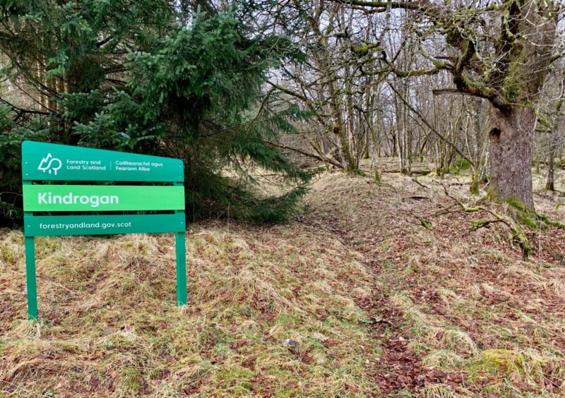
The track continues towards the former Kindrogan Field Centre, but first left took me uphill to the woods. The path system marked on maps is sketchy now to say the least, but I ventured into the trees just to the right of the large green Kindrogan forestry sign following the faint line of a former path.
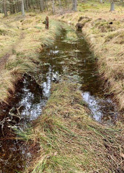
I had to dodge round a few toppled trees in the early stages, but the path became more obvious, if a little wet and overgrown, before emerging at a track. Just to the right in the trees was an old walled burial ground.

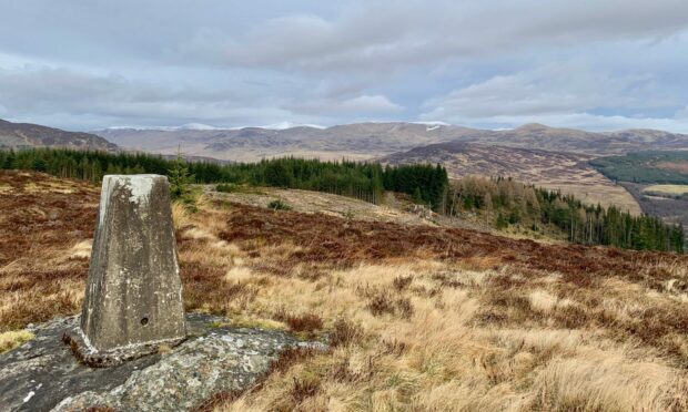
The path was supposed to continue straight ahead through the heavily felled slope, but although there were traces at times it was easier to pick my own line through the debris. It may not be pleasant, but it is relatively short-lived, and higher up the terrain eased for a smoother passage to the trig pillar sitting amongst the heather.
For anyone who’s counting, Kindrogan Hill is the 4355th highest hill in Scotland, and the distant views of higher regions were nice. The initial descent routes had also been obliterated: I went north-west at first following orange markers which twisted down to a flat muddy area and led straight ahead on an obvious wide firebreak through the pines.
The break threatened to become a little overgrown at times, but there was no problem and eventually it emerged on to a forest track. A few signed junctions kept me right before I made the diversion along to Loch Curran, a lonely and peaceful oasis amongst the trees.The only obvious sign of life was a young buzzard skimming across the water before resuming its high perch. From springtime, there is always a chance of spotting an osprey here.
I retraced my steps to the main drag and headed out along the edge of the wood to a gate, the boundary for Kindrogan Wood where I sat and had lunch, the distant sound of drumming woodpeckers echoing through the trees.
The way ahead became grassier and there was some heavy waterlogging at times, before the surface hardened again and led through a scattering of holiday lodges and then out along a farm lane to meet the Cateran Trail.
The return journey was mostly plain sailing, just a few hurdles to overcome in the shape of fallen trees blocking the path in some parts, but the dodging around wasn’t too taxing.
ROUTE
1. Take track towards Kindrogan and turn left uphill at cottages (signed: Kirkmichael via Kindrogan Wood).
2. As track curves left, head into woods on faint path to right of forestry sign. This path is little used and there are some fallen trees but stick with the line, sometimes wet and overgrown, until it comes out on track left of burial ground.
3. Cross track and head uphill through felled area: there are semblances of a path but it gets lost in the debris and its best to make your own line until reaching easier ground for walk up to trig pillar.
4. Leave summit in north-west direction at first following orange marker sticks which then twist downhill on grassy ramps to cross flat muddy area and head into clear passage between trees. This eventually leads out to track.
5. Turn right, then left at junction (both signed). Keep left to next junction and make short diversion left to visit Loch Curran.
6. Retrace steps to track junction and continue south-east to take grassier track along lower edge of woods. This merges with another grassy track (signed) and leads out to metal gate.
7. Go through gate and follow track east, passing woodland lodges and then hotel. Keep following road but when it curves right go straight ahead on signed track to emerge on Cateran Trail at end of lane.
8. Turn left and follow signed trail past Tullochcurran, Loch Cottage and then Dalreoch to reach starting point.
INFORMATION
Distance: 15.5km/9.5miles
Ascent: 446m/1465ft
Time: 4-6 hours
Grading: Long, varied circuit mostly using forestry and farm tracks which requires reasonable level of fitness and careful navigation in places, although it is well signed. Ascent to Kindrogan Hill is mostly rough and pathless and there is still tree damage on part of Cateran Trail requiring some minor diversions. Very muddy in places, some sections prone to heavy waterlogging, sturdy footwear advised. Farmland route – dogs under close control.
Start/finish: Parking either side of old bridge near Kindrogan (Grid ref: NO 062625) opposite Enochdhu on A924.
Map: Ordnance Survey 1:50,000 Landranger Map 43 (Braemar & Blair Atholl) and 52 (Pitlochry & Crieff); Ordnance Survey 1:25,000 Explorer sheet 387.
Tourist Information: VisitScotland, Perth iCentre, 45 High Street, Perth, PH1 5TJ (Tel 01738 450600).
Public transport: Buses to Enochdhu and Kirkmichael on Blairgowrie to Pitlochry route (No 71).


Conversation