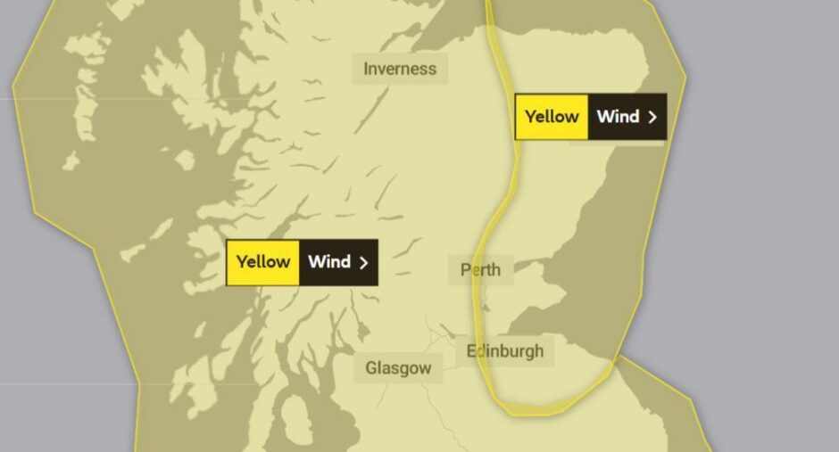
Dundee and Fife have been hit with an amber “danger to life” warning for wind as forecasters predict Storm Malik could bring gales of up to 65mph.
The strong to gale-force winds are expected to hit the east of Scotland on Saturday alongside some spells of rain.
Met Office forecasters initially put a yellow warning in place from 7am until 3pm but this has now been upgraded to an amber alert.
Meanwhile, the yellow warning for disruption as a result of strong winds has been extended to Monday at mid-day.
Coastal areas like Aberdour in Fife and Carnoustie in Angus are likely to see the worst of the wind.
Gales of up to 65mph in Tayside and Fife
In Dundee forecasters are predicting wind speeds of 61mph from around 9am, with the weather settling as the day goes on.
The westerly winds could cause disruption, the Met Office says, with Scots advised Storm Malik was likely to affect rail services and other public transport.
The warning also says it is probable that there will be some damage to buildings, such as tiles blown from roofs.
“There is a good chance that power cuts may occur, with the potential to affect other services, such as mobile phone coverage,” the Met Office said.
Met Office chief meteorologist Paul Gundersen said: “The impacts of Storm Malik are going to be greatest in Denmark on Sunday, but the track of the storm in the preceding hours means that the UK will be dealt a glancing blow as Malik moves eastwards on Saturday.
“The highest winds are expected in exposed coastal areas in the North and East of Scotland, but it will be a windy day for most.”
What does the forecast say?
Patchy rain on Friday evening is expected across Tayside and Fife. The rain is likely to turn persistent in Perthshire, with strong to gale-force winds.
The rain will clear from Saturday morning, replaced with bright spells and strong winds that are expected to worsen as the morning goes on.
Scots are being told the worst of the wind will hit from around 9am in the east, with potentially severe gale force winds building to about 65mph.
The forecast states: “Rain soon clearing to leave bright spells and blustery showers, mainly in Angus and Perthshire.
“Gale or severe gale force south-westerly winds becoming north-westerly and easing towards evening. Feeling cold. Maximum temperature 8°C.”
Heading into Sunday, the forecast says: “Staying unsettled with wind, rain and hill snow on Sunday.
“Strong northwesterly winds with a few wintry showers on Monday, then overnight rain. Showers again on Tuesday with northwesterly gales.”
Train delays
Train speed restrictions will be in force on parts of the Dundee to Aberdeen route and the East Coast Mainline on Saturday morning, into the early afternoon.
The speed restrictions are being introduced amid fear of fallen trees and other debris falling on to tracks or damaging overhead power lines.
Passengers are advised to allow extra time for journeys and check with their train operator about changes to services.
Liam Sumpter, Network Rail route director for Scotland, said: “The safety of our customers and colleagues is our first consideration during severe weather.
“We are monitoring the conditions very closely and have teams in place across the country ready to react quickly to any damage caused by the weather.”
Storm Arwen: Dundee council issues update on work to reopen Templeton Woods


