Birnam Glen and Rumbling Bridge, Perth & Kinross
It was a perfect day to be following the water. The rain of the last 48 hours had ceased and the winter’s first big snowfall had slipped into serious meltdown, leaving the rivers and burns boisterous.
The sudden switch in the weather – a day of calm after the continuous torrent – convinced me to make a sudden switch as well. Instead of heading to the lochans north of Dunkeld, I decided to make a circuit to the south of the A9 from nearby Birnam.
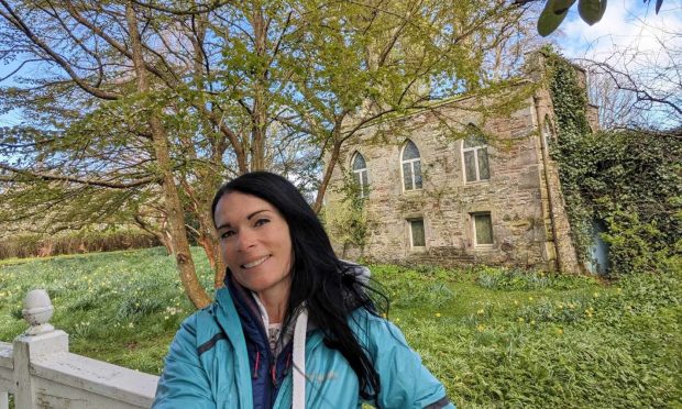
I found a parking space outside the village’s arts and conference centre, a favourite with families due to its links with the author Beatrix Potter. Many of her childhood summers were spent in the area and the centre has a fine exhibition and garden focussing on her life and characters from her books.
A short-cut through the garden led to a left turn into a lane then followed the line of the Inchewan Burn, under the railway and the busy A9 and into the quieter confines of Birnam Glen.
The remains of the snow had hardened into ice and as I walked between the wooded slopes and the mossy wall above the tumbling waters, I was glad I had put the micro spikes on early: at this time of year, this lovely little glen is starved of sunlight.
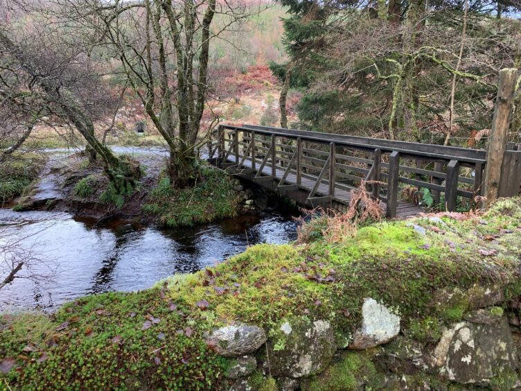
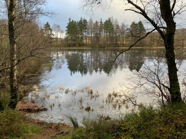
The path split higher up, and I headed right, crossing a wooden bridge and then following the path on the other side of the water round to a wide track junction. My route swung left. A little further on there was a short detour down to a small lochan.
Once back on track I took the very muddy option going left into the trees at the next signpost. The going improved after passing through a gate, a lovely winding path through mixed woodland, although there were some waterlogged patches.
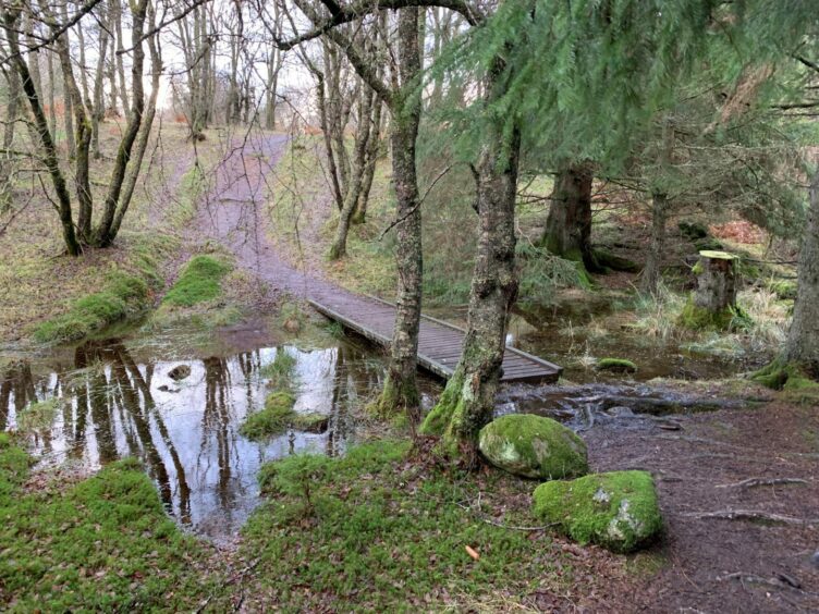
After crossing a low wooden walkway and cresting a small rise, I emerged into more open ground and a track which twisted past Tomgarrow and out on to a farm lane. Turning right brought me out on the A822, and a careful crossing to a path leading into woodland.
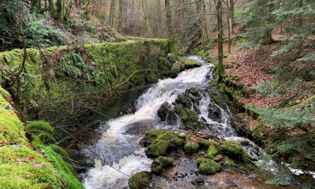
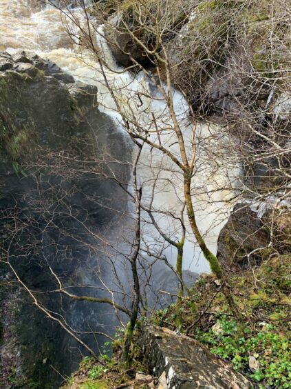
There was no likelihood of navigation problems now – the assault on the ears from the River Braan below saw to that, thundering waters plunging under the old stone Rumbling Bridge, spray splashing over the ramparts like the release from a steam valve.
I finally pulled myself away, heading over the bridge. The signposts came thick and fast, pointing the way downhill through The Hermitage on a path high above the thrashing of the river, all the more spectacular for the number of fallen trees in its midst.
Eventually I reached the roaring Black Linn Falls, a solid white sheet crashing down below the folly, Ossian’s Hall. This was built in 1757, the focal point of a landscape designed for the entertainment of the Dukes of Atholl.
From here it’s just a case of sticking by the riverside path through the giant Douglas firs until the exit but that may change soon with work finally underway to re-open the path on the opposite side of the river which has remained closed for nearly 15 years.
The final leg took me through the village of Inver before heading back under the A9, leaving a short pavement walk to Birnam.
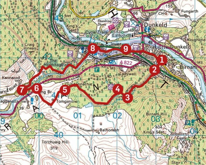
ROUTE
1. Walk west along main street past Beatrix Potter Garden (or cut through) and turn left up track (signed Birnam Hill Path/Inchewan Path) by Inchewan Burn.
2. Pass under A9 and rail line and keep following track by burn as it swings right to gate. Go through and stay on track until reaching signed junction.
3. Go right to cross wooden footbridge and take path round to left to track junction. Turn left, staying on main track and ignoring any turns, to reach next signed junction.
4. Turn left on path into woods, pass through metal gate then continue as path swings left through trees, to pass house and cross small bridge before emerging in more open ground.
5. Pass entrance to Tomgarrow and walk down track to junction. Turn right and head to A822.
6. Cross road, take path opposite into woods and follow round towards car park. Turn down right to reach minor road and River Braan, then turn right to cross Rumbling Bridge.
7. Follow minor road uphill to corner and turn right (signed). Where track swings left, continue straight on, following signs to walk along bank of river. Pass The Hermitage and walk down to car park then out towards A9.
8. Turn right along signed path parallel with A9 for short distance before heading right into village of Inver. Turn left on path just before bridge.
9. Walk round to wooden bridge, cross then immediately turn left to pass under A9 then turn right along path and minor road to reach A923 before walking back through Birnam.
INFORMATION
Distance: 10km/6miles
Ascent: 220m/722ft
Time: 2.5-4 hours
Grading: Lovely varied circuit through woodland and along riverbanks on well-signed paths and tracks, short sections of minor road walking. Some ascent but mostly low-level, suitable for most fitness levels and abilities. Can be very muddy or waterlogged in places, sturdy footwear advised. Take extra care when paths are iced. Farmland route, so you may encounter farm livestock – dogs under close control.
Start/finish: Parking at Birnam Arts Centre (Grid ref: NO 031419) or in nearby streets.
Map: Ordnance Survey 1:50,000 Landranger Map 53 (Blairgowrie & Forest of Alyth); Ordnance Survey 1:25,000 Explorer sheet 379.
Tourist Information: VisitScotland, Pitlochry iCentre, 22 Atholl Road, Pitlochry, PH16 5BX (Tel 01796 472215).
Public transport: Bus and train services to Dunkeld.