River Ericht, Blairgowrie, Perth & Kinross
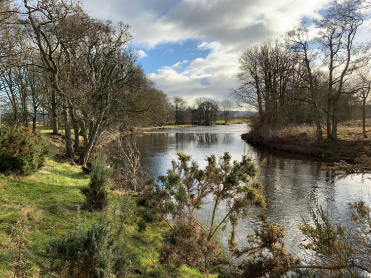
ON a beautifully crisp winter morning, it seemed especially fitting to be following the lazy curves of the River Ericht around a peaceful, low-level circuit.
After all, its name is said to come from the Gaelic ‘eireachdas’ meaning beauteous, most likely a reference to the landscape through which it flows.
There’s no doubt the description fits this walk perfectly.
The Ericht separates the towns of Blairgowrie and Rattray, and the route starts in the centre of the former before crossing to the latter, then following the water round its constant twists and turns to Kitty Swanson’s Bridge before looping back round into Blair.
It is part of the extensive Blairgowrie Path Network and there are regular signs and arrow pointers to shepherd you round.
After crossing the road bridge over the river, a right turn then a quick left into Ashgrove Road saw me following the edge of Davie Park until emerging on a minor road.
There is a pavement at first but once past the last of the houses it’s on to the open road.
There are signs designating this as walker and cyclist friendly, but although it’s quiet and you can always step up onto a grassy verge, you should be aware of farm traffic.
I walked past berry fields, farm buildings and the shells of old mills, while running quietly alongside were the now redundant engineered water courses (lades) which once powered the textile industry.
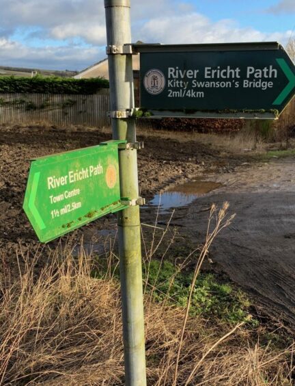
A prominent sign on the left signals when to leave the road and head off right over the water course and into the trees for the River Ericht Path.
Now it was just a case of keeping to the banks for the next few kilometres until reaching the bridge.
Silver water in the sunlight
The going was gentle, the views revealing wide stretches of water caught silver by the sun at times, narrower glimpses through the trees at others.
The path meanders round the policies of farm properties, through a series of gates and little bridges, and there are raised bankings at certain points.
The woods were filled with the sounds of birdlife, plenty of movement between the high branches.
I also spotted a buzzard and a heron, although I was left disappointed in the quest to catch sight of any kingfishers.
There are plenty of benches along the banks to allow you to sit for a while and experience the hypnotic effect of just watching the water roll by.
Although it was dark and full, the river never felt less than graceful, never seemed in any particular rush.
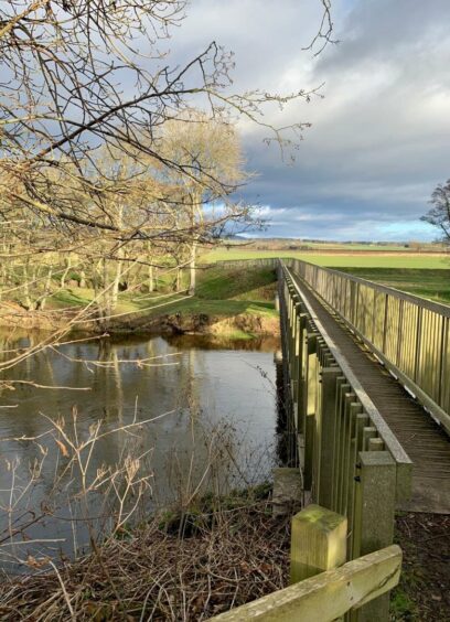
At last I reached Kitty Swanson’s Bridge, the turning point in the circuit.
Kitty Swanson operated a ferry
The lady in question lived in a cottage nearby and used to operate a small ferry crossing on this stretch of the water in the late 1800s which helped transport local children to school.
The bridge was originally built between the wars, and the current version is a replacement built in 2015.
Once over the bridge, I went down a few wooden steps and continued along the side of the river.
The path climbed to stay high above the water for a while until eventually descending to pick up its line again.
At a long bend in the river, the path moved away along the edge of fields before taking a sharp turn left to a gate leading out on to the road.
I followed the tarmac past the farm at The Welton then continued further down until the route became reacquainted with the river again, and stuck with it along the streets back to the start.
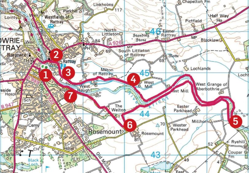
ROUTE
1. Exit car park and head up main road. Cross bridge over River Ericht turn first right into Haugh Road then first left into Ashgrove Road.
2. Follow road round to enter Davie Park and follow sign for River Ericht Walk along tarmac path along edge of the park until it exits on minor road.
3. Turn left along pavement past houses then continue on road past fields passing West Haugh and Ashgrove Mill to reach sign pointing to small bridge on right, go through (or around) gate and head straight on to Ericht Path.
4. Path now follows curves of river, crossing wooden bridges and going through farm gates, for some 3km before reaching Kitty Swanson’s Bridge.
5. Cross bridge and go down steps to right for riverside path. This carries on following river bends along field edges and wooded sections until taking a sharp turn left to emerge at road.
6. Turn right and follow road back into Blairgowrie, at one point taking a short-cut path along the river edge before re-joining the now busier road.
7. Cross and walk along pavement where a left turn just past Tesco store leads back to car park.
INFORMATION
Distance: 13km/8miles
Ascent: 75m/245ft
Time: 3-4 hours
Grading: Pleasant riverside circuit to suit all ages and fitness levels along woodland paths, field edges and minor roads. Muddy in places, exposed tree roots, good footwear advised. Route passes through farmland sections, dogs under close control. Please be sure to close all gates.
Start/finish: Wellmeadow car park in Blairgowrie (Grid ref: NO 180451).
Map: Ordnance Survey 1:50,000 Landranger Map 53 (Blairgowrie & Forest of Alyth); OS 1:25,000 Explorer sheet 381.
Tourist Information: Tourist Information: VisitScotland, Perth iCentre, 45 High Street, Perth, PH1 5TJ (Tel 01738 450600).
Public transport: Regular bus service from Dundee and Perth to Blairgowrie (Nos 57, 59).
