Deuchary Hill may be of modest height, but when it comes to views it packs a real punch.
We had been forced to abandon a day on the big summits due to high winds, but ended up blown away by this rugged little gem.
There seems to be something exciting round every corner – and there are plenty of corners. It’s well sign-posted – sometimes bewilderingly so – every post creaking with four or five options, and it pays to keep checking the map.
The trees were sighing as we left the already busy car park, heading north on the track which swings gently this way and that. The first sign that it was going to be a good day came as a red squirrel ambled across our path near the house at Hatton.
As we took the right-hand branch of the track at Mill Dam – the Upper Path to Loch Ordie – there was evidence of recent beaver activity at the outflow amongst the trees and also further downstream, but unfortunately there was no sign of the perpetrators. The day was still quiet. The sky’s grey pall was mirrored on the water, a family of swans a few flecks of white moving lazily across the surface.
As the track rose, it became rougher and more vegetated. We ignored a branch to the right and continued through the trees with the views ahead and to the west opening out.
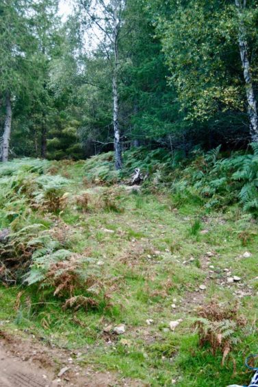
The turning for Deuchary Hill is easy to miss, an imperceptible ramp heading off right into a gap in the trees and bracken. We did a bit of a double take, checked the maps. Even then, the initial ascent on the overgrown path doesn’t exactly inspire confidence, but it soon clears to more open ground.
Benachally and its monument provided a useful backdrop as we aimed for the skyline. The path took another turn left, then right, over boggy terrain before we were treated to the great reveal.
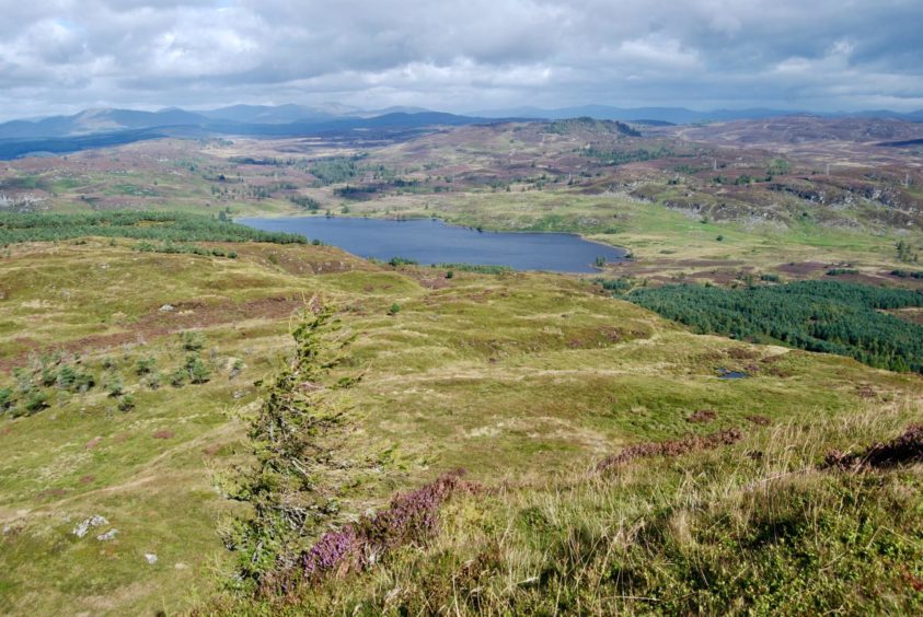
Just beyond a rocky lip lay the hidden Lochan na Bienne, its shores carpeted in purple heather, with the summit of Deuchary Hill towering above. From here it looks like a fair climb, but the path takes an easy line and even with a short final steepening it doesn’t take long.
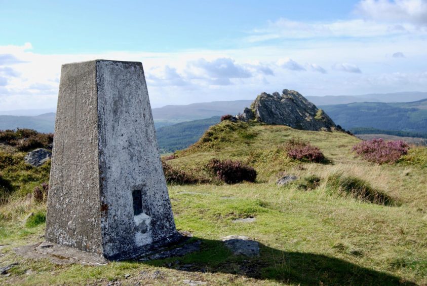
The views from the summit trig point are expansive; the waters of Lochan na Bienne were now deep blue under brightening skies while Loch Ordie grabbed the attention to the north. Off to the west, the snaking line of the Tay was prominent.
Close to the trig, there’s a handy windbreak nearby in the shape of a curious blade of rock which sits above a small grass bowl, perfect for a hilltop picnic.
To complete the circuit, we took the path dropping south-east which eases its way through rough slopes of heather, rock and trees to reach the track coming in from the north. This can become very wet in places but it soon emerges at a junction passed earlier in the day just above the waters of Mill Dam and then it’s just a case of following the inward route back to the car park.
The paths were now busier with walkers and cyclists, and it was encouraging to see so many young families enjoying a leisurely day out. Deuchary Hill and its multitude of tracks and paths has something for everyone.
Alan Rowan is a well-known author and walker. You can follow his regular mountain adventures at munromoonwalker.com
Route:
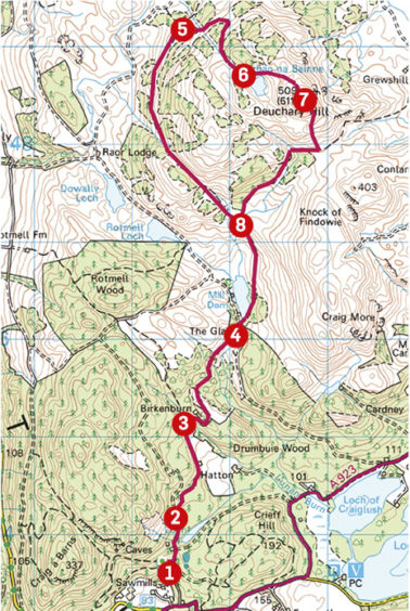
1. Head back out of car park and turn left almost immediately on to Atholl Estates track, signed for Mill Dam and Upper Hatton.
2. Ignore first track going off right, then at fork keep right alongside fence past Hatton.
3. The track cuts sharply round Birkenburn before turning back north towards The Glack.
4. Go through metal gate and reach signpost at Mill Dam. Turn right on Upper Path to Loch Ordie with the water of the Dam on your left.
5. After around 3km a grassy track goes off into trees and bracken on your right, rising to more open ground.
6. Head right on the rough and muddy track and before reaching the skyline, swing left to reach another track which should be followed to Lochan na Bienne.
7. A narrow grass path now weaves gently upwards to reach the trig point summit. Leave the summit by heading south on a good path through the rock and heather terrain to reach a track coming in from the east and follow this to path junction.
8. Retrace the route back to the car park.
The Lowdown
Distance: 10.5km/6.5 miles
Ascent: 563m/1835ft
Time: 4-6 hours
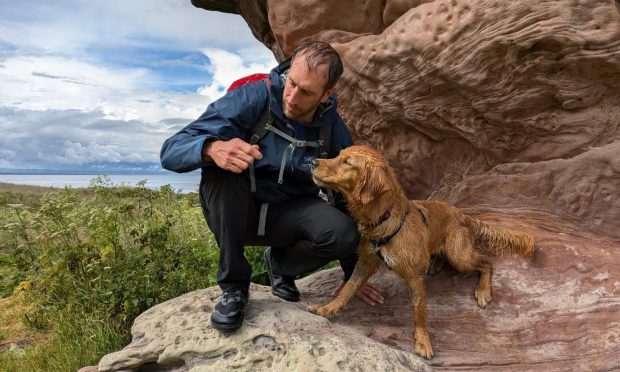
Grading: Circuit on tracks and paths, some boggy and wet sections, and steep but short final rise to summit. Please keep dogs under close control – sheep and ground nesting birds.
Start/finish: Cally car park off A923 one kilometre north of Dunkeld, second lane on left (Grid ref: NO 023437)
Map: Ordnance Survey 1:50,000 Landranger Map 53 (Blairgowrie & Forest of Alyth); Ordnance Survey 1:25,000 Explorer sheet 379.
Tourist Information: Dunkeld Visitscotland Information Centre, The Cross, Dunkeld, PH8 0AN (Tel 01350 727688)
Public transport: Bus and train services to Dunkeld.
You can follow Alan’s regular mountain adventures at munromoonwalker.com or on Facebook (Munro Moonwalker) and Twitter (@munromoonwalker)