Hill of Alyth, Perth & Kinross
The modest hill that gave the ancient town of Alyth its name is the centrepoint of a fine circuit that offers a pleasant and varied walk that should appeal to all ages.
Alyth means steep bank or rugged place, from the Gaelic “aileach”. It was an important market town, and in the mid-1800s the textile industry was a huge employer with nearly 350 working in the town’s two mills.
The starting point for the walk is Market Square, handy for public transport. There is an information board and plenty of signposts along the way to keep you on the right track.
I crossed the footbridge over the burn and turned left up Commercial Street, then a right up Hill Street. Signs for the Cateran Trail pointed to a left turn which led past the Lands of Loyal Hotel where the track became rougher before reaching three gates.
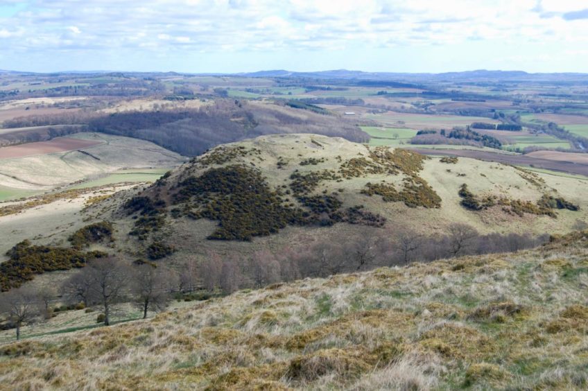
Hill of Loyal is a short diversion, less than half an hour total, and is worth the little effort for the view east to Barry Hill and the remains of a vitrified fort. To make the ascent, go through the metal farm gate on the right, keep to the fence initially then take the path which heads right to weave through straggling stands of trees.
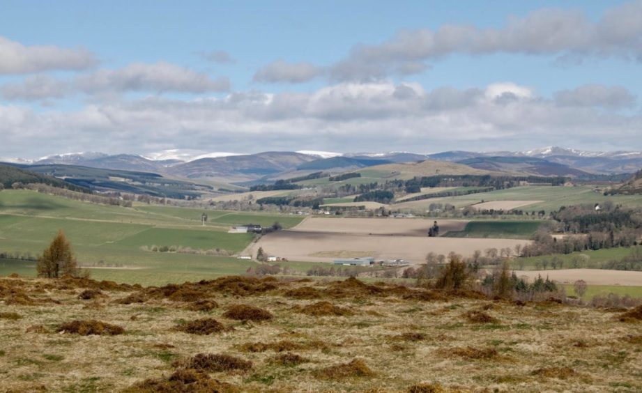
A cairn just beyond the barbed wire fence – easy enough to squeeze through – provided the best viewpoint. Equally impressive was the sight of the rolling hills of the Angus Glens stretched out along the horizon to the north.
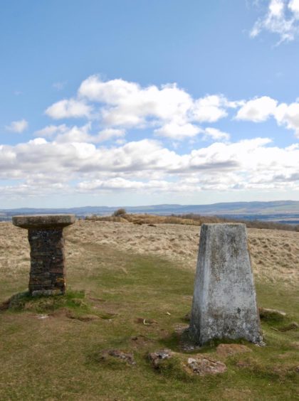
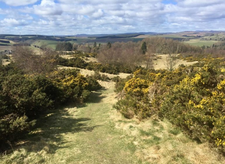
I retraced my steps to the three gates, this time opening the wooden pedestrian one to follow the path cutting through the thick blanket of gorse to the summit of Hill of Alyth. There is a trig point, a view indicator and a wooden seat looking down on Alyth, but the highest point is actually on another hump to the west.
The network of paths offers many options to extend or shorten the walk, and you can drop south to head back into Alyth if time is short. Otherwise, take the path west, passing a small body of water and pick up the Cateran Trail which turns north to reach a minor road.
I turned left and walked to a junction. You can then turn left and follow the road – it is marked cyclist and walker friendly, but be careful – for a couple of kilometres along to the entrance for Den O’ Alyth. I chose to avoid as much road walking as possible so turned on to a signed path to Alyth.
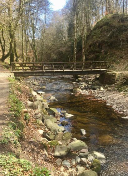
This led into the trees and round the line of a fence before emerging back on to the road via a boggy passage out of the wood just where a huge fallen tree lay across the path. I then crossed the road and dropped down a leafy slope to pick up a path running along the side of the burn.
This came to an abrupt end beside a wooden bench where a metal barrier has been placed across the path. The section beyond here is in a dangerous state due to erosion caused by damaging floods in 2015.
I took the path heading sharply left to reach the road and then continued until a small parking area on the right gave access to the den beyond any difficulties.
This final stretch on a leafy path through mixed woodland was the perfect finish to the day and it came to an end all too soon. Once through the double metal entry gates, it was just a case of walking down past the impressive church and back to the square.
Route
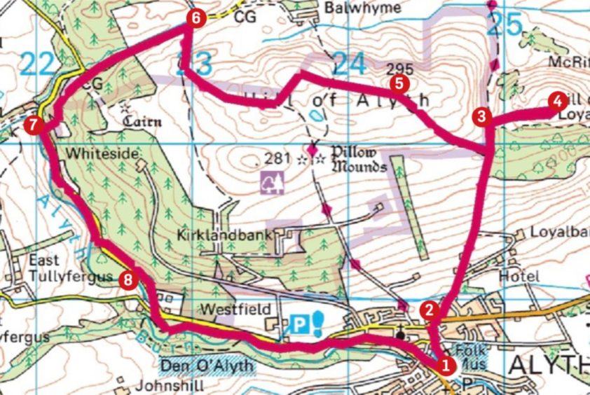
1. Leave main square to cross footbridge, turn left on Commercial Street and walk parallel with the burn before curving right up Hill Street.
2. Turn right at top of hill following signs for Cateran Trail, then left up Loyal Road, passing entrance for Lands of Loyal Hotel, and continue to end of track and three gates.
3. If including Hill of Loyal, go through metal farm gate on right, following fence for short distance then path on right to summit.
4. Retrace steps to pedestrian gate and follow path west to top of Hill of Alyth.
5. Leave summit on path heading west, passing small lochan en route, to join line of Cateran Trail (signed) and follow downhill, turning north to reach minor road.
6. Turn left along road to junction, then left again on signed Path to Alyth. This runs along fence line then drops down opening on right to regain road at Alyth Wood sign.
7. Cross road and drop down slope to pick up path running south by Alyth Burn. Follow this until reaching wooden bench where there is high metal barrier across path. This section has been cordoned off due to dangerous condition of path.
8. Turn sharp left heading uphill then right on to road to reach small parking area and path for Den O’ Alyth. Stay east by water to emerge at metal entrance gates then follow road downhill past church and back to parking.
Information
Distance: 10.5km/6.5miles
Ascent: 320m/1.050ft
Time: 3-4 hours
Grading: Woodland and hill paths, farm tracks and minor roads. Two short, easy ascents (one optional), suitable for all ages. Can be wet underfoot in places, good footwear recommended.
Start/finish: Parking in Market Square, Alyth (Grid ref: NO 246485).
Map: Ordnance Survey 1:50,000 Landranger Map 53 (Blairgowrie & Forest of Alyth); OS 1:25,000 Explorer sheet 381.
Tourist Information: Tourist Information: VisitScotland, Perth iCentre, 45 High Street, Perth, PH1 5TJ (Tel 01738 450600).
Public transport: Buses to Alyth from Dundee-Blairgowrie route (57/57A) and Kirriemuir (128).
