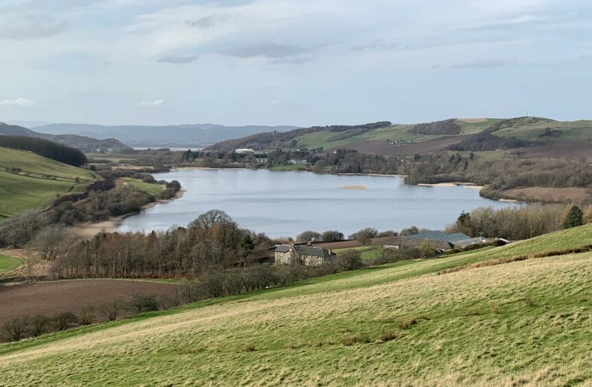
Lindores Loch, Near Newburgh, Fife
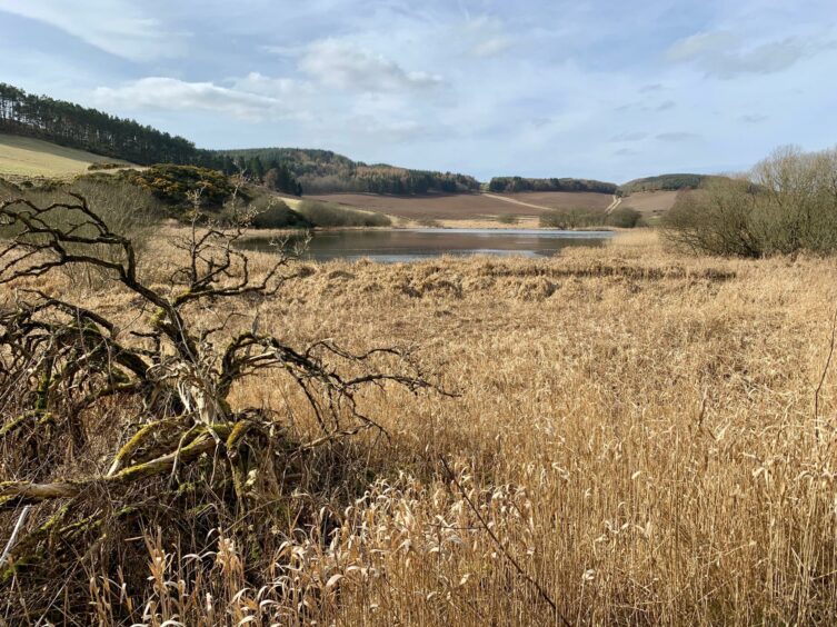
The shallow freshwater Lindores Loch is a blue jewel in the pastoral Fife countryside just south of the Tay which provides a fine focal point for a pleasant wander.
With another couple of smaller lochs nearby, the area is popular with anglers. Lindores Loch is a protected site of special scientific interest due to the importance for plant, insect and birdlife. At one time, it was also a source of water for powering local mills.
There is a variety of options on good paths and over some of the surrounding hilltops, but on this occasion I chose to approach from the pretty hamlet of Collessie to the south. There is handy parking at the Victory Hall – there is no charge but donations are welcome.
The first part of the walk shadows the Perth to Ladybank rail line, and although there are plenty of twists and turns along the whole route, there is always a handy signpost just when you need one.
I turned left out of the car park and headed downhill, then turning right as signed to Grange of Lindores via Collessie Den and passing the old station house (the station was closed in 1955) to pick up a narrow grass path which heads steadily uphill.
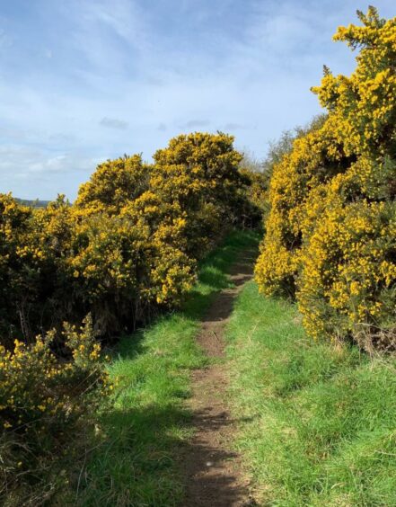
My attention was caught by a pristine small plantation of silver birch glistening off to the left before I disappeared into a tight passage through the gorse to emerge at a track junction. The signs pointed downhill, a tarmac section alongside a towering, brilliant yellow gorse hedge, before I reached a rail bridge and the turn on to the B937.
The next section along the side of this road is brief but the traffic can come round at a fair lick, so its wise to stick to the unofficial grassy verge until you can cross safely to the minor road signed for Goldenloch Fishery.
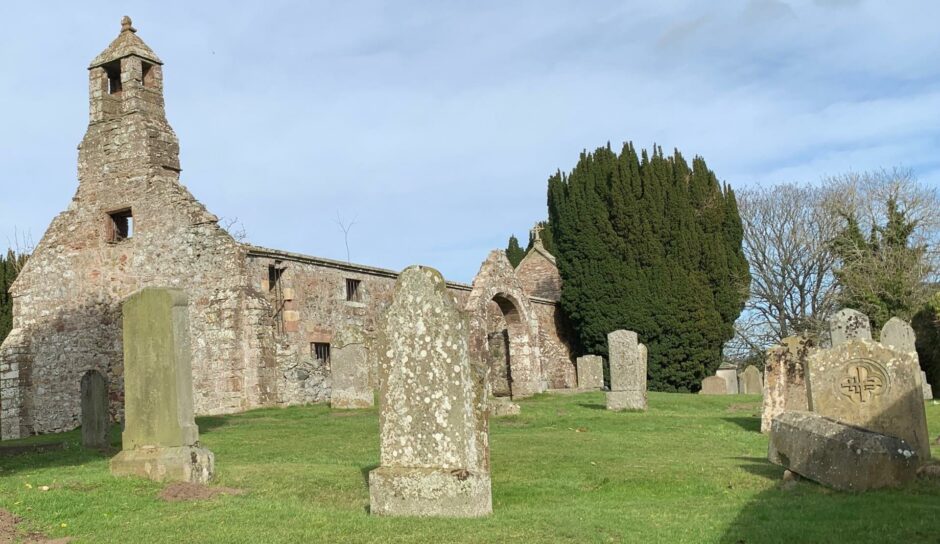
I passed Black Loch, the sound of a woodpecker drumming in the distance, and then Golden Loch, busy with anglers. As the road started to curve to the right, I headed straight on uphill, passing the entrance to Berryhill House, to reach a signpost pointing the way across a field to the ruins of Abdie Old Church.
I continued to Dunbog Parish Church, built to replace the old kirk, and made a right turn across another rail bridge for the quiet road walk to Lindores. I veered right to briefly follow the B937 before crossing to a wooden fenced entrance into the mixed woodland (it would be easy to walk past this).
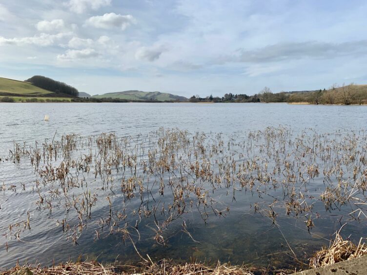
The path climbed through the trees, giving fine glimpses of the shimmering loch below, before dropping back to meet the road again. A short diversion can be made to the pier area for open views down the loch, but the main route took a turn up a farm lane until a signed path on the right led back into woods.
A gate in a fence gave access to a climb through fields where the loch could be seen to best effect. I continued following the signs through a succession of gear shifts, at one point watched by a family of circling buzzards, until I reached the earlier track junction to retrace the final steps back to Collessie.
ROUTE
1. From car park, turn left and walk downhill. Turn right by signpost (Public Path to Grange of Lindores via Collessie Den) with Den Burn on left. Pass Station House and take grassy path which climbs steadily.
2. Beyond first house go left (signpost) then descend beside high gorse hedge to rail bridge. Cross to B937 and head north for short distance (grass verge), cross and turn left on to minor road for Goldenloch Fishery.
3. Road passes Black Loch (on left) then Golden Loch (right). As you start to descend towards cottages, head left uphill and pass entrance to Berryhill House to reach signpost on right for Abdie Old Kirk.
4. Follow path across field, then pass Abdie House and churchyard and remains of Old Kirk. Continue to Dunbog Parish Church, turn right over rail bridge, then right again on A913 towards Lindores.
5. Keep right along B937 and shortly after road sign on right, watch for entrance on left for path (no sign). This rises through trees above road, eventually joining track from Inchrye and returning to B937.
6. Turn left up farm track, then right at sign for footpath into trees. Go through metal gate in fence at treeline and head straight up grass to next fence. Turn right across field by edge of trees and wall to lower fence.
7. Once over fence, follow signs right across field to gate. Go through on muddy track and at signed junction with incoming track from right, keep left along edge of trees to gap then turn right on track following markers round west side of small plantation.
8. Turn left for short distance then right through wooden gate and follow markers down to Braeside where Collessie Den inward route is rejoined.
INFORMATION
Distance: 11.5km/7.2miles
Ascent: 275m/900ft
Time: 3-4 hours
Grading: Pleasant waymarked loch circuit with gentle ascents suitable for most fitness levels along woodland paths, farm tracks, and grass slopes. Some short sections on minor roads, quiet but care needed. Some muddy sections, good footwear advised. Farmland route, dogs must be under close control.
Start/finish: Collessie Village Hall (Grid ref: NO 287134), free parking, but donations welcome.
Map: Ordnance Survey 1:50,000 Landranger Map 59 (St Andrews); Ordnance Survey 1:25,000 Explorer sheet 370.
Tourist Information: VisitScotland, St Andrews iCentre, 70 Market Street, St Andrews, KY16 9NU (Tel 01334 472021).
Public transport: None to start point.


