Glendevon Reservoirs, Ochils, Perth & Kinross
I have been in the Ochils enough times to recognise that even the simplest route can be tougher in reality than in the planning, yet this circuit of the Glendevon reservoirs still managed to take me slightly by surprise.
To paraphrase an old football cliché, it turned out to be a walk of two halves. The first was easy, a stroll up a surfaced track past the lower reservoir and then on to the higher one. The second, however, was a whole new ball game, a rough and often pathless tramp across often strength-sapping terrain.
Perhaps we were lulled into a false sense of security by that initial walk in. Or maybe it was simply the searing heat of the day that contributed to such weary legs on a walk of relatively short distance.
I met my walking partner for the day at the small parking area just off the A823 road through Glen Eagles, accessed from the turn-off signed for Frandy Fishery. Despite being an Ochils regular, Derek was intrigued by the suggested route as he had never explored the hills north of the reservoirs.
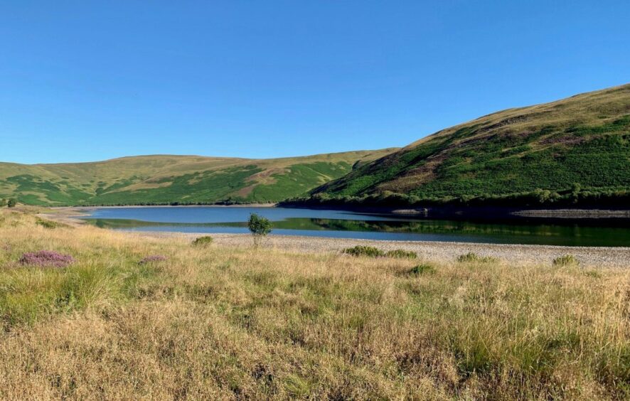
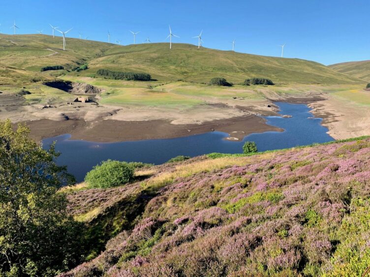
The heat was already stifling as we took the track up to the Lower Reservoir where the static blue glass of the water perfectly mirrored the flawless sky. We continued climbing between the trees towards the Upper Reservoir, ignoring the track going left to pass through a metal gate with a sign pointing the way to Blackford.
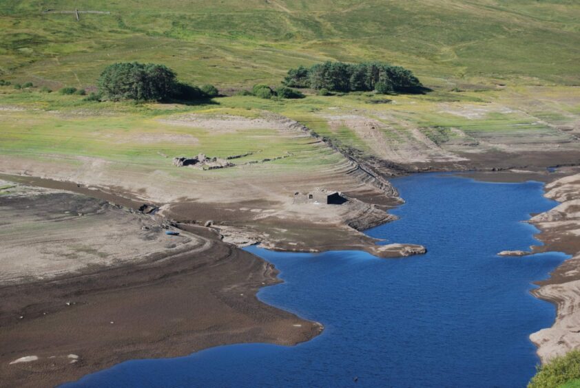
Gazing down from the dam wall, the results of the recent long, hot dry spell were evident. The waters had shrunk to such an extent that the old submerged farm had reappeared with a bit to spare, the surrounding shore rings of varying shades of brown showcasing a timeline of consistently dropping levels.
We crossed the dam then hopped over a stile and took the path heading steeply uphill. Another fence crossing took us higher before we left the path to turn left along the fence-line.
Eventually this vague walkway was swallowed by bracken and we found it easier to take a direct line through long grass aiming for the prominent crag on the skyline. Those of a braver nature can stick with the intermittent path further along the shoreline to the entrance of Glen Bee before then turning uphill to Craigentaggert Hill.
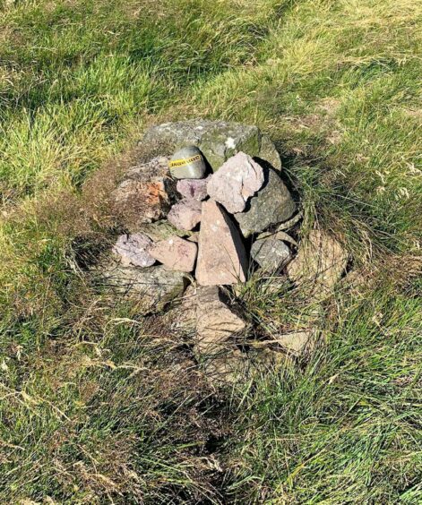
We surprised a couple of roe deer, enough to put a spring in their step as they bounded quickly away. We followed their escape route to the flat summit where there was a small, tidy cairn which held a stone with the hill name neatly painted on to it for the avoidance of any doubt.
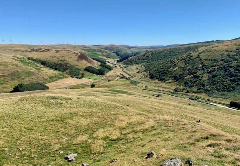
Looking across the guillotined hillside and its swathe of brilliant purple heather, the horizon held a Who’s Who of Munros, with Ben Vorlich, Stuc a’ Chroin and the Lawers range leading the line.
A grass path twisted east over another bump before fizzling out at the sudden deep divide with Wether Hill. We dropped direct, not a recipe for the health of the knees – we should have gone further left where the drop was not so steep.
We picked up an ATV track taking us to a drystone wall and fence which had to be crossed to reach the unmarked high point just beyond. Any of a half-dozen spots could be a winner.
The contours kept sinking as we made our way towards Common Hill where there were two tops of equal height, neither bearing a cairn. The second, rockier top provided a fine view of depth down the glen, and the drop from here to the inward track was short and sweet.
ROUTE
1. Take surfaced track heading west from parking area which climbs past Frandy Farm to reach Lower Glendevon Reservoir.
2. Continue on track through wooded section to Upper Reservoir, ignoring track on left and going through metal pedestrian gate to cross dam or using grassy path just below (signed: Blackford Path).
3. Once across, use stile then climb hill path before crossing fence to right side and continue higher up to end of fence-line.
4. Leave main path here to turn left and follow rougher path by fence high above reservoir. Just above stand of trees, leave the somewhat vague path and strike directly uphill (north-west) aiming for obvious crag on skyline.
5. Pass over or around crag and continue on pathless terrain to summit of Craigentaggert Hill, which is marked by a small cairn.
6. Turn east on grass path over next minor bump before reaching steep cleft with Wether Hill. It’s better to cross this higher to left before picking up grassy atv track climbing to wall and fence. Cross to reach unmarked summit just beyond.
7. Continue on atv track as it takes lazy line following ridge towards Common Hill. There are two summits of equal height, no cairns.
8. From the eastern top, make short drop down pathless slope to reach surfaced track a short distance from parking.

INFORMATION
Distance: 12km/7.5mls
Ascent: 442m/1450ft
Time: 4-6 hours
Grading: Mixed route: easy approach to reservoirs on surfaced tracks, then more strenuous return with couple of short but steep ascents using hill and atv paths with rough, pathless sections. Those doing the full circuit should have reasonable level of hill fitness and relevant navigation experience. Sheep will be encountered on the open slopes – dogs under close control.
Start/finish: Parking near start of Hydro track off A823 Glen Eagles road (Grid ref: NN 948051), turn-off signed for Frandy Fishery.
Map: Ordnance Survey 1:50,000 Landranger Map 58 (Perth & Blair Alloa); Ordnance Survey 1:25,000 Explorer sheet 366.
Tourist Information: VisitScotland, Stirling iCentre, Old Town Jail, St John Street, FK8 1EA (Tel 0131 472 2222).
Public transport: None.


