Dun da Lamh, Nr Laggan, Highland
There are reckoned to be the remains of around 1700 ancient hill forts scattered across the length and breadth of Scotland. Many have been reduced to just markings on a map, but others still display bold walls and grassy ramparts.
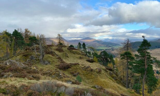
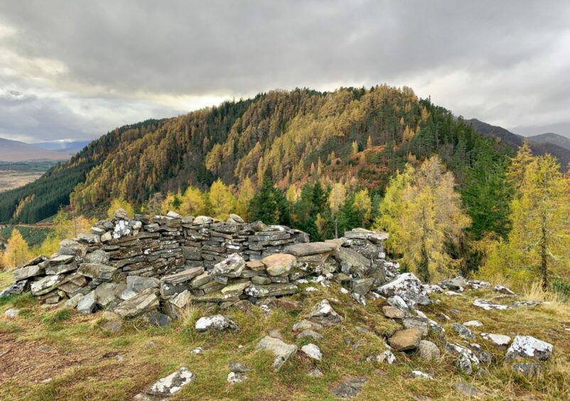
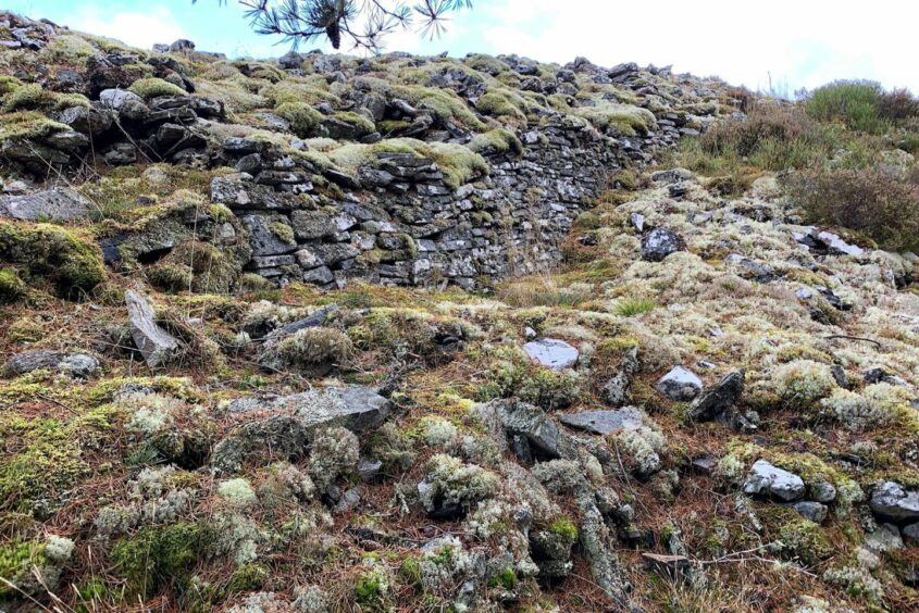
One of the more impressive is the Pictish Dun da Lamh (pronounced Larve) which is situated on a forested top high above the Spey Dam. The name means the fort of two hands, and is thought it may refer to the host twin summits of Black Craig.
Surrounded by rocky natural walls on three sides, there is a definite feeling of impregnability about its position, but a sloping ramp gives access to the cairn on its crown for today’s walker, the culmination of a fine woodland circuit from the south.
The route is generally well signed (Blackwood Walk, blue arrows) but forest clearance work has resulted in a few signs being toppled into the undergrowth or posted missing altogether.
It starts from the Pattack Falls woodland car park a little west of Laggan on the A86 (this is also known as the Druim an Aird car park), crossing the road and passing a green metal vehicle barrier on a track leading into the trees. There’s no sign for the first turn on to an obvious, but somewhat overgrown, path which heads right almost immediately.
This pushes uphill through encroaching broom to reach a track where a right turn leads round by a small pond and on to a long forestry road. There are still signs of storm damage, and there has been a lot of recent clearance work which gives this stretch a fairly desolate feel.
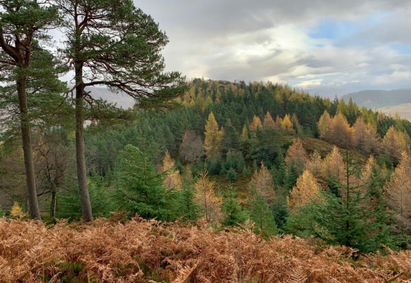
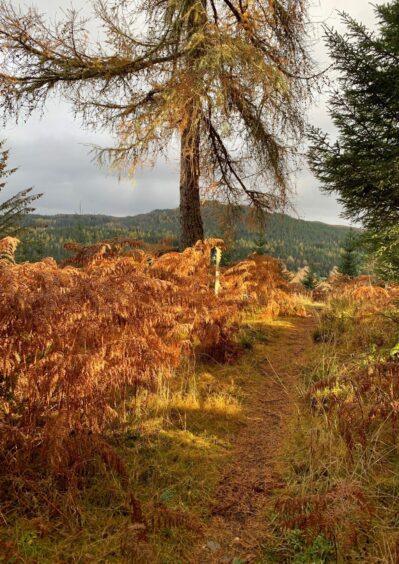
Don’t let it put you off – the mood soon changes dramatically. After the track swings left and then right again, a faded signpost on the left points to a lovely hill path, penned in by copper bracken at first but soon opening out, which lifts you above the pine and into more open and mixed woodland.
The lichen-encrusted signposts, objects of beauty in themselves, appear at regular intervals as the path heads over one rocky summit and then on to the highest point where is a smaller cairn and lovely views in all directions.
The hill fort is still a fair bit away and involves dropping steeply through mixed woodland on the path, but when the scenery is this stunning there is no hardship. The angle does mean you need to take care as it can be very muddy, and there are lots of exposed tree roots and rocks.
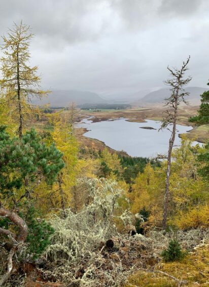
As you near the bottom of the path, the forested top holding the fort seems a long way up but this is a false perspective: just enjoy the autumn colours of the intervening foliage and press on.
It all becomes clear at the col, where there is a picnic table and seats, an information panel and a three-way sign. It doesn’t take long to reach the top of the fort, a lovely spot to linger on a fine day.
The return journey is mostly straightforward on good path and track sections, although one of the blue arrow signs pointing back into the woods (on the left after the first merging of tracks) could easily be missed so keep your eyes out for it.
It’s possible to make an early exit on to the A86 but that means a longer stretch along a busy road. Far better to retrace your steps when reaching the pond, even with the bushwhacking involved on the incoming path.
ROUTE
1. Exit car park, cross A96 and head west for short distance to reach track entrance on right. Go past green vehicle barrier, follow path to left then quickly take smaller path on right. This is overgrown in places but heads uphill to meet rough track.
2. Turn right and after passing small pond on left, keep left as forestry track heads gradually uphill. At junction, track turns left then takes hairpin turn right slanting uphill.
3. As you draw closer to transmitter dead ahead, signpost on left (Hilltop/Fort) signals turn left on hill path, through thick bracken at first but improving higher up, to emerge above trees.
4. After more open ground, path goes through scattered woodland on final climb to two cairned tops (second one is summit).
5. Continue on path as it drops into delightful mixed woodland and then down to col where is signpost, picnic table and seats and information panel.
6. Take left branch which heads up to hill fort, then slanting line going left then right to shelter cairn on highest point.
7. Return to junction and follow sign for Achduchil, path at first then track. Where track splits, go right then watch for marker post on left (Blackwood Walk, blue arrow) for path which heads downhill through trees.
8. Keep right at next junction, and follow woodland path and then track back to pond and retrace steps down to A96.
INFORMATION
Distance: 8.75km/5.5miles
Ascent: 426m/1398ft
Time: 2.5-4 hours
Grading: Enjoyable and not too taxing woodland walk on hill paths and forestry tracks to ancient hillfort with fine views. Couple of stiff ascents, should be fine for anyone with reasonable level of fitness, but likely too much for younger children. Mostly well sign-posted, although some hard to spot or missing. Some overgrown sections, exposed tree roots and rocks which may be slippy especially on descent, very muddy in places, sturdy footwear advised.
Start/finish: Pattack Falls (Druim an Aird) car park off A86 (Grid ref: NN 567903) around 7km west of Laggan.
Map: Ordnance Survey 1:50,000 Landranger Map 35 (Kingussie & Monadhliath Mountains); Ordnance Survey 1:25,000 Explorer sheet OL55.
Tourist Information: VisitScotland, Aviemore iCentre, 7 The Parade, Grampian Road, Aviemore, PH22 1RH (Tel 01479 810930).
Public transport: None to start.


