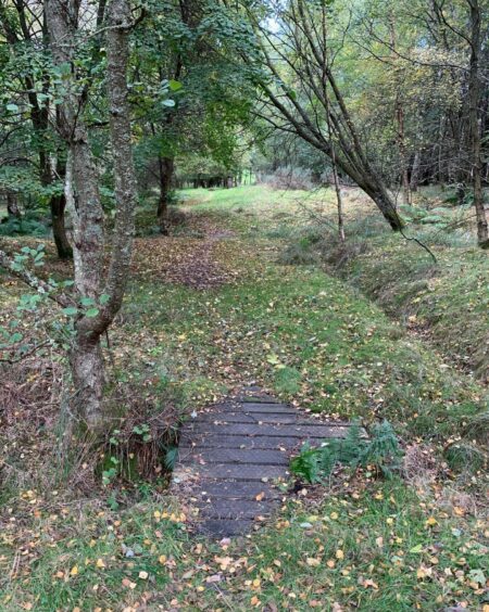
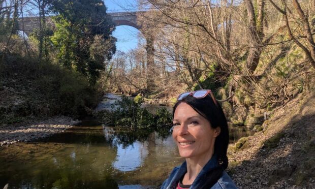
Newtyle rail trail, Angus
The network of old rail lines that run around the Angus village of Newtyle provide a pleasant wander at any time of year but particularly on a crisp winter day of blue skies, low sun and icy mists.
The Dundee to Newtyle line opened in 1831 and was the first railway north of the Tay. It was closed to passengers in 1955 and eventually shut down altogether in 1967.
Since its creation in 2008, the present path has been lovingly maintained by a dedicated band of volunteers.
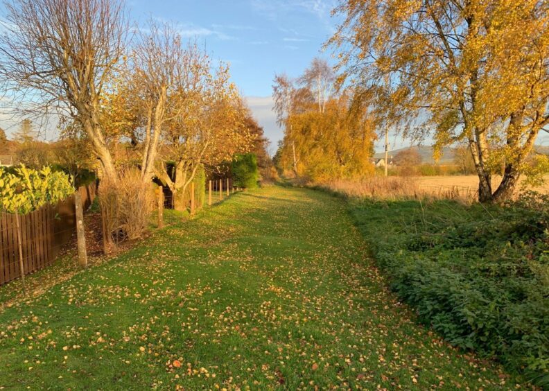
The network also offers variations starting just over the Perth and Kinross boundary from Meigle or Ardler. I chose the latter, adding an extra couple of miles through a lovely corridor lined with beech trees even though it involved retracing my steps at the end of the day.
From the main street in the village, I followed the signpost directing me between two rows of cottages before turning left on to the now grassy line of the track bed (a right turn will take you out to Coupar Angus).
Passing alongside fields and across the county boundary led out to a minor road. I turned right then right again at a split to head up to houses at Newbigging. After yet another right turn at a junction, I went through a wooden gate on the left on a path which crossed between fields.
This soon joined the railbed, a few steps leading up to the next right turn. I was surprised to have seen no one else so far given the popularity of the paths, but that changed as I headed along the line, walkers appearing from both directions.
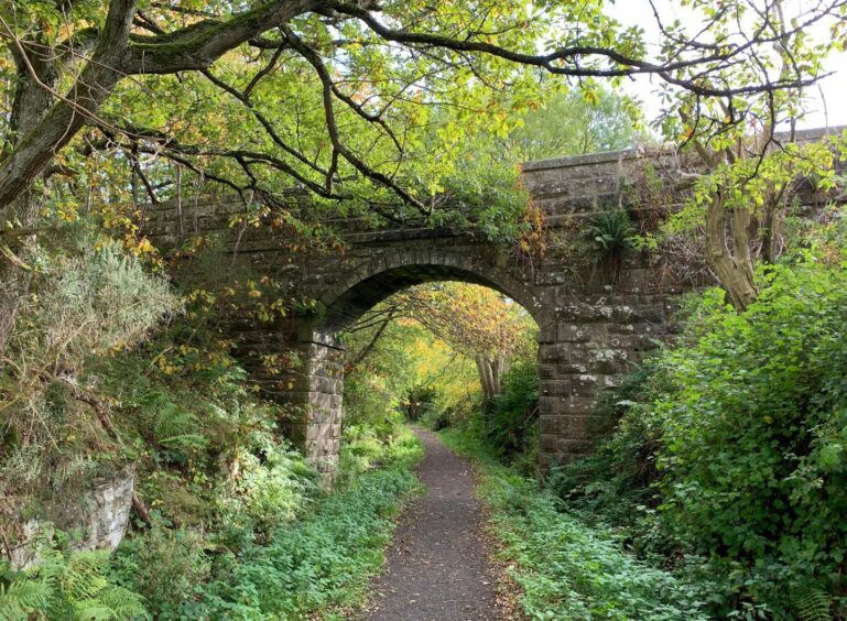
Just before the stone viaduct, another set of steps to the left (signed for Bannantyne Path) led up and over the viaduct and between walled sheep fields to a pedestrian gate and then a bigger farm gate.
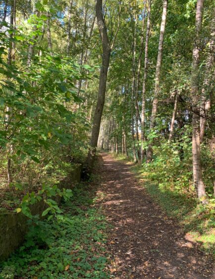
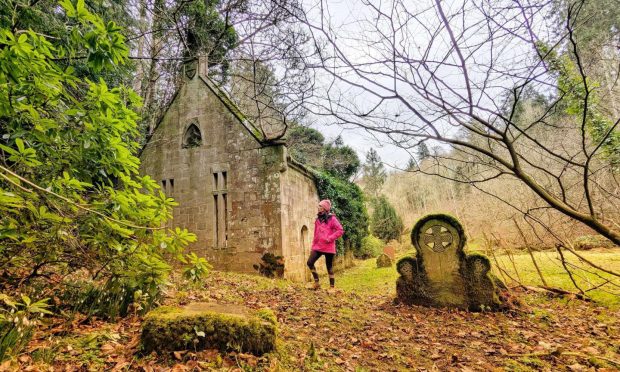
I turned left and walked up the field edge to reach a gate in a wall giving access to a forestry track in the grounds of Kinpurnie Castle. A stile on the left then led into woodland, a good path now winding its way east. There were a few fallen trees to dodge round but no real problems.
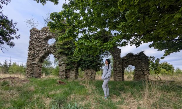
Near the edge of the wood, I passed the large wooden cross dedicated to the wartime Polish priest, Father Karol Bik, who collapsed and died in 1941 while out for a walk.
Beyond this point, access to the woods was closed off for clearance work, but my route dropped down steps then turned sharply left on another section of track bed before reaching the turn-off which took me through houses at Kirkton and then into Newtyle.
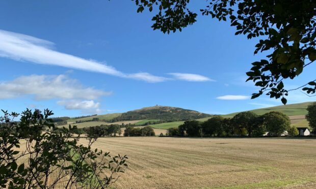
I passed the church then crossed the road and walked along pavements to the small car park where there was a signpost for the rail walk. This delightful section passed through mixed woodland showing the final colourful flourish of the year, while there were also clear views over to Kinpurney Hill and its prominent tower.
The path eventually crossed the B954 and continued in a straight line through open countryside which made the lowering temperatures suddenly more noticeable.
I dropped down a flight of steps to reach the minor road, which I crossed to rejoin the tree-lined corridor back to Ardler. Spots of light rain blew through on the final leg creating a rainbow arch which added the perfect finish to a perfect walk.
The volunteers who keep these paths open and in such good shape deserve all the help they can get, so please consider making a donation to their work at Newtyle Post Office.
ROUTE
1. From Ardler village, follow signed path west for Newtyle for about 2.5km to emerge on minor road.
2. Turn right up road, then take branch right at junction leading to Newbigging. Turn right again at next junction and follow road round before turning left through gate to path (signed Wester Backie).
3. When path starts to curve left, go up wooden steps then turn right on old rail bed. Just before reaching stone viaduct, go left up wooden steps and cross viaduct (signed Bannatyne Path).
4. Go straight ahead by pedestrian gate on grass corridor, then through bigger farm gate and turn left to walk up edge of grassy field to reach wall with pedestrian gate.
5. Take grass track uphill, turning left at wooden step over fence and follow path as it weaves through woodland to eventually emerge at gate and steps. Turn left along path at foot of steps and follow to reach junction.
6. Turn sharp right taking track which leads down through houses at Kirkton and into Newtyle. Turn left after church, then cross road and take first right, walking along pavement to reach car park on left (signed Railway Walk).
7. Follow path north, crossing B954 then continuing east to reach wooden steps leading down to minor road. Cross and turn right to pick up track leading back to Ardler.
INFORMATION
Distance: 12.25km/7.7miles
Ascent: 140m/460ft
Time: 3-4 hours
Grading: Easy low-level and well-signed circuit for all ages and abilities following woodland tracks and paths mainly on bed of old rail line with some walking on quiet minor roads. Muddy in places, some fallen trees to be skirted in one woodland section. Dogs under close control near farm livestock, please remember to close all gates.
Start/finish: Ardler village (Grid ref: NO 265421) parking on main street.
Map: Ordnance Survey 1:50,000 Landranger Map 53 (Blairgowrie & Forest of Alyth); OS 1:25,000 Explorer sheet 380.
Tourist Information: VisitScotland, Dundee iCentre, V&A Dundee, 1 Riverside Esplanade, Dundee DD1 4EZ (Tel 01382 527527)
Public transport: None to start, bus services to Newtyle and Meigle (No 125).
Conversation