Craigower, Pitlochry, Perth & Kinross.
Craigower is a fine wee winter hill, its sheltered wooded slopes and summit ideal fodder for shorter days and the often less than predictable weather conditions that come with them.
Small in stature it may be at just 407 metres (1335 feet) high, but the ascent is strenuous enough to burn off lingering festive calories and the views from the top, over the Tummel valley, offer ample reward.
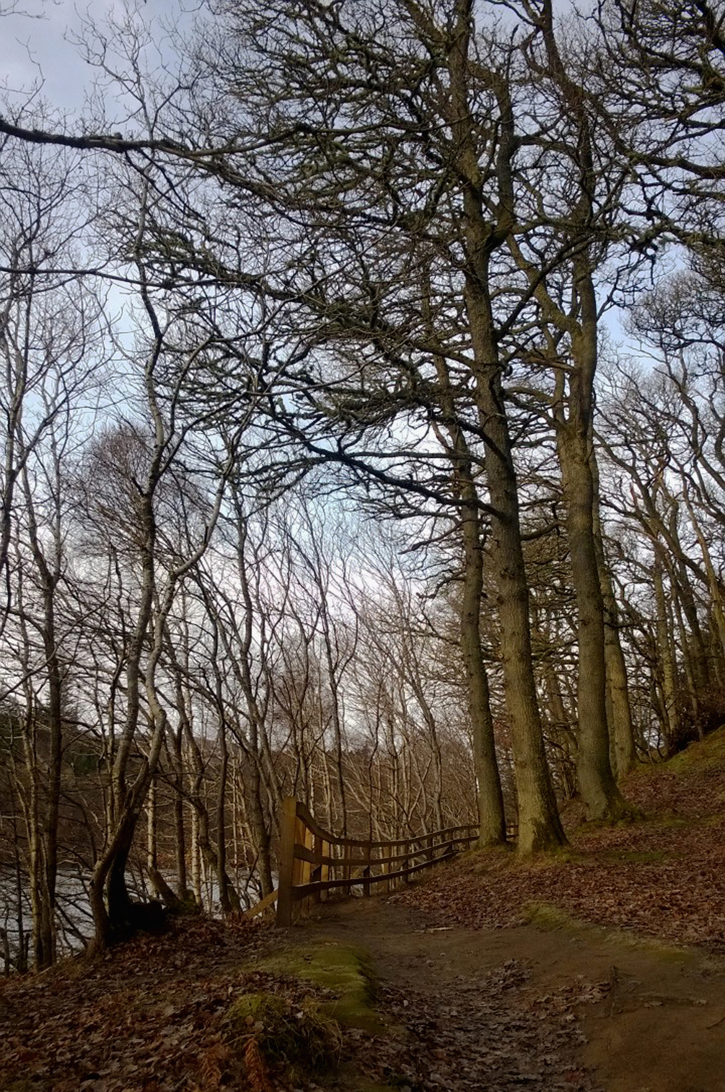
With a dusting of snow on the ground, I began my hike in the holiday town of Pitlochry, at the foot of the hill, a brief stint through mature woodland lining the shore of Loch Faskally warming my legs up nicely.
Heading up through housing to the A924 (the town’s main thoroughfare), I negotiated the parallel railway line at a gated pedestrian crossing before ascending quiet Cuilc Brae.
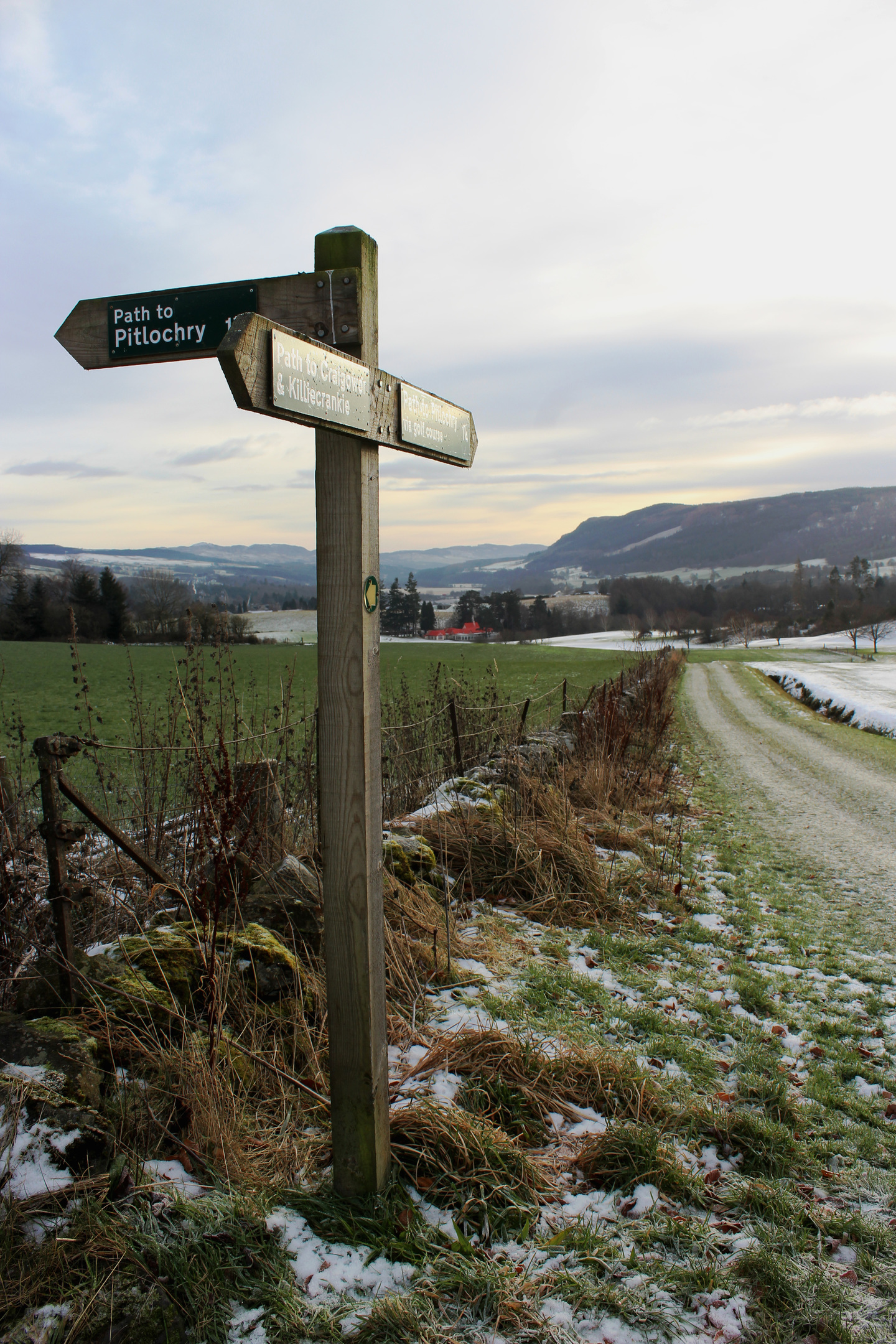
With ice underfoot, I stepped carefully, a sign part way up the lane leading me to the boundary of Pitlochry Golf Course, its 18-holes hewn from farmland in 1909 to replace a nine-hole course which, at the time, was considered below par for the developing Highland resort.
From a wooden gate, a waymarked right of way crosses the fairways, kinking right around a low mound and small disused quarry before climbing along the edge of the course to meet a track just east of Lower Drumchorry. Care should be taken to avoid interrupting play.

The ascent continues from here, another track rising to a red corrugated iron roofed cottage at Upper Drumchorry where the route to Craigower swings left, accompanying a wall bordering the northern edge of the course for a way before curving up into the plantation, part of the Tay Forest Park.
A track briefly interjects before the incline intensifies, the way pulling steeply up below tall larch and pine, the summit temptingly visible through the slender trunks.
A National Trust for Scotland marker post (the trust owns the upper slopes and summit of the hill) is a good spot to pause and catch breath before bearing right through silver birch and oak, steps concluding the climb.
Atop the hill, the trail forks – the left arm leading to a bench offering a quiet spot to sit and savour views south over Pitlochry and the Tummel valley. Return to the junction and the other spur continues to a viewpoint indicator where a gap in the trees affords a vista west to Loch Tummel and the distant peak of Schiehallion.
Below, the path dips back into the trees briefly before rising over felled ground to meet a forest track, my route of descent. Looping down, it offers a different perspective on Craigower’s wooded flanks.
Returning to the golf course, I followed track then road past a steading at Balnacraig, the higher, snow-capped peak of Ben Vrackie appearing to the north, before descending a tree-lined lane past the clubhouse to Loch Cuilc.
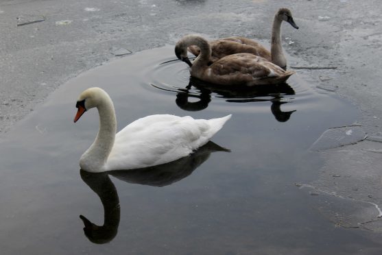
Heavily iced, a family of swans, all looking decidedly unimpressed by the cold snap, had managed to carve out a couple of pools in which to sit.
If I had packed sandwiches I would have been tempted to share them, but my plan was to seek some warming sustenance in the centre of Pitlochry, now just a short walk away. So, with a tinge of guilt, I left them to their chilly puddles and trotted down into town.
ROUTE
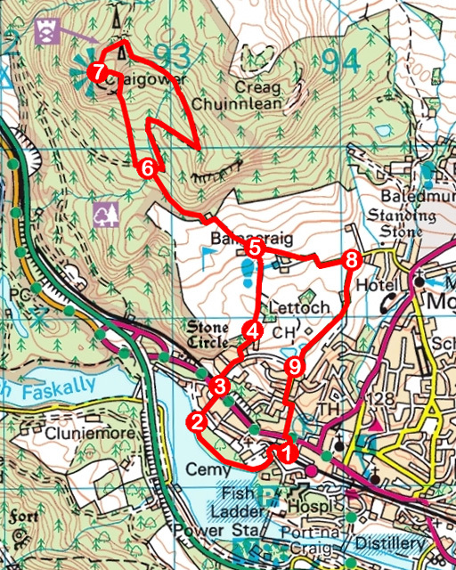
1. Descend Rie Achan Road under railway, bear left then fork right down to Loch Faskally. Go right along waterside path.
2. Turn right on path bordering wooden fence then continue up Lagreach Brae to A924. Cross to bus stop.
3. Go left along track behind bus stop, cross railway and ascend Cuilc Brae, branching left where signed for Craigower.
4. Go through gate and follow path across golf course, ascending to track.
5. Ascend track to red-roofed cottage and go left along waymarked path to meet forest track.
6. Go left briefly then right (signed Summit of Craigower) up path to summit.
7. Descend path (signed Return Route to Car Park), bearing right to meet track between two masts. Go right, descending track to point 6. Retrace steps to point 5 then walk east (signed Pitlochry) along track.
8. In 600m, turn right, descending Golf Course Road to Loch Cuilc.
9. Turn left, descending Golf Course Road and Larchwood Road to A924. Cross to Rie Achan Road.
INFORMATION
Distance: 8km/5 miles
Ascent: 350m/1150ft
Time: 3 hours
Grading: Moderate well-signed route follow tracks, paths and minor roads with strenuous ascent to summit. Stout footwear recommended and take care on untreated lanes if icy
Start/finish: Public car park (Pay & Display), Rie Achan Road, Pitlochry (Grid ref: NN 936582)
Map: Ordnance Survey 1:50,000 Landranger sheets 43 and 52; Ordnance Survey 1:25,000 Explorer sheet OL49
Tourist Information: Pitlochry iCentre, 22 Atholl Road, Pitlochry PH16 5BX (Tel 01796 472215)
Public transport: Citylink M90 or Stagecoach 24/27 bus services from Perth to Pitlochry or by train from Perth


