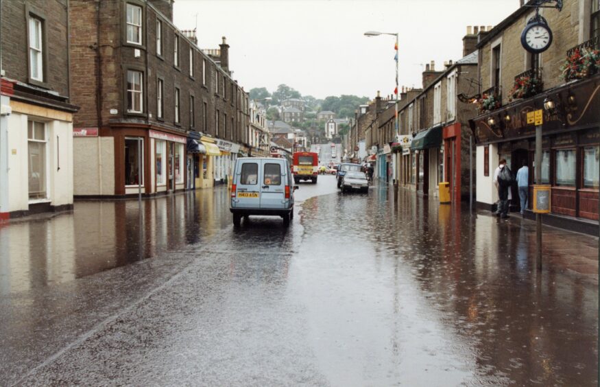
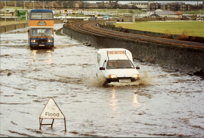
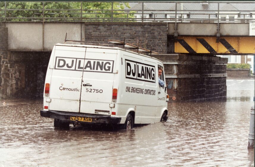
More than 1,500 people were forced to leave their homes after the Great Tay Flood of 1993 brought chaos and destruction to Courier country.
The snow which had made for a picturesque start to the New Year soon melted, resulting in region-wide blackouts and closures.
At the time, the Evening Telegraph described it as one of the worst environmental disasters the area had ever seen.
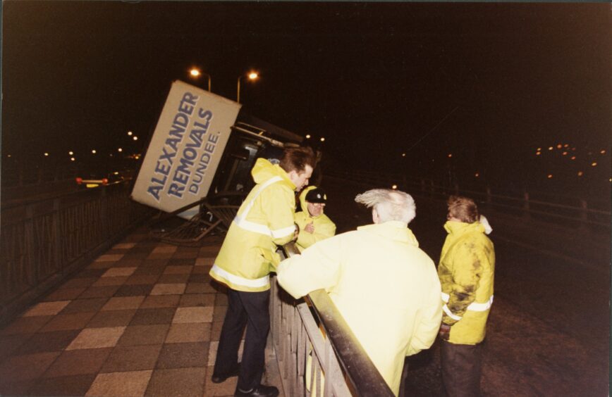
Perth and Kinross was the worst-affected region with a state of emergency declared and these dramatic images from DC Thomson’s archives show the extent of the devastation.
So what happened 30 years ago?
Blizzards battered the countryside on January 11 1993 and left several roads across Tayside and Fife inaccessible.
More than five inches of snow had covered the district when the high winds kicked in that evening.
Six lorries jack-knifed at Cairnie Braes, shutting the M90.
A police spokesperson told the Perthshire Advertiser on the day: “We’ve been sat in our cars on the M90 flashing our lights to alert drivers to the treacherous conditions.
“But some vehicles have still been trying to overtake in the fast lane.
“It’s unbelievable.
“Absolutely ridiculous.”
A Dundee doctor was trapped in his car on the road but was rescued by local police.
Dr James Dunbar slept in his car for several hours before the police were able to create a path and rescue him and 100 other drivers trapped in the blizzard.
At the time, Dr Dunbar told the Tele: “I was really lucky.
“It wasn’t a bad place to get stranded.
“I’d run the car engine for 25 minutes, switch off, fall asleep then wake up with the cold about an hour later.
“I haven’t had so much sleep in ages!”
The extreme weather meant 43 schools had to be closed in Perth, including Pitlochry High and Breadalbane Academy.
The five feet of snow near Auchterarder caused more than 1,000 vehicles to be abandoned on the A9.
Two army trucks fought their way up the 10-mile stretch of road with a police escort to take supplies to the 400 stranded motorists seeking refuge in the nearby village hall.
With no bread left in the town and milk running low, supplies were limited.
Even once safely within the hall, there were no guarantees anyone would be able to stay warm due to the region-wide power cuts.
Anyone trying to leave to obtain supplies was redirected back to the hall by police.
Meanwhile, in Dundee, the Marks and Spencer in the Murraygate plus Boots on High Street both shut due to the weather and advised their staff to remain at home.
Factories across Dundee also faced a staffing crisis.
The city’s outlying housing schemes were particularly affected when the buses stopped running and cut them off from the rest of the city.
However, a spokesman for Tayside Regional Council said it was the western flank of Tayside, from Kinross north-west to Blair Atholl, that had been hardest hit by the blizzard conditions.
Radio Tay set up a “snowline” to broadcast important information and advice.
Over the course of four days Ally Bally and his hardy squad had taken almost 30,000 calls and broadcast 6,500 bulletins.
Gritters and ploughs were also working hard across Tayside from first light on January 12 to try and clear the roads.
In Fife around 1,000 tonnes of salt were used in the first 24 hours alone.
When the snow started to thaw a couple of days later, there was a country-wide sigh of relief as roads started to open up again and pupils were told to return to school.
It wasn’t to last, however.
An emergency control unit was set up at the Perth and Kinross Council headquarters when the melted snow and heavy overnight rain resulted in a red flood warning being issued near the Bridge of Earn.
In the early days of flood warnings, the forming of an emergency unit was extremely significant.
The river had burst its banks and was threatening to flood the nearby village.
The regional water services department in Dundee sent sandbags and manpower to help prevent the spread of the water.
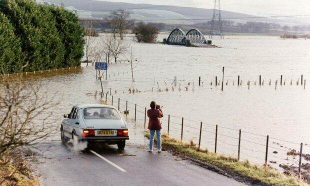
By January 17 the River Tay was recorded at its highest-ever level with a river flow of 2,268 cubic metres per hour.
The River Eden had burst its banks; time would tell if the Tay would too.
The Tay Road Bridge was closed by Fife Police, who stopped allowing access into North East Fife due to severe floods at Cupar, Newburgh, and Newport.
The restriction was lifted after a few hours but high winds with gusts of 80mph meant buses and HGVs were still banned from crossing.
Several houses flooded in Newburgh and Gateside.
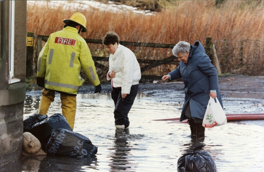
And the RAF were called in to transport sandbags to additional houses, especially to those whose walls were in danger of collapsing due to water damage.
An ambulance crew from Cupar fought their way through the floods to Auchtermuchty where the fire brigade were trying to save several people reportedly trapped in a building.
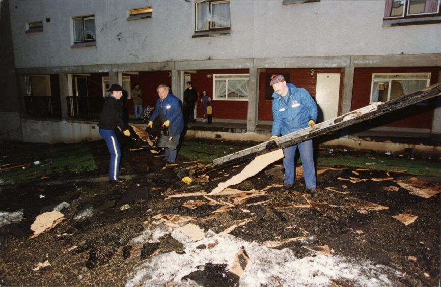
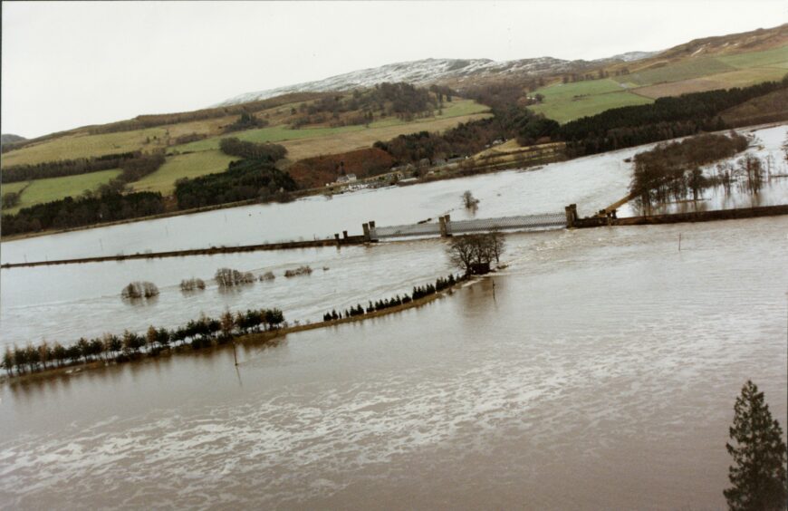
However, it was in Perth and Kinross that the worst of the damage occurred, when the River Tay did eventually burst its banks.
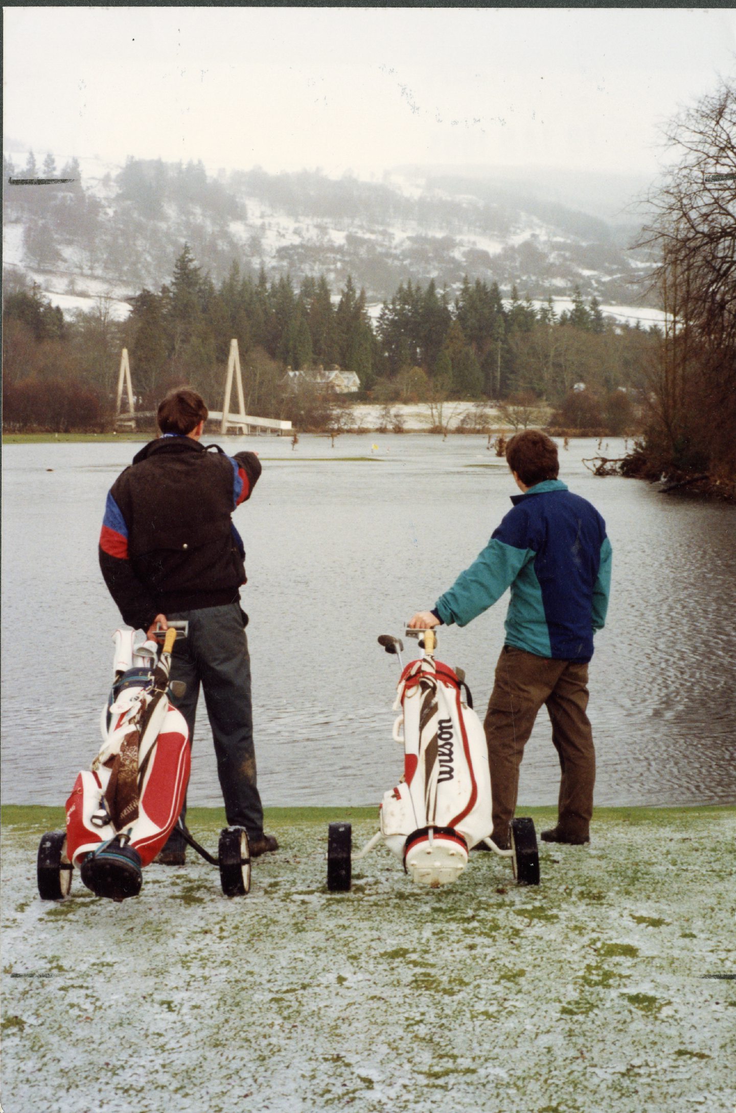
Two protection points in Perth had breached and the River Tay flooded the ground floors of hundreds of houses.
Around 400 people had to be evacuated from that area alone.
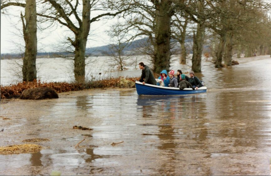
In an operation that the Tele described as “Dunkirk-like”, small boats rushed to the area and transported the residents to an emergency centre at Perth Grammar School.
In 1993 the Tele reported: “The Army, Navy, and RAF all provided boats, including assault craft, and a general appeal went out to boat-owning members of the public.
“The Perth Grammar School was soon filled to capacity by the residents.
“For safety reasons, Hydro-Electric has implemented a phased power cut in several parts of the own.
“The rescue operation continued in darkness, broken only by the flickering of torches.”
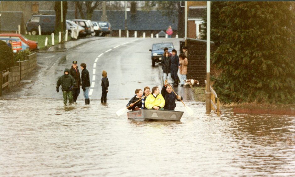
In total, more than 1,500 people from Perth and Kinross were evacuated.
The causes for the flood were widely debated, although the heavy rains which many felt had turned the tides had some looking to climate change for the first time.
Regardless of its cause, the local councils knew they needed a solution.
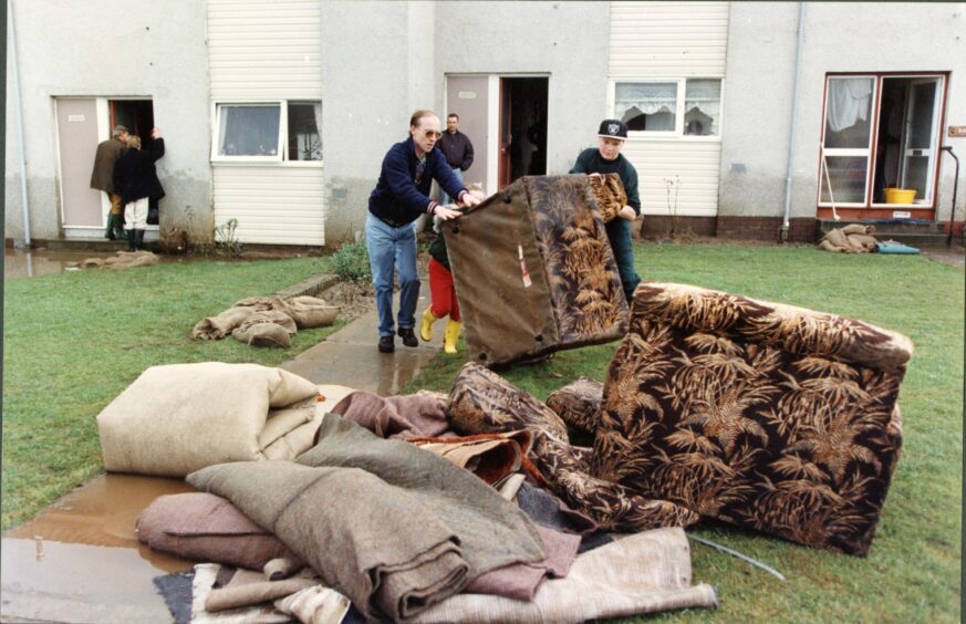
The Great Tay Flood eventually led to the multi-million-pound Perth Tay defences that were put in place in the 2000s.
They were completed in 2001 for £25 million.
The design for the new flood defences included more than 80 gates and provided structural protection for the surrounding homes.
While the damage of the 1993 flood could never be undone, it would hopefully never be repeated.