Traffic is to be banned in streets around more Angus primary schools as children arrive and leave.
We’ve created maps to show where you will soon be prohibited from driving around Newtyle, Maisondieu, Seaview and Muirfield primary schools.
And we explain when the restrictions, introduced to make getting to and from school safer for children, will be in force and who is exempt.
A school-friendly zone – as the schemes are called by Angus Council – is already in force at Muirfield Primary School, in Arbroath, but has been extended to streets at its other entrance.
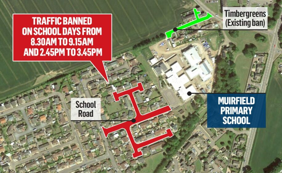
Muirfield Primary traffic ban
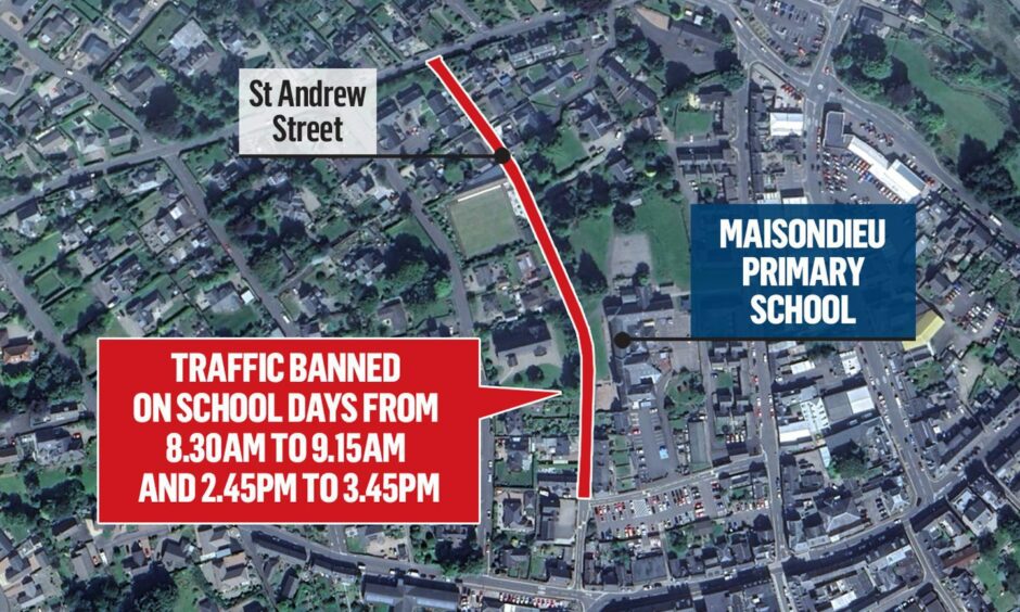
Maisondieu Primary traffic ban
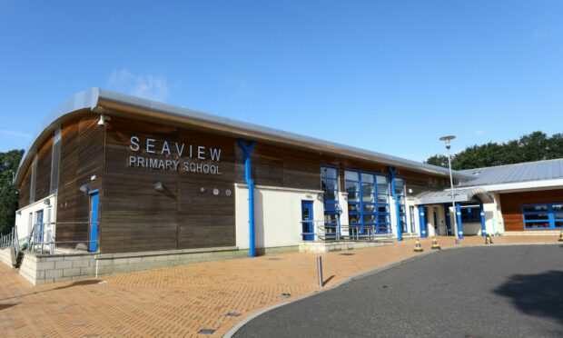
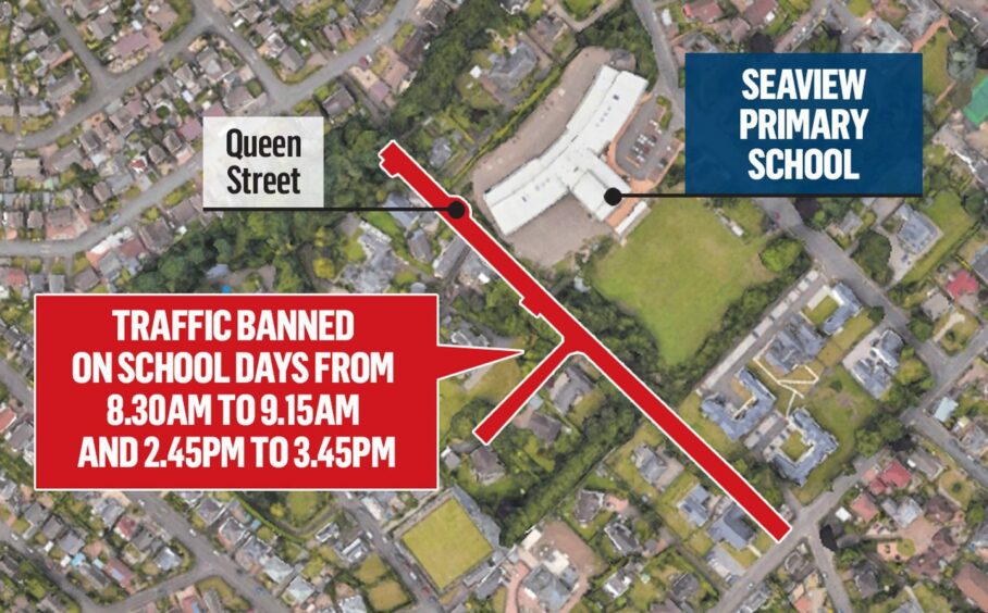
Seaview Primary traffic ban
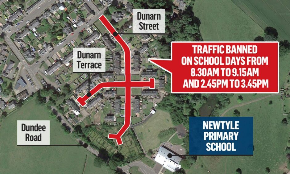
Newtyle Primary traffic ban
When will the new Angus school traffic bans be in force?
It’s intended that the new restrictions, approved by Angus Council on Tuesday, will come into force when schools go back after the summer holidays in August.
This will initially be for 18 months on a trial basis.
Traffic will be prohibited in the streets marked red on our maps between 8.30am and 9.15am and 2.45pm and 3.45pm on school days.
The streets are:
- Muirfield Primary School, Arbroath – School Road (restrictions already exist in Timbergreens)
- Maisondieu Primary School, Brechin – St Andrew Street
- Seaview Primary School, Monifieth – Queen Street
- Newtyle Primary School – Dunarn Street and Dunarn Terrace
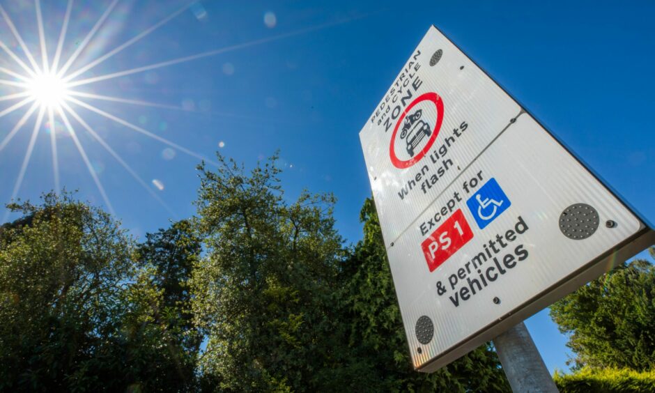
Signs will be erected at the entrance to the school-friendly zones advising motorists of the restrictions.
Why are these traffic bans being introduced?
Concerns have been voiced about vehicles dropping off and picking up children too close to the school gates. There are also issues with visibility at junctions, congestion and premises having access blocked.
Angus Council says the school-friendly zones are in the interests of pedestrian and traffic safety and will encourage more walking and cycling to and from school.
Who is exempt and how are they enforced?
Cyclists, blue badge holders, residents with permits, school buses, emergency vehicles and utility company vehicles for emergency works will be exempt from the prohibition.
Angus Council says the nature of the locations will make schemes largely self-enforcing but it could conduct enforcement along with Police Scotland.
Non-exempt drivers who enter the zones while they are operational could be fined £50.
Which other Angus schools have or could have traffic bans?
Traffic is already prohibited in streets around:
- Ferryden Primary School
- Muirfield Primary School, Arbroath
- Langlands Primary School, Forfar
- Liff Primary School
- Southesk Primary School, Montrose
- Carlogie Primary School, Carnoustie
- Andover Primary School, Brechin
- Letham Primary School.
Those at Ferryden, Langlands and in Timbergreens at Muirfield have been made permanent and minor amendments are proposed at Carlogie, Letham and Southesk.
School-friendly zones already requested for other communities will only be implemented once the new schemes have been tested.
However, part-time traffic bans are not considered suitable for all schools, such as those with gates onto main roads.


Conversation