
Cambus o’ May, Ballater, Deeside
Yet another day of strong winds, another day when staying on lower ground was the more sensible option, so a long stroll around the banks of the River Dee fit the bill perfectly.
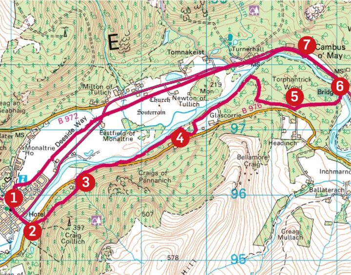
The pretty Deeside village of Ballater is the starting point for an eight-mile loop through various sections of woodland to the Cambus o’ May bridge with a return along the track bed of a former rail line which is part of the Deeside Way.
The landscape is always interesting, the route is always well signposted, and there are a couple of worthwhile detours on the inward half which won’t make much of a dent on the time.
The Cambus o’ May bridge only reopened last year after being severely damaged during the devastating floods brought by Storm Frank back in 2015, a year that also saw the Victorian railway station buildings in Ballater destroyed by fire.
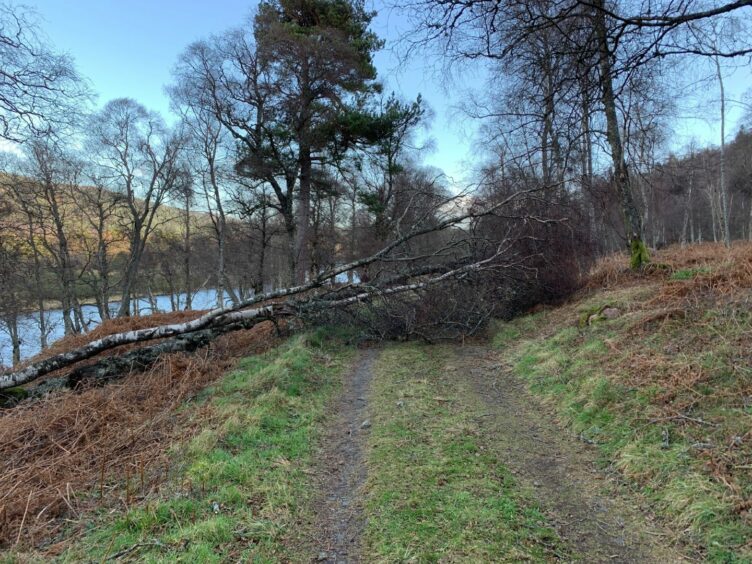
The station has since been beautifully restored, but the recent series of storms have once again brought problems to the surrounding woodlands with so many trees uprooted or snapped off, so many more clinging on by a thread.

Like any forest walk at the moment, you should be prepared for diversions due to damage or clearance work. There were lots of fallen trees to negotiate along the paths; I felt like a combination of limbo dancer and Grand National thoroughbred.
It felt a little unnerving at times as the wind brushed through the trees, the heavy creaking and sighing suggesting they were debating if or when to topple on the intruder.
From the centre of the village, I walked along the main road and crossed the bridge over to the South Deeside road, immediately heading into the wood opposite. The slopes above were clear felled, and everywhere along the track east were huge log piles, signs of the current tidy-up.
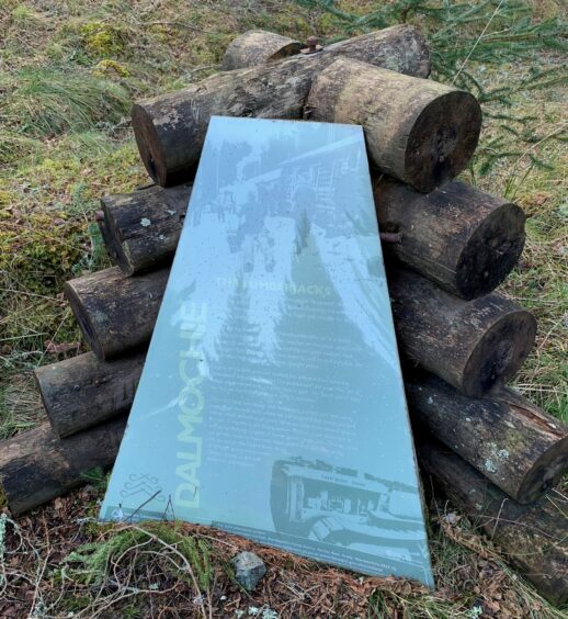
I passed the site of the former Dalrachney camp where lumberjacks from Newfoundland were based during the war, a pair of information boards standing to tell their story. The track turned downhill to emerge at the road and a short walk led to a gate giving entry to a grassy track heading down to the Dee.
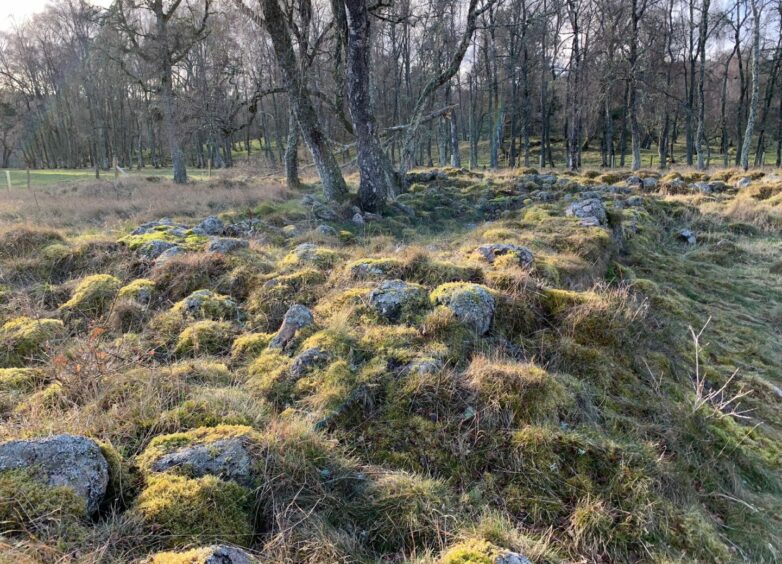
The continuing mix of path and track winds along the curves of the water through sections of oak, birches and Scots pines, eventually reaching the stony remains of the former settlement of Torphantrick before turning towards the pristine white bridge and the halfway point of the walk.
After crossing the bridge and turning left, the route takes an almost straight line along the tree-lined track bed, the arboreal casualties once again impossible to ignore.
The first optional detour came after some 2.5km at a crossroads, a gate on the left giving entry to a small wooded hillock which is topped by The Needle, a monument to former landowner William Farquharson, the Laird of Monaltrie, which was erected by his widow.
A little further on, there’s the opportunity to visit the ruined chapel and walled cemetery at Tullich. This was built in the 1200s on the site of an earlier Medieval chapel estimated to date from somewhere between the 7th and 9th Centuries. It contains a display of carved stones, and there are information panels along the way about its history.
Entry is by a series of gates via a corridor through grazing land, so please be sure to securely shut all gates and keep dogs under strict control. Shortly after leaving Tullich, the track crossed the busy A93 to head back into Ballater.
ROUTE
1. Turn left on to A93 through centre of town and cross bridge over River Dee to South Deeside Road.
2. Cross road and take signed path heading left into wood. Keep left at sharp bend, passing site of former Dalrachney camp, then left again as track heads downhill to rejoin road.
3. Cross to pedestrian walkway heading right until reaching gate (signed), go through and follow grassy track then path by river through woods.
4. Shortly after passing through area of gorse bushes, route curves to left at first then right on grass track to reach gate into cattle field. Cross field to another gate and follow path round fenceline and back into trees (alternative path around field by fence line for dog walkers).
5. Path eventually emerges at track, keep right with newly planted area on your right until corridor path going off into trees on left. At junction go straight across and head down past scant remains of Torphantrick settlement then follow path round to Cambus o’ May bridge.
6. Cross and turn left along Deeside Way, and after passing front of house fork right on to long straight, route of former rail line running alongside A93.
7. Follow this all way back into Ballater, with one crossing of A93 near finish. Along the way there are optional detours left to The Needle monument, and right to Tullich church and cemetery.
INFORMATION
Distance: 13km/8miles
Ascent: 120m/395ft
Time: 3-4 hours
Grading: Delightful river circuit mostly on woodland paths and track of former rail line, brief section on footpath along side of road. Suitable for all ages, although may prove too far for small children. Route passes through farmland, dogs under close control.
Start/finish: Parking at Old Royal Station, Ballater (Grid ref: NO 369959), other parking available nearby.
Map: Ordnance Survey 1:50,000 Landranger Map 37 (Strathdon & Alford) or Map 44 (Ballater & Glen Clova); Ordnance Survey 1:25,000 Explorer sheet OL59.
Tourist Information: VisitScotland, Ballater iCentre, Station Square, Ballater, AB35 5QB (Tel 01339 755306).
Public transport: Buses to Ballater on Aberdeen-Braemar route.


