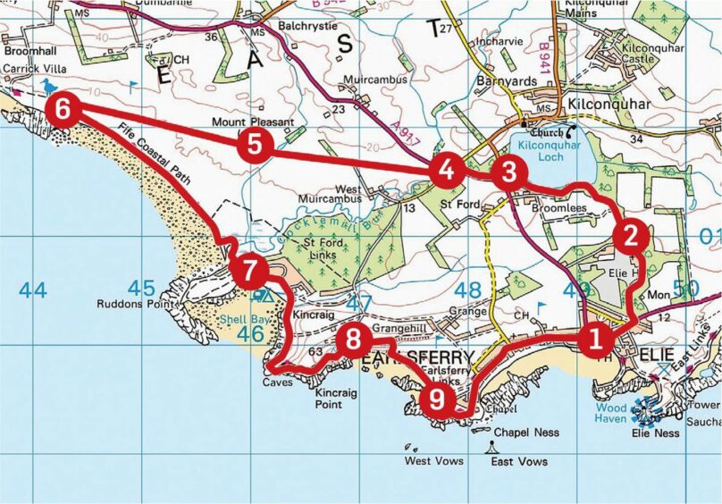
Elie circuit via Kilconquhar Loch, Fife
The linked coastal villages of Earlsferry and Elie are the focal point for a fine walking circuit through a constantly changing landscape.
The route can be tackled in either direction depending on which way the wind is blowing but on a fine day anti-clockwise is the preferred option, saving the stroll back along the beautiful rugged coastline for the inward leg.
The derivation of the name Elie is unclear; one suggestion is a variation on eilean (island) referring to its sheltered harbour, another is from eiladh, the place of the tomb, or ayle, a covered cemetery.
No such mystery with Earlsferry. Deemed a royal burgh in the 11th Century, it was named after the ferry service which ran across the Forth, initially to allow MacDuff, the Earl of Fife, to tend to his estates. It also became popular with pilgrims heading for St Andrews.
The journey along the warren of quiet roads on a misty Sunday morning gave no hint of the bustling scene that would await in Elie – the harbour area in particular was buzzing.
Within minutes though, I was out of the throng, a short walk east along the main street and a left turn into Elie Estate along a surfaced tree-lined track towards the peaceful shores of Kilconqhuar Loch.
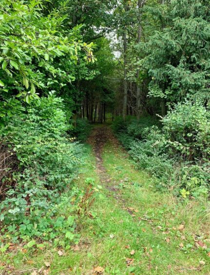
After exiting the estate, a path on the opposite side of the road twisted its way through a delightful wooded area, which ended all too soon at another road. Once over the main road, the walk changed again, now using the bed of the old railway as it took a direct line on a corridor between fields.
I watched a couple of buzzards playing aerial games before they circled off into the distant treeline just beyond the ruin at Mount Pleasant. The squat hump of Largo Law started to come into view over to the right, its presence growing on the way through the golf course.
The map shows a straight line through the course, but the marked route weaves around with plenty of prominent signs of keep you right. Once out the other side, I doubled back almost immediately to pick up the Fife Coastal Path.
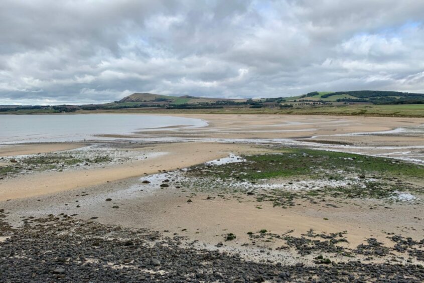
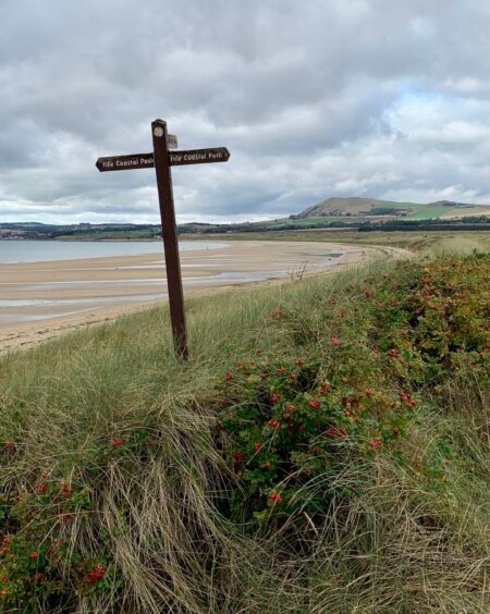
The tide was well out so I managed to walk along the sweep of the Largo Bay sands, just a few little rivulets to hop across. On nearing the rocky protrusion of Ruddons Point, I stepped up into the dunes where a signpost signalled a turn inland over a couple of wooden bridges.
The path carried on round the edge of the caravan park at Shell Bay, then climbed again along the clifftops below Kincraig Hill. Soon I arrived at a sign pointing the way down to the Elie Chain Walk, well worth taking a look but perhaps better left for a separate excursion.
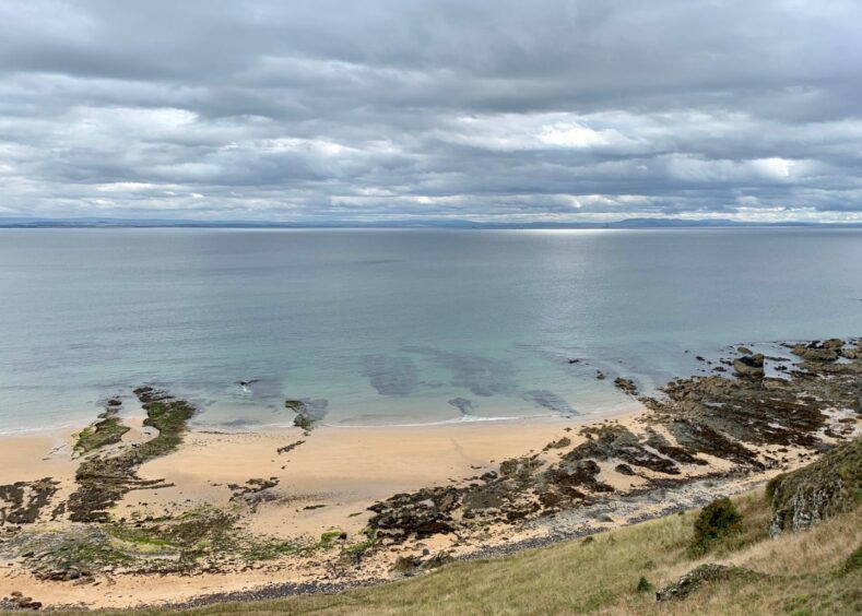
The route continued along the cliffs, passing numerous remains of World War II gun batteries and shelters and enlivened by the frequent sight of kestrels hovering above the fields to the left. The bird’s eye view down to the sands of Earlsferry was pretty spectacular as well and the descent to the bay was fast on the stepped path.
The beach option was again available going forward until the path made a cut inland. It returned to the front on a grassier trajectory passing the ruins of the chapel before heading up through the streets of the linked villages and back to the start.
ROUTE
1. Head east along main street, turn left at entrance to South Lodge into Elie Estate. Stay on track which passes houses to your left until reaching gate.
2. Go straight ahead (purple core path arrow). Ignore left turn, keep on main track as it turns above southern shore of Kilconquhar Loch then exits at North Lodge.
3. Cross road and take path into woods directly opposite. When this emerges from trees, turn left on minor road to reach A917, then cross with care to track opposite.
4. Go through metal gate on right. This is line of old railway which runs between fields to reach entrance to Dumbarnie Links golf course.
5. Follow signed route through course. After exiting far end, turn sharply back on to Fife Coastal Path at Largo Bay. At low tide you can walk along beach, otherwise take path through dunes.
6. As route nears Ruddons Point, watch for signpost on left directing you across couple of wooden bridges and round towards caravan park (you can also take branch loop round the Point).
7. Walk along edge of caravan park and round Shell Bay, then follow path as it hugs cliffs below Kincraig Hill. Signs on right point down to Elie Chain Walk.
8. Beyond this, path starts to drop down series of steps to Earlsferry Beach. Again there is choice of beach or dunes walk.
9. Follow signs heading inland round golf course, then on grassier section passing ruined chapel before turning up through streets and back to start.
INFORMATION
Distance: 15km/9.5miles
Ascent: 155m/510ft
Time: 3.5-5 hours
Grading: Fine mixed circuit which can be easily extended or shortened, well-signed with many points of interest along the way. Woodland paths, tracks and Fife Coastal Path, quiet streets and some pavement walking. May be too long for younger children. Route passes through farmland, dogs under close control.
Start/finish: Parking on Elie High Street (Grid ref: NO 492001) also at Ruby Bay (two hours free). Public toilets available and plenty options for refreshments.
Map: Ordnance Survey 1:50,000 Landranger Map 59 (St Andrews); Ordnance Survey 1:25,000 Explorer sheet 371.
Tourist Information: VisitScotland, St Andrews iCentre, 70 Market Street, St Andrews, KY16 9NU (Tel 01334 472021).
Public transport: Regular bus services to Earlsferry, Elie and Lower Largo.


Conversation