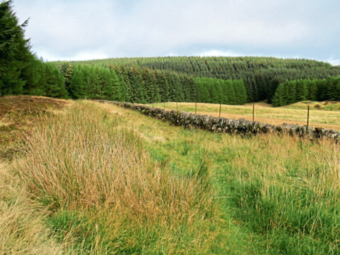
Blackhill Forest, Stronachie, Perth & Kinross.
At first glance, Blackhill Forest – one of numerous commercial plantations tucked away in the folds of the Ochil Hills – looks a less than enticing prospect, the map revealing just a short network of tracks snaking through the conifers.
However, as is so often the case, there is more to this wood than initially meets the eye with the cartography telling only part of the story. To discover all it has to offer, you must pull on your boots and seek out hidden trails lurking in the trees.
Popular with locals and dog walkers, access to the forest is from a track end parking area in a bend in the road just south of the hamlet of Stronachie.
The gates are padlocked but a stile spans the adjacent fence, the track splitting beyond.
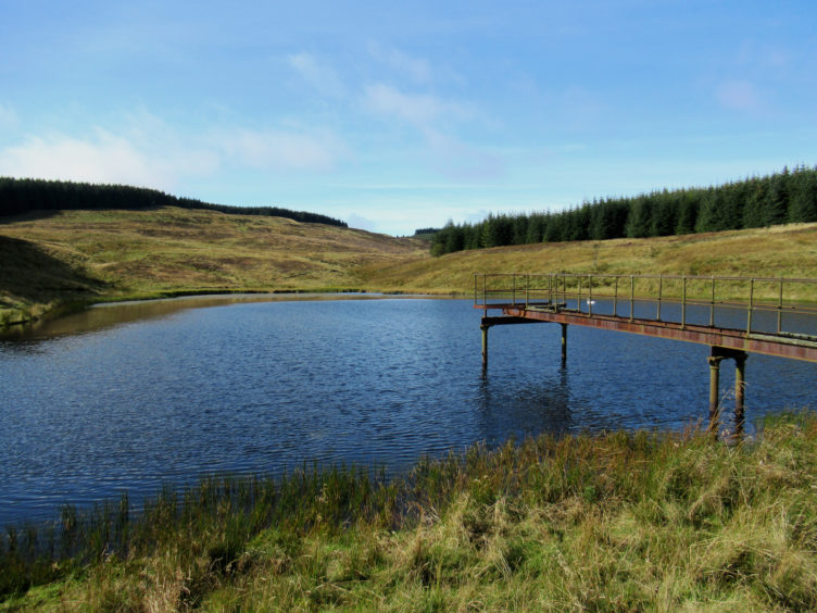
The gravel road on the left forks up into the plantation while the heathery waymarked trail branching right leads to Stronachie Reservoir, a tranquil stretch of water flanked by pasture.
The reservoir was created to supply water to Stronachie Distillery, a legendary name in the history of lost whisky producers. Established in the 1890s, the tiny white-washed distillery sold its distinctive malt until a decline in the industry forced its closure in 1928.
Aside from the reservoir, little now remains of the enterprise or of the five-mile long narrow-gauge railway laid to haul in coal and grain from Meikle Seggie after locals complained heavy trucks were churning up the rural road.
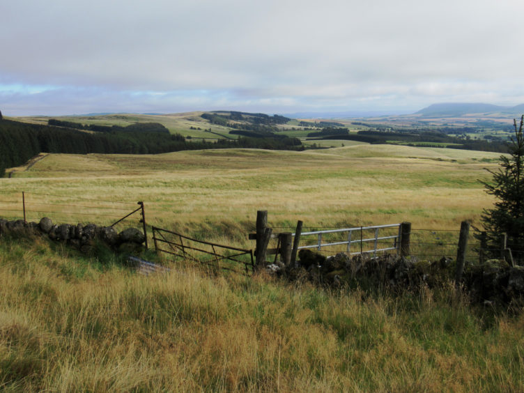
The forest track ends by the pool, but a path continues ahead, rising along the edge of the plantation, bounded to the right by a wall and fence. It is a steady incline on to wooded Slungie Hill, views opening out over Fife to the east as height is gained.
Where the slope flattens off, the waymarked path swings left into the forest, but go straight ahead, staying on the edge of the plantation, across a patch of heathery ground and the way reaches the north-west corner of the forest.
Here, the trail curves left, descending south, initially by a band of established trees then over open ground. Lower down, the path becomes less distinct and a bit boggy in places, but its line is clear enough as it weaves around scattered conifers, crossing a tiny stream before the terrain underfoot improves ahead of its convergence with a track.
With views west over a patchwork of plantations carpeting the lower hills of the Ochils, the forest road dips to cross Corse Burn beyond a quarry.
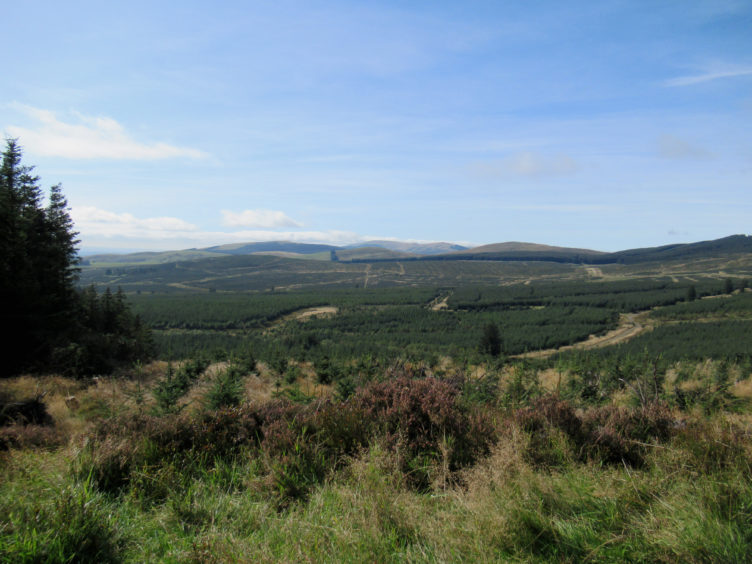
Blackhill Forest itself is a real mixed bag of planting, the trees on the upper slopes of the hill older and taller while blocks of spruce and pine of varying ages and stages cover the valley below, ensuring that, for now at least, walkers enjoy a decent outlook over the surrounding countryside.
From Corse Burn, the track climbs, curving up through bushes of gorse and broom to a gate and stile on the eastern edge of the plantation.
While the track leaves the plantation here, striking out across grazing land, I remained within the parameters of the plantation, picking up a grassy path following the boundary wall and fence north.
Enjoying vistas east towards Fife and the Lomond Hills, the path leads back into the forest where a short track walk concluded my time in the trees.
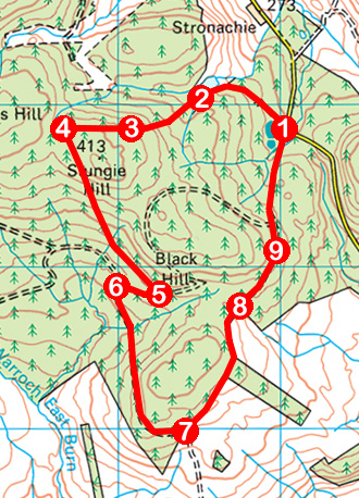
ROUTE
1. Cross stile by gates, turn right (red arrow waymarker) and follow track through forest, curving left in due course to reservoir.
2. Where track ends, continue straight ahead on path rising by fence line along edge of plantation to junction at top of incline.
3. Ignore waymarked path branching left and continue ahead, along edge of plantation.
4. Approaching top corner of plantation, swing left and descend path to meet track.
5. Turn right and descend track to junction.
6. Turn left, descending track to cross stream then ascend track, curving up to reach gate and stile.
7. Don’t cross stile but go left, ascending grassy path running parallel with fence along eastern edge of plantation.
8. Ascend track rising through forest to junction
9. Ignore track branching left and continue straight ahead to next junction. Bear right, descending to parking area.
INFORMATION
Distance: 6.5km/4 miles
Ascent: 170m/560ft
Time: 2 hours
Grading: Moderately easy route following forest tracks and paths with some stints of fairly strenuous ascent. Stout footwear recommended
Start/finish: Track end parking area at gated entrance to Blackhill Forest on minor road between Path of Condie and Meikle Seggie, 800m south of Stronachie (Grid ref: NO 070078)
Map: Ordnance Survey 1:50,000 Landranger sheet 58; Ordnance Survey 1:25,000 Explorer sheet 369
Tourist Information: Perth iCentre, 45 High Street, Perth PH1 5TJ (Tel 01738 450600)
Public transport: None