Calendar An icon of a desk calendar. Cancel An icon of a circle with a diagonal line across. Caret An icon of a block arrow pointing to the right. Email An icon of a paper envelope. Facebook An icon of the Facebook "f" mark. Google An icon of the Google "G" mark. Linked In An icon of the Linked In "in" mark. Logout An icon representing logout. Profile An icon that resembles human head and shoulders. Telephone An icon of a traditional telephone receiver. Tick An icon of a tick mark. Is Public An icon of a human eye and eyelashes. Is Not Public An icon of a human eye and eyelashes with a diagonal line through it. Pause Icon A two-lined pause icon for stopping interactions. Quote Mark A opening quote mark. Quote Mark A closing quote mark. Arrow An icon of an arrow. Folder An icon of a paper folder. Breaking An icon of an exclamation mark on a circular background. Camera An icon of a digital camera. Caret An icon of a caret arrow. Clock An icon of a clock face. Close An icon of the an X shape. Close Icon An icon used to represent where to interact to collapse or dismiss a component Comment An icon of a speech bubble. Comments An icon of a speech bubble, denoting user comments. Comments An icon of a speech bubble, denoting user comments. Ellipsis An icon of 3 horizontal dots. Envelope An icon of a paper envelope. Facebook An icon of a facebook f logo. Camera An icon of a digital camera. Home An icon of a house. Instagram An icon of the Instagram logo. LinkedIn An icon of the LinkedIn logo. Magnifying Glass An icon of a magnifying glass. Search Icon A magnifying glass icon that is used to represent the function of searching. Menu An icon of 3 horizontal lines. Hamburger Menu Icon An icon used to represent a collapsed menu. Next An icon of an arrow pointing to the right. Notice An explanation mark centred inside a circle. Previous An icon of an arrow pointing to the left. Rating An icon of a star. Tag An icon of a tag. Twitter An icon of the Twitter logo. Video Camera An icon of a video camera shape. Speech Bubble Icon A icon displaying a speech bubble WhatsApp An icon of the WhatsApp logo. Information An icon of an information logo. Plus A mathematical 'plus' symbol. Duration An icon indicating Time. Success Tick An icon of a green tick. Success Tick Timeout An icon of a greyed out success tick. Loading Spinner An icon of a loading spinner. Facebook Messenger An icon of the facebook messenger app logo. Facebook An icon of a facebook f logo. Facebook Messenger An icon of the Twitter app logo. LinkedIn An icon of the LinkedIn logo. WhatsApp Messenger An icon of the Whatsapp messenger app logo. Email An icon of an mail envelope. Copy link A decentered black square over a white square.

Walkers left wondering about absence of core paths from maps

Councillor Tim Brett is calling upon Ordnance Survey to include the Core Path network on its range of maps in order for walkers, cyclists and all who enjoy the outdoors to be able to plot their course for their enjoyment of the countryside.

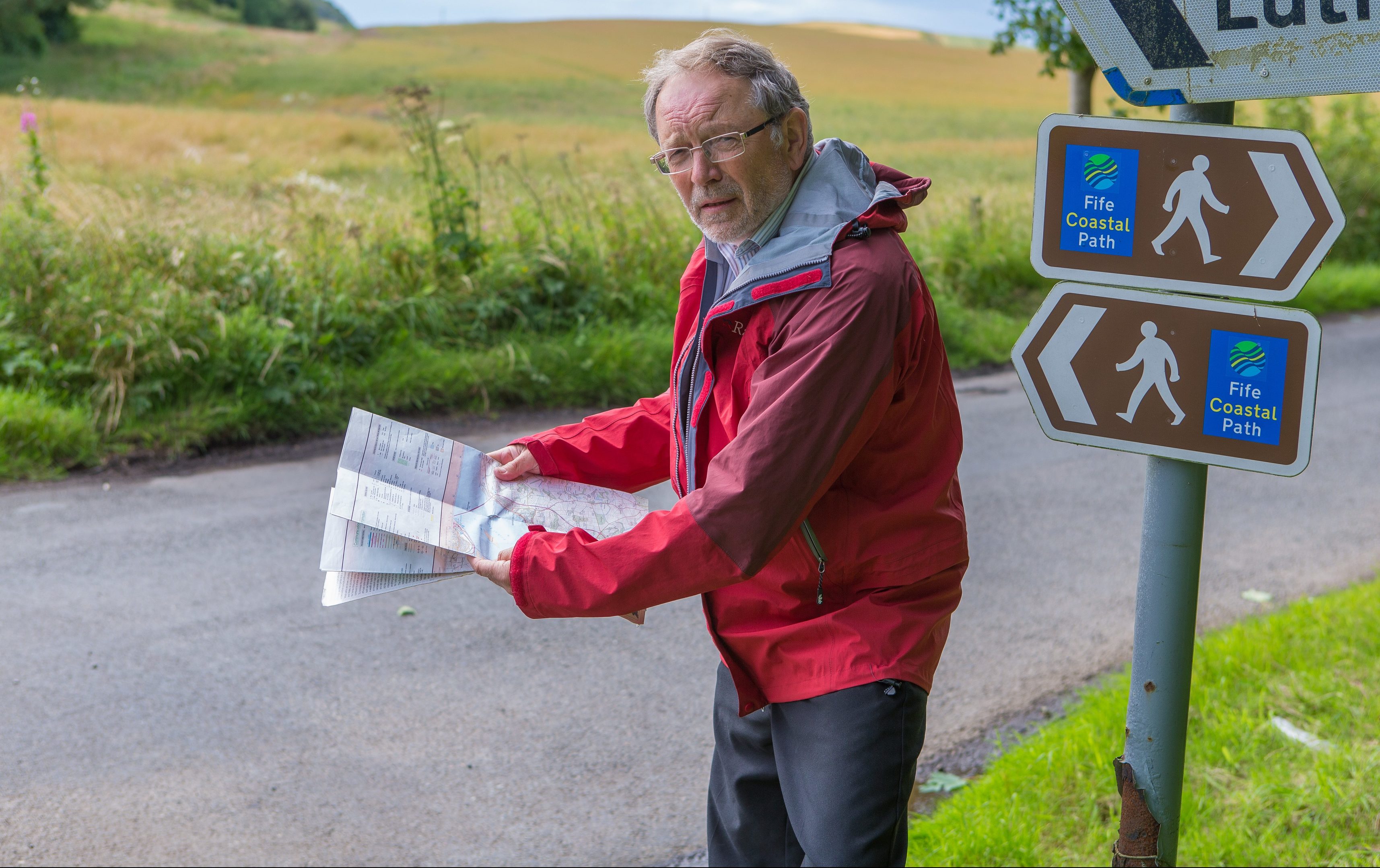
Keen walkers have been left puzzled as to why key path networks across Scotland are not featured on official Ordnance Survey (OS) maps.

Rights of way have been marked on English maps since the end of the Second World War, but the omission of core paths from Scottish ones is now apparently causing some consternation.

The issue has been flagged up by senior Fife councillor and avid walker Tim Brett, who has written to OS calling on the organisation to redress the balance.

“A great deal of time, effort and expense has gone into developing the core path network throughout Scotland, so it is disappointing that Ordnance Survey maps, which are some of the best in the world and used by visitors and residents alike, do not currently include these paths,” the Liberal Democrat member for Tay Bridgehead commented.

“From my discussions with local access officers I know that this has been the subject of discussion with Ordnance Survey for some time so it is not clear why they are reluctant to do this.

“Core paths have now been developed for all 32 Scottish local authorities, providing access to some of our best countryside.

“While many local people know the routes and use them regularly, visitors lack this knowledge and therefore rely on maps.

“Clearly-marked routes on maps and signs at the start and finish of the paths makes it easy for everybody to use them.”

No firm explanation has yet been provided as to why the core paths do not feature on OS maps, although it is understood concerns about their accuracy may have prevented their inclusion up until now.

Mr Brett, who completed his Munros in 2004, pointed out that maps south of the border not only show rights of way but also long distance paths, and added: “I cannot see why this should not be extended to Scotland.

“Discussion about core path development have been taking place with Ordnance Survey since 2002 and, whilst I believe they claim that the business case for inclusion is unclear, I am sure that the enhancement in tourism would justify it.

“Whilst there is a general right to roam here, I know that many walkers would feel much more comfortable knowing they are on a designated path.”

A spokesperson for OS said the organisation has been “investigating the options” around including core path information into its digital and paper products.

“For some time we have been working with a number of stakeholders involved in the project including local authorities, the Improvement Service, the Scottish Government, Scottish Natural Heritage and the National Access Forum,” the spokesperson added.

“At OS we recognise that there are potential benefits for including this information in our products and how valuable this level of information is for helping people and communities to get outside.

“We are currently working with the project stakeholders on the core path data to ensure that it is as accurate and consistent as possible.

“OS manages the geographic database for Great Britain and it is important that any information added to this database meets the highest standard of accuracy and quality.”