Montrose town is at the mercy of its neighbouring golf course…
its last line of defence against the North Sea.
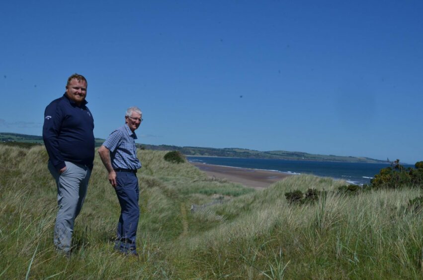
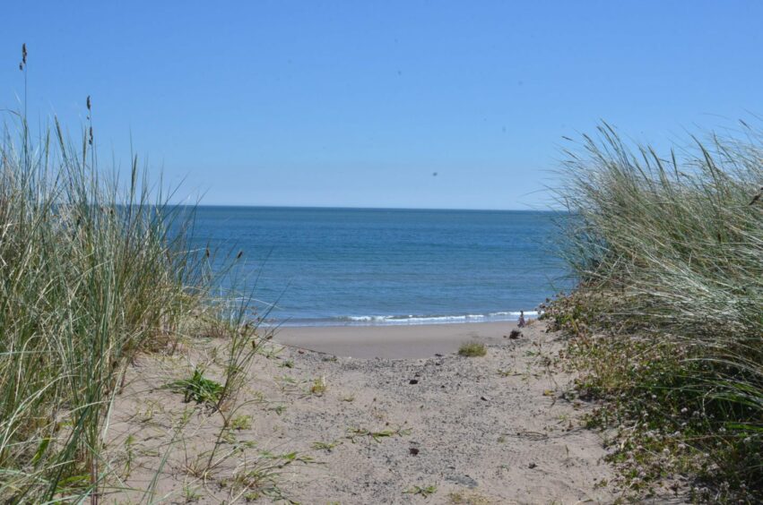
The 1562 Course at Montrose Golf Links has been played for centuries.
But it may struggle to get through the next few decades as its sand dunes erode landward.
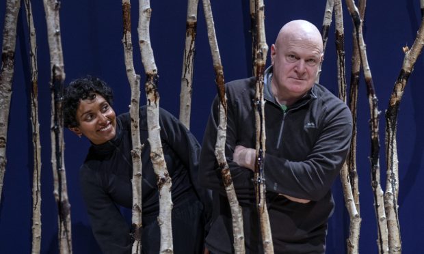
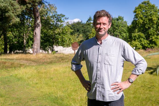
“If it breaches here, we’re toast,” says John Adams, a former chairman at Montrose Golf Links.
In recent years John has been involved in Dynamic Coast, a national project focusing on our changing shorelines.
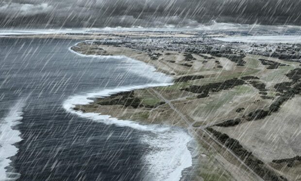
We used Dynamic Coast webmaps to visualise a worst case scenario for our waterfronts by 2100.
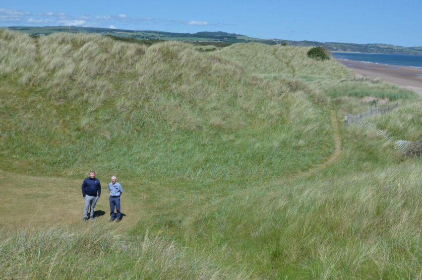
John and Montrose Golf Links general manager David Brown took me on a tour of the 1562 Course to demonstrate how the links are at the sharp end of coastal erosion.
Coastal erosion is squeezing the course, making it narrower, and taking away the dunes which are Montrose’s last line of defence against a major flooding incident.
“If you look at the 2nd to 7th holes, that is what protects Montrose,” says David.
“Once you get beyond that, you start to get to sea level.
“If the sea breaks through, then Dorward Road and the people of Montrose are in a lot of trouble.
“What the golf course is doing is protecting the town.”
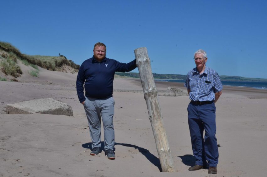
The course is shrinking
It seems hard to believe, but the wooden posts on the sands mark where a fairway stood in 2006.
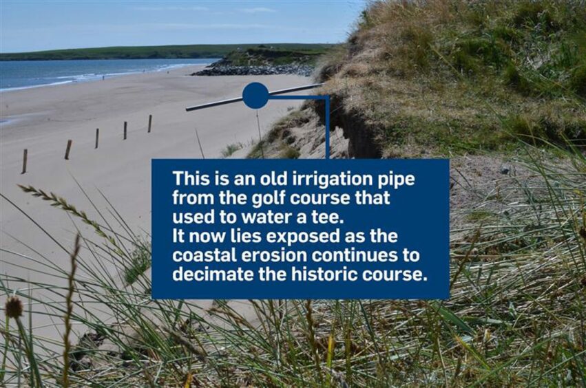
And this pipe once irrigated a tee.
The 3rd tee had to be moved as the edge of the dunes crept closer.
It will probably have to be moved again.
A storm in 1999 wiped out the 6th tee.
Paths have been wiped out. What’s left of them lead nowhere.
Looking over the dune edge, John says: “This was being played three years ago.”
One of the vulnerable points is a hollow between the 3rd green and the 3rd tee.
John says there is a channel where water can get behind the dunes and threaten properties beyond.
Erosion is bad for business
The loss of huge swathes of the golf course not only threatens the safety of the town.
Every time there is damage to the tees, greens and fairways, that incurs a cost.
And while there is the option of reconfiguring the course, and the adjacent Broomfield Course, that option is not ideal.
“If you wanted to add two holes, you wouldn’t get much change out of £1 million,” says David.
“As a business we have to plan, but it’s difficult to plan for what might be.”
Moving holes, or merging the two courses, would also mean closing the course and loss of revenue.
The coast is slipping away – and fast
Montrose has been a focal point for the Dynamic Coast research project and it’s easy to see why.
It’s a particularly long section of soft coastline and is very vulnerable to storm damage.
The study discovered that Scotland’s shores as a whole are now eroding at twice the rate they were receding in the 1970s.
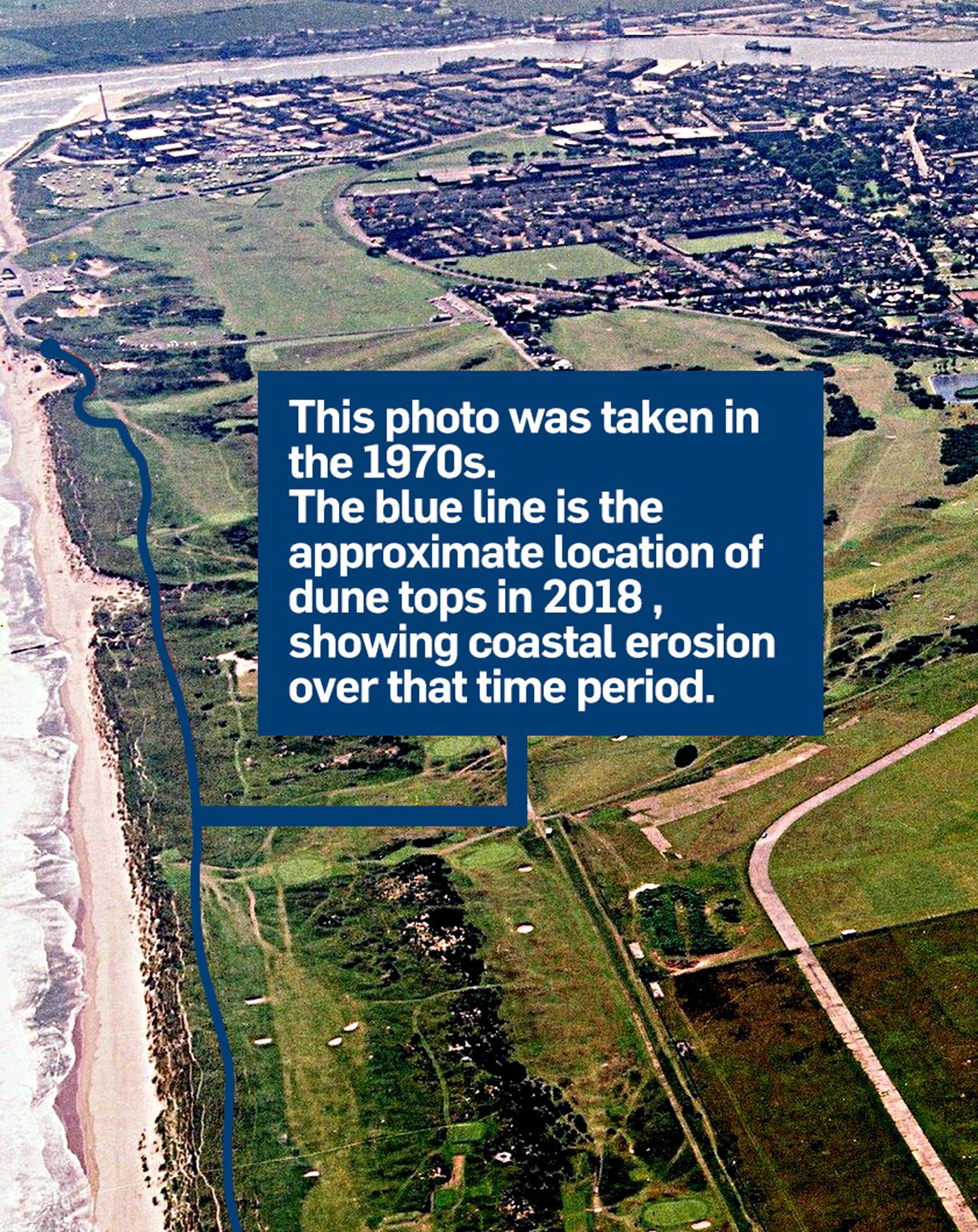
At Montrose, the coast is now believed to be retreating at a rate of two metres per year.
On average, Scotland’s eroding shorelines are disappearing at a rate of a metre per year.
And this is set to speed up.
Managed Retreat
There is no attempt to hold the line at Montrose Links.
Instead, the approach is a “managed retreat” of the dunes.
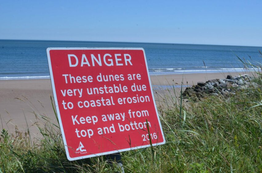
David does not agree this is the right approach.
And he says there needs to be immediate action from Angus Council and the Scottish Government.
“If it’s a managed retreat, where does that start and where does it stop?”
“What we need now is action.
“We as a business don’t want to pass blame, we just need the coast to be protected.”
An Angus Council spokesperson said the Dynamic Coast research was informing its approach.
The policy of ‘managed realignment’ of the dunes was approved in January 2017 as part of the council’s revised Shoreline Management Plan (SMP2).
A council spokesperson said the aim was to “maintain the integrity of the dunes as a natural defence while maintaining protection to the majority of the golf course into the long term”.
‘Perfect storm’
John describes the impacts of climate change as an “unknown”.
But he says a “perfect storm” is inevitable.
“We know we’re going to get a storm from the east with a high tide.”
And that could knock out the dunes, and deluge the town, he says.
Timeline for Montrose flooding prevention
The spokesperson told us Angus Council has spent £100,000 over the past 10 years trying to save the coast at Montrose.
And authority bosses have set aside a further £600,000 to tackle the problem.
“Detailed designs for these works are under development,” says the spokesperson.
“The critical element will be to source suitable material to be used to ‘fill the gaps’.”
The council is in talks with Montrose Port Authority about using material dredged from the navigation channel of the port to reinforce the dunes.
Could a ‘sand engine’ be the answer?
John has backed the idea of a ‘sand engine’, also known as a ‘sand motor’, at Montrose to protect the coast.
This would look like an extensive ‘island’ of sand just off the shore.
The approach has already been used at The Hague in the Netherlands, where the ‘Zandmotor’ has been created.
It involved shifting a colossal 21.5 million cubic metres of sand from offshore to a site 10 kilometres off the coast.
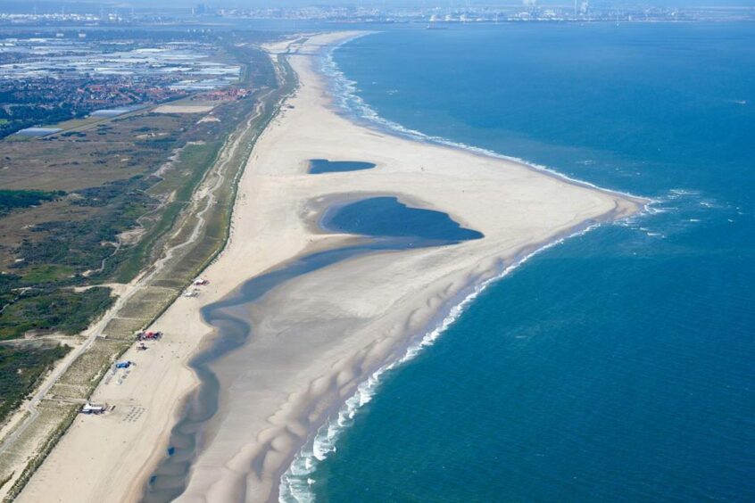
Over time, wind and tides will shift sands from the artificial peninsula towards the beach.
If this was done at Montrose, it would have the long term effect of feeding the dunes, making them grow and become more stable.
Sand is dredged and dumped, forming a hooked peninsula.
The Angus Council spokesperson indicated a sand engine was not out of the question.
She said the authority has not ruled out “mega nourishment of the beach and dune reshaping” by 2050.
“This approach has been used internationally and has been called a sand engine or sand motor, which is in effect transports a large deposit of sand placed near to the shore by natural wind, wave and tidal power.”
However, it is not the cheap option. And the price tag may prove prohibitive.
When the work was carried out at The Hague in 2011, the price tag was 70 million Euros, just short of £60m.
Credits
Words and interviews by Aileen Robertson
Visualisations by Chris Donnan
Graphics by Gemma Day
Scrollytelling by Emma Morrice, Joely Santa Cruz and Lesley-Anne Kelly
Drone photography by Steve Brown
SEO by Jamie Cameron
Special thanks to Dynamic Coast


Conversation