St Monans to Anstruther, Fife
I had planned to catch the sunrise from the Fife Coastal Path. Instead, having set off at 3.30am, I found myself driving along the warren of roads to St Monans in zero visibility.
By the time I had parked at the Auld Kirk, the grey had lifted but the muted early light had blurred the lines between sea and sky. The total silence suggested it had also smothered any hint of sound.
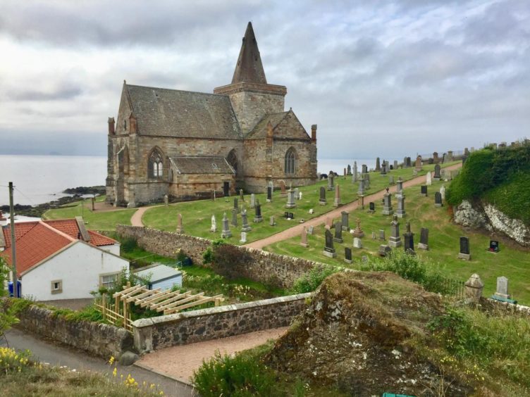
The stone church which has stood above the cliffs in one form or another since the 13th Century is said to be have been built nearer to the sea than any other in Scotland. It is also one of the most beautiful. Even on a day such as this, it seemed to radiate light from its commanding position above the village.
The Fife Coastal Path offers so many links and combinations for day walks: the option I had chosen was from St Monans through the neighbouring villages of Pittenweem and Anstruther then looping back west on the core path network through fields and woodland.
I moved through the deserted harbour and along the coast passing the windmill which was used to pump water to the nearby saltpans, a major industry around the Forth Basin in the 1700s and 1800s, then the long neglected open air pool.
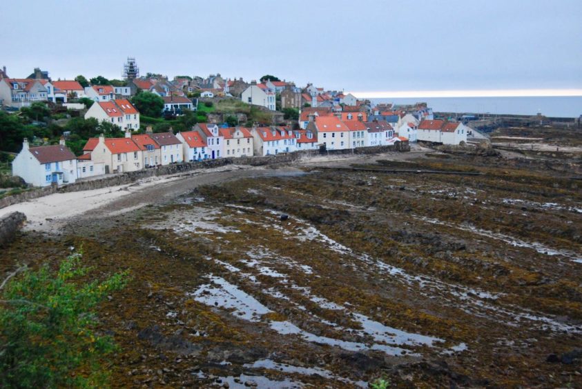
This section of path is suffering the effects of erosion and there were one or two polite diversions before the rise and fall into picture postcard Pittenweem. There were signs of the start of a working day at this harbour, and in tandem the seabirds had suddenly come alive.
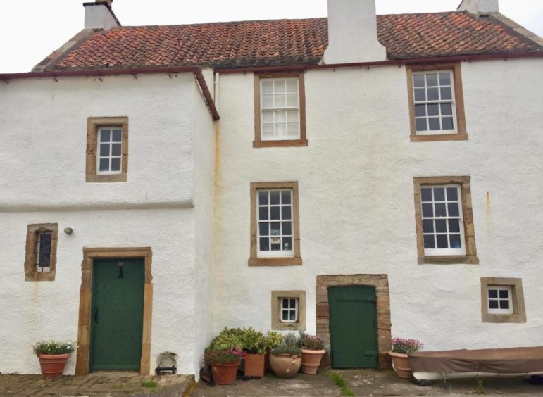
The path took a turn uphill to the right to leave Pittenweem, but before I did so I went to see Gyles House at the edge of the harbour, built in 1626 for Captain James Cook and which subsequently remained in his wife’s family for nearly 300 years.
The signs took me round a golf course and into the streets of Anstruther. I parted company with the coastal path at the main road, ignoring the turn to the harbour and instead heading across and up the residential Dreelside, now looking for the purple core path signs.
These led to some steps and an old stone bridge, which is crossed to follow a farm track into the Dreel Meadow Nature Reserve. The track took me past some cottages and over a burn before reaching a junction where a left turn led round Easter Grangemuir Farm.
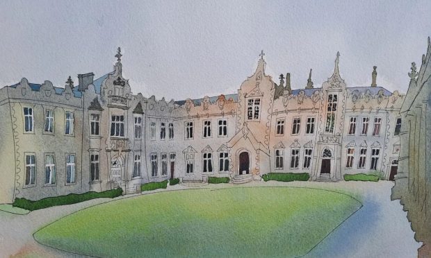
I emerged at the road for a short walk round to a track signed for Inch and followed it round to the impressive entrance gate to Balcaskie Estate. Just before reaching the main house, the track curved right, then right again before a left turn and another left into the woods just before a large beech hedge.
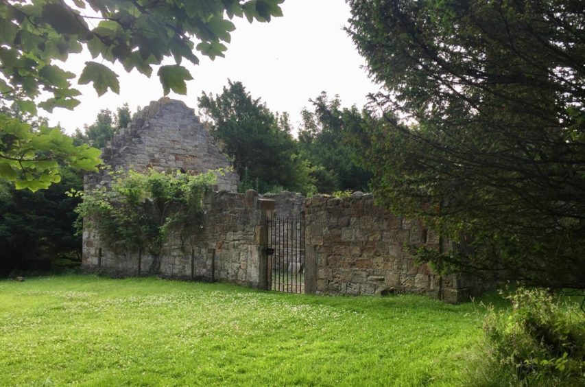
Tucked away amongst the trees is the roofless ruin of Abercrombie Church, once the parish church for the area and the burial ground of the Anstruther family.
A wooden gate led away from this tranquil spot, through a field and across the road into the quiet settlement of Abercrombie. St Monans was now just a short hop away along the pavements, along with the light and the sound that been missing when I had set out for that elusive sunrise.
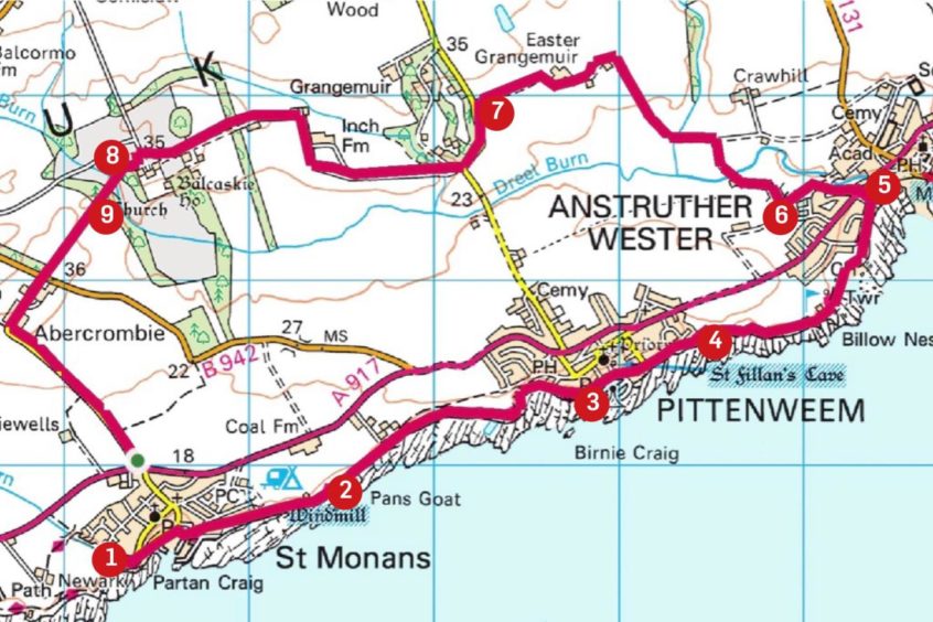
ROUTE
1. Follow sign for Fife Coastal Path downhill via lane and flight of steps to harbour, head east along front and narrow road to parking area, then path passing windmill on left and old pool on right.
2. After stretch of coastline walking, path rises to enter playpark above another old pool at Pittenweem, then takes sharp turn right down to West Shore.
3. Keep heading east along harbour and follow FCP signs uphill to left, leaving road by gap in wall on right to walk by fence behind houses.
4. Head right along edge of golf course, follow signs along Shore Road and Crichton Street.
5. Leave coastal path at main road, cross and head up Dreelside, curving right towards park, then take red ash path going north to old stone bridge.
6. Climb steps and turn right over bridge then follow farm track past houses and cross burn by wooden bridge. Stay on track until it reaches junction, turn left and follow it round past cottages to Easter Grangemuir Farm then out to main road.
7. Turn left on road for short distance to reach entrances to Balcaskie Estate, take track (signed Inch) to estate gates. Pass stable block and swing right before Balcaskie House. After passing front of house, swing right then take track left, and after crossing bridge turn left into woodland path just before beech hedge.
8. At next junction, turn right to Abercrombie Church and burial ground.
9. Go through wooden gate on field path to road, then cross and walk through Abercrombie and follow road back to St Monans.
INFORMATION
Distance: 12.5km/8 miles
Ascent: 110m/370ft
Time: 3-4 hours
Grading: Coastal and woodland paths, farm tracks and minor roads. Suitable for all ages. Can be muddy in places, good footwear recommended. Dogs under close control around farmland.
Start/finish: Car park beside St Monans Auld Kirk (Grid ref: NO 528014). There is also on-street parking and a couple of other small car parks in village.
Map: Ordnance Survey 1:50,000 Landranger Map 59 (St Andrews, Kirkcaldy & Glenrothes); Ordnance Survey 1:25,000 Explorer sheet 371.
Tourist Information: VisitScotland, St Andrews iCentre, 70 Market Street, St Andrews, KY16 9NU (Tel 01334 472021).
Public transport: Regular buses to St Monans and Anstruther on Leven-St Andrews route (No 96).
