An off-shoot of the Cleish Hills, Saline Hill lies to the south of the main ridge of heavily forested, craggy wee peaks. Paired with neighbouring Knock Hill, its grassy slopes are largely free of tree-cover, offering an exposed ascent with superb views from the summit.
The hill rises above the west Fife village of Saline, a community that can trace its roots back to the 13th century.
Crossing the road from the car park lying at the western end of Main Street, I wandered along North Street and Bridge Street, passing cottages dating from the 18th and 19th century when Saline was the centre of a thriving weaving industry.
Pausing briefly to explore an ancient churchyard, I continued along the road to the periphery of the village, branching right on a farm track at Tullohill Cottage.
The way climbs between fields, rising towards Killernie, a farm perched on the hillside overlooking Saline.
Where the track swings right towards the farm sheds, I left the potted tarmac and continued straight ahead through a gate, ascending the edges of fields where sheep grazed to join a track at the top of the pasture.
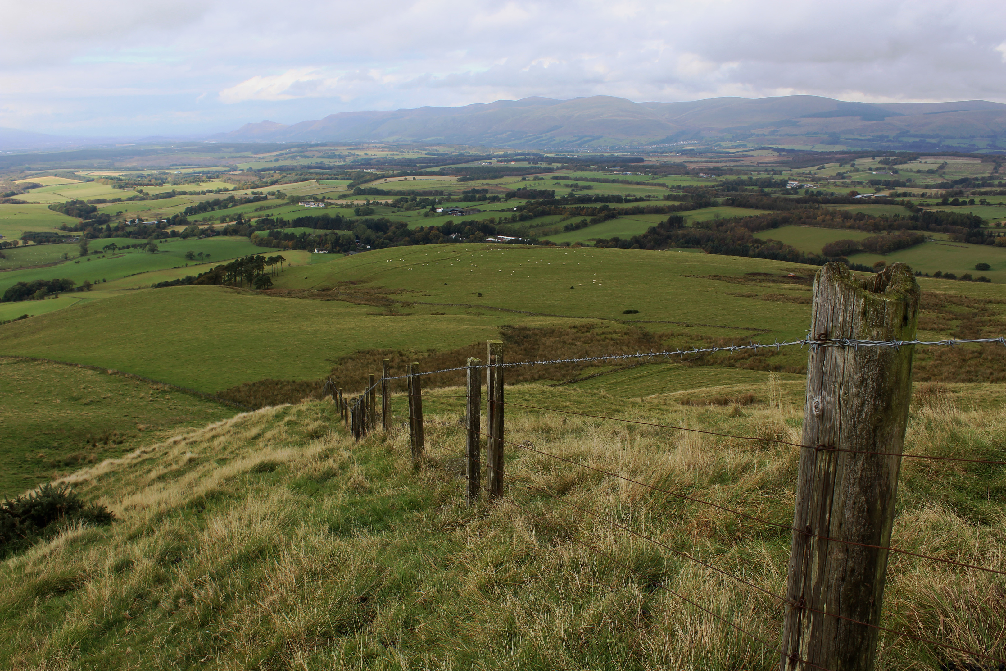
Enjoying a sunny autumn day, the view north towards the Ochil Hills immediately grabbed my attention, offering an excuse for a much needed rest before I pressed on up the rough track, negotiating thickets of gorse as I rose on to open hillside above.
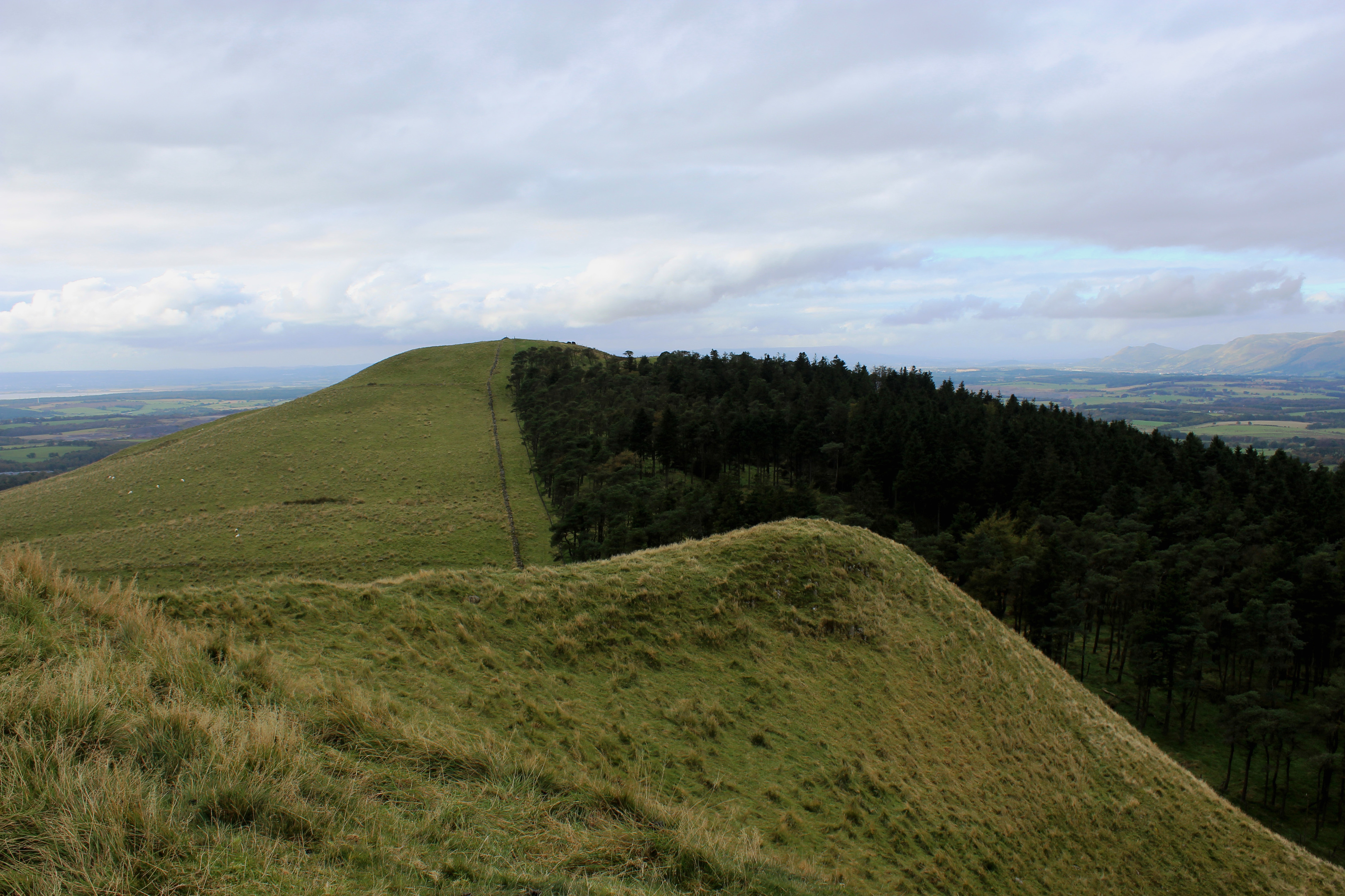
The way curves right, meeting up with a wall and fence, a handy navigational aid that stays true all the way to the summit. The grassy slope now steeper and the terrain underfoot coarse and lumpy, I zig-zagged up the western shoulder, keeping the boundary line close at hand.
With hard-fought height gained, the gradient eventually eased and I enjoyed an airy high level stroll along the ridge to a cairn and post marking the top of Saline Hill.
There are peaks aplenty to spot from here. The Ochils remain very much in focus while, closer to hand, the Cleish Hills can be seen to the north, and Knock Hill, bristling with communications masts and often echoing to the sound of motor racing, lies to the east. To the south, across the River Forth, the Pentlands are visible on a clear day.
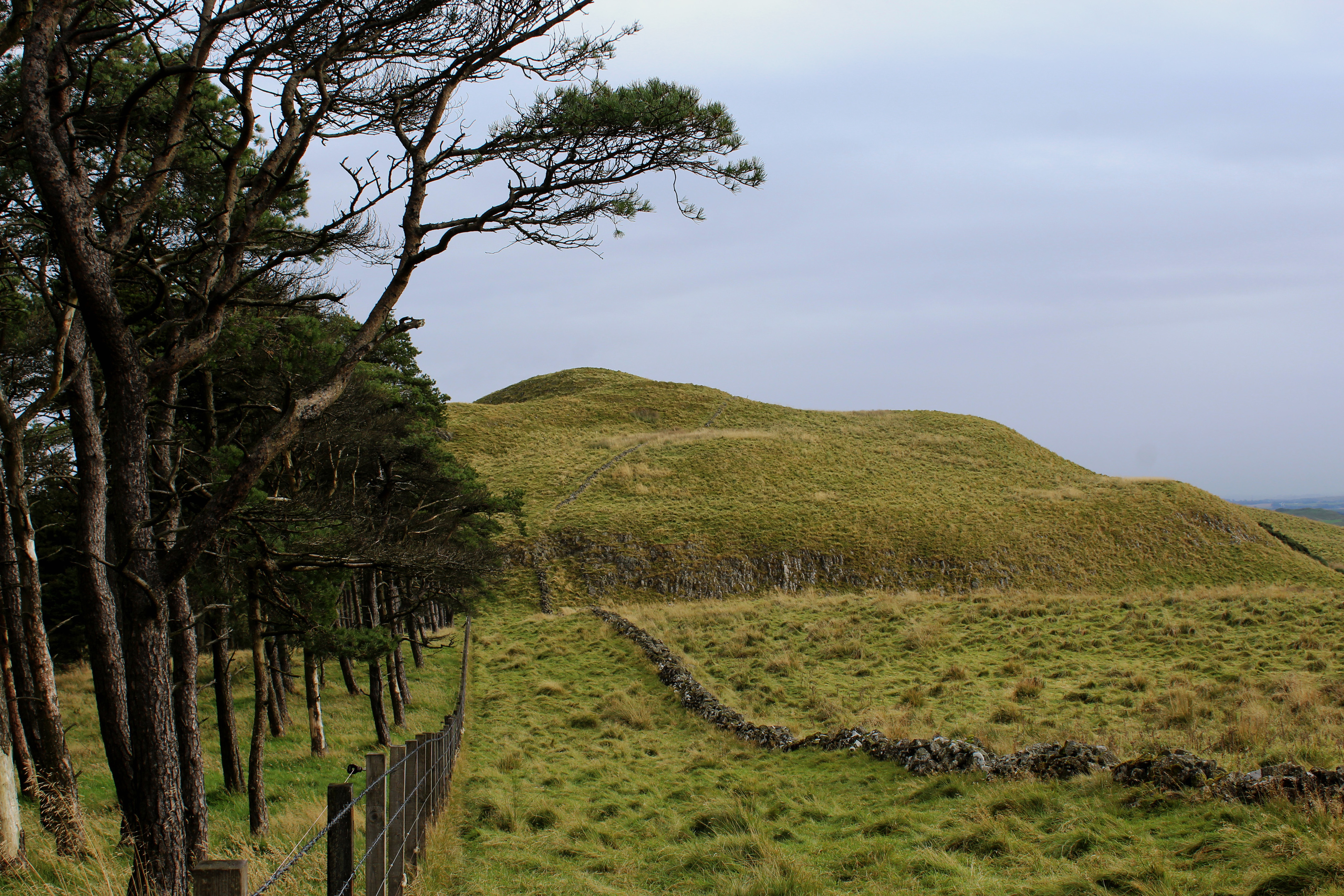
Below the top of Saline Hill, beyond a plantation of skinny pines, Easter Cairn is the site of an Iron Age fort, an easily attainable second summit demanding just a little easy scrambling.

From this ancient stronghold, I descended north, an initially steep grassy slope leading down to rough pasture and, below a small quarry, a field. If there are no crops growing here, cross to a set of metal gates on the northern perimeter of the field. If there are crops, circuit around the edge of the field to the same point.
Beyond the gates, a track loops down towards the steading at Sheardrum, passing through a succession of gates to a junction where the road home strikes south-west, rising between fields and passing a shed and, above it, the arched stone roof of a disused subterranean water tank.
A little further on, beyond a quarry, a rough, grassy path breaks left, the way contouring around the western flank of Saline Hill, skirting the upper boundary of fields, to meet the track back to Saline.
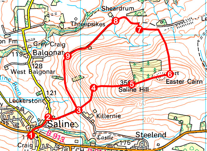
ROUTE
1. Cross Main Street (B913) and follow North Road to post box. Go right on Bridge Street to Tullohill Cottage, on edge of Saline.
2. Turn right and ascend track.
3. Where track swings right, continue ahead through gate and ascend field edge, passing through second gate. At top of pasture, bear left through gate and ascend rough track.
4. Bear right and ascend east by wall and fence to summit.
5. Descend east along edge of plantation and ascend Easter Cairn.
6. Descend north by wall/fence, passing through two gates to third gate below small quarry. Continue down across field to pair of gates on northern edge of field.
7. Beyond gates, go left on track, descending to junction by Sheardrum.
8. Continue straight ahead, following track south-west.
9. Go through second of two metal gates on left and follow field edge path south to point 3. Retrace steps to Saline.
INFORMATION
Distance: 7.2km/4½ miles
Ascent: 265m/875ft
Time: 2-3 hours
Grading: Moderate upland route with strenuous ascent early on. While there are tracks and paths for much of the way, parts of the route are pathless, the terrain rough in places. Keep dogs under close control due to livestock
Start/finish: Main Street car park, Saline (Grid ref: NT 022924)
Map: Ordnance Survey 1:50,000 Landranger sheet 58; Ordnance Survey 1:25,000 Explorer sheet 367
Tourist Information: Dunfermline Information Centre, 1 High Street, Dunfermline KY12 7DL (Tel 01383 720999)
Public transport: Stagecoach bus services 4 and 6 link Dunfermline with Saline


