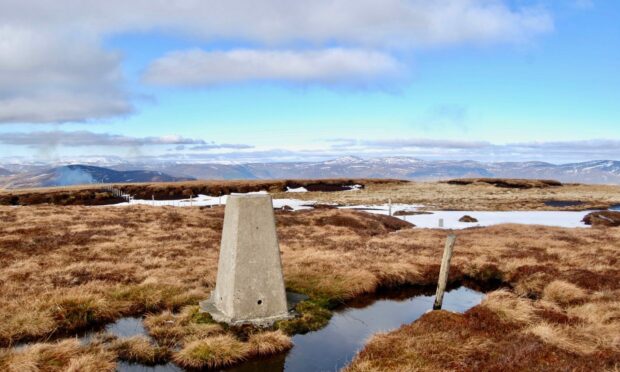
Hill of Wirren, Glen Lethnot, Angus
The white pillar marking the summit of Hill of Wirren is always a welcome sight for those walking the sprawling high ground which lies between Glen Lethnot and Glen Esk.
Indeed, on particularly wet days it can almost appear to be floating on the surface near the fence line, a buoy amongst a vast sea of heather and peat bog that signals relief to weary travellers.
Even on dry days, this a wet place. After all, this is the hill of springs, the name Wirren believed to have come from the Gaelic ‘fhuaran’. Old maps have shown it as Worren and Warren, but the spelling doesn’t matter – it’s all about the water.
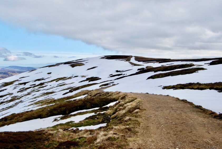
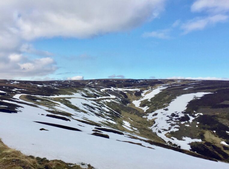
That’s why all my excursions here have been in the winter months, when the cloying black ground is frozen solid – or at least to a consistent crunch – or when it is buried under deep soft snow. The lack of tree cover is also less jarring on eye in winter, a network of tracks making for good progress across the fairly barren landscape.
On previous occasions I have started from higher up the glen, but this time I began from the parking area beside the primary school at Bridgend just a few miles north-west of Brechin.
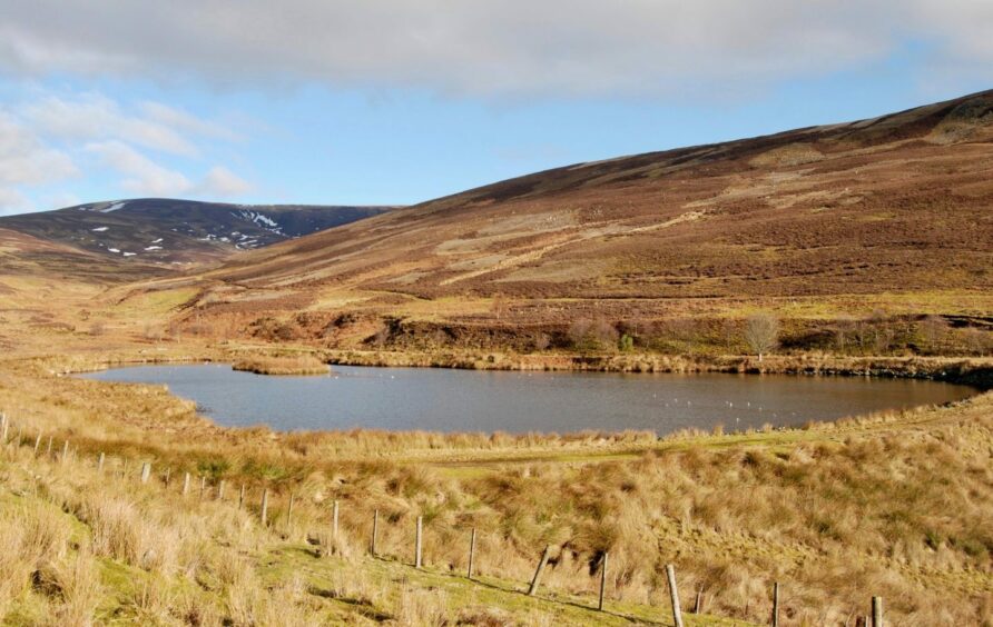
The snow cover had mostly retreated, the remaining patches on distant slopes sparkling under the direct sun. The track took me uphill past a couple of cottages then along the side of the small man-made lochan which was occupied with geese, ducks and gulls. The lapwings were also busy, their peewit calls filling the air, a fitting soundtrack to their aerobatics.
The temperature was contrary: warm during the steady push uphill on the track, cold during any stop to admire the view I had just left behind. Higher up, the white coats of hares were intermittent blurs in the heather as they darted for cover at the presence of an intruder.
I left the track and took a direct line – at least, as direct as is possible in these ground conditions – through the contrasting black and white of the quagmire, heading for the summit. The trig pillar soon came into view but there were still a few necessary twists and turns, and a few moves over and around fences, before I reached my goal.
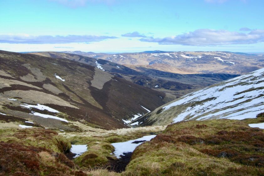
The flatness of the summit area reveals some surprising depth on the northern side towards Glen Esk. The highest point is tightly flanked by two other family members, West and East Wirren. The descent goes over East Wirren which is also marked with a trig pillar, somewhat unusual to see two on the same hill so close together. This summit is also a better, more expansive, viewpoint.
Like so many of Scotland’s high tops, there is a poignant backstory to these hills. Over the centuries, many suicides were buried on the slopes. As they were barred from consecrated ground in the lower glen, they had to be carried well away from their homes by families mindful of evil spirits. Their graves were often marked by a tall cairn.
These hills are also the site of wreckage from at least half-a-dozen World War II plane crashes – there was a training school at nearby Montrose airfield – including those of a Hawker Hurricane, a B24 Liberator and a Bristol Beaufort.
The track makes for an easy descent, finding its way down to a small hut near a junction. Those who have had enough can continue following the track downhill to the right where it will eventually meet with the incoming route.
However, for a little variety, it’s simple enough to make the short push up to the top of Craig Narg then descend on the track across its eastern flank before turning right for the final few steps back to the car.
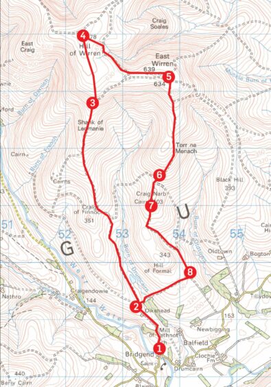
ROUTE
1. Follow track to left of school, passing cottage (Dykehead) to junction.
2. Turn right and quickly left on track heading uphill past lochan by Burn of Drumcairn and at track junction take left fork going across side of Craig of Finnoch and up the Shank of Ledmanie.
3. When track starts turning right, leave it and take easiest line directly over peat hags to trig pillar marking summit of Hill of Wirren.
4. Head south-east from summit to join track running east which climbs to subsidiary top of East Wirren where there is another trig pillar.
5. Drop south passing along shank of Torr na Menach to reach hut below Creag Narb.
6. You can descend from this point by continuing west and then south to rejoin inward track. Otherwise, continue south on track heading directly to cairned top of Craig Narb.
7. After next small rise, track drops below Hill of Formal to reach track junction.
8. Turn right on track which crosses Burn of Drumcairn then right again retracing steps past Dykehead to start.
INFORMATION
Distance: 14km/9miles
Ascent: 625m/2050ft
Time: 4-6 hours
Grading: High-level route for fit, experienced and well-equipped hillwalkers, sustained walking over featureless ground requiring good navigation skills in winter months when tracks and paths may be covered by snow and ice. Dogs under close control due to ground nesting birds and around farms.
Start/finish: Parking area beside Lethnot Primary School at Bridgend, Glen Lethnot (Grid ref: NO 536685).
Map: Ordnance Survey 1:50,000 Landranger Maps 44 (Ballater & Glen Clova); Ordnance Survey 1:25,000 Explorer sheet 54.
Tourist Information: VisitScotland, Dundee iCentre, V&A Dundee, 1 Riverside Esplanade, Dundee DD1 4EZ (Tel 01382 527527).
Public transport: None.
Tourist Information: VisitScotland, Ballater iCentre, Station Square, Ballater, AB35 5QB (Tel 01339 755306).