Each and every section of the 183-kilometre Fife Coastal Path has its charms but it’s difficult to see past the stretch between Crail and St Andrews for sheer rugged beauty.
Considering the proximity to the county’s fourth largest population centre and the popularity of the East Neuk as a holiday destination, it may come as surprise to find only a handful of other walkers along the way.
The rough and wild feeling on this stretch of coastline never fails to delight: from deserted sandy beaches and rocky inlets, outrageous rock formations and clifftop views, it all slots together beautifully, accompanied by a continuous chorus of birdsong.
This is also a walk that benefits greatly from public transport. The bus service from St Andrews to Leven provides a selection of jumping-off points for any of the villages along the coast meaning you can pick and choose a distance to fit your mood.
On this occasion, I decided the 23km Crail option was too much for my schedule and instead plumped for a start from Kingsbarns.
In the event, it proved to be more than fulfilling. A 20-minute ride saw me dropped in the village centre, with a short walk down to the shore where there is parking for those who prefer to arrive by car.
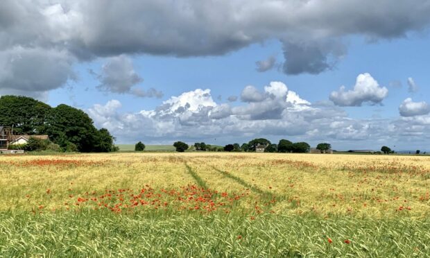
My first impression was that I had stepped into a Monet painting, poppies colouring golden fields of wheat, framed by shadowed trees, blue skies and towering cotton wool clouds.
The next thought was one of solitude, a dog walker the only person I met during the initial stroll along the path between the golf course and the rocky shore.

There was a profusion of butterflies and a constant darting of martins, while out on the rocks I spotted a few shags and a lone heron. Further on, the field edges were the domain of corn buntings.
When the path dropped to the sandy shore near Babett Ness, the lack of footprints apart from my own brought to mind a favourite childhood book, Robinson Crusoe, a literary creation with Fife roots.
The solitary theme continued as I passed an abandoned building long surrendered to nature on the way to Kenly Water. To avoid crossing the wide outflow, the path contoured inland, passing through a shaded wood and then twisting round a series of tracks and minor roads to return to the coastline.
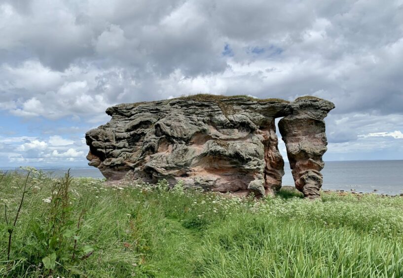
The path became rather overgrown as it headed towards the striking Buddo Rock, a huge sandstone presence that looks as if has melted over and over to form a series of swirls and complex shapes. It’s possible to squeeze up the passageway through the middle – I couldn’t resist.

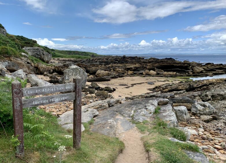
The route onwards grew more untamed with lots of ups and downs before I arrived at the tidal section.
A sign warns of the dangers of attempting to cross at high water, but I had timed it right and clambered over the rock step to head into the next bay where more treasures awaited, this time in the shape of the Rock and Spindle formation.
Beyond, the path climbed up on to cliffs and the route took on a more civilised feel as I descended back into St Andrews where the beach and the ice cream kiosks were going like a fair in the sunshine.
How to find the route
From bus stop in Kingsbarns, walk south along A917 and turn left at coastal path sign, heading down minor road to reach shore car park.
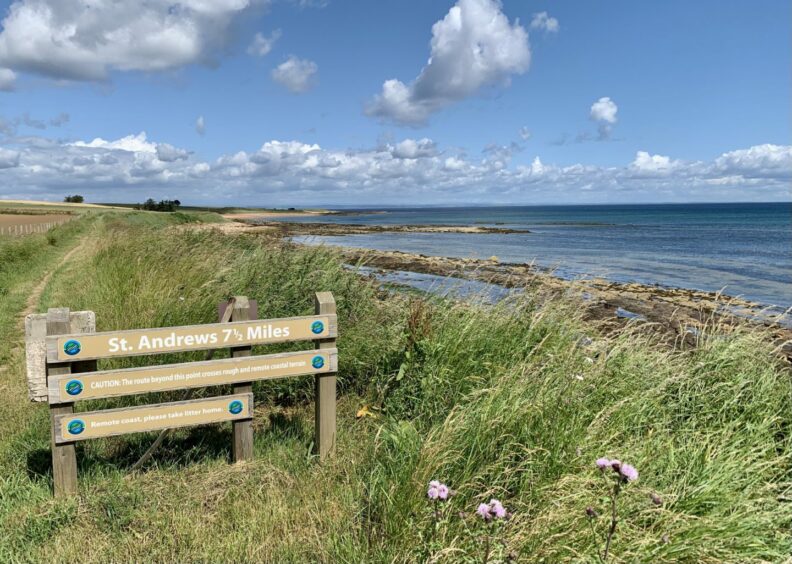
Turn left on path which passes picnic area and toilets and runs along edge of golf course then fields to reach signed junction. Keep straight on to cross stile past sign that reads: St Andrews 7.5 miles.
Ignore branch heading left to Kingsbarns and descend to sandy shore to pass headland of Babett Ness, then go inland again to pick up path. Cross sandy bay, pass ruined building and follow path signed for Boarhills.
When you reach Kenly Water, turn left into wooded glen and follow river up stream, crossing bridge and passing another ruin. Path eventually descends to bridge at bend in river – cross and follow lane on far side to reach road.
Turn left and head uphill, then take track straight ahead at left-hand bend to emerge near farm. Turn left, then right (signs, but easy to miss) to pass barns and turn right at next signed junction. Head left to climb stile and descend to shore.
After passing Buddo Rock, cross two stiles in succession then a stream before following section of path up and down cliff. Go through gap in wall, then right and right again where bridge leads through trees back to shore and tidal section (warning sign).
Scramble up marked rock with handrail where step has been cut. Pass the impressive Rock and Spindle formation and climb flight of stone steps to reach clifftop.
When path forks, keep left then bear right below campsite boundary and head down steps to follow path round caravan park and continue into St Andrews.
More information
Distance: 13.5km/8.5miles (from Crail 23km/14.5mls)
Ascent: 140m/460ft
Time: 4-5 hours (from Crail add 2.5 hours)
Grading: Well-signed linear walk along one of the wilder stretches of the Fife Coastal Path. Some short steep ascents and rocky steps, muddy in places, but generally suitable for all fitness levels. Check tide times – one section can be impassible at high water.
Start/finish: Kingsbarns village bus stop (Grid ref: NO 594121). Car park further down at seafront (charges).
Map: Ordnance Survey 1:50,000 Landranger Map 59 (St Andrews); Ordnance Survey 1:25,000 Explorer sheet 371.
Tourist Information: VisitScotland, St Andrews iCentre, 70 Market Street, St Andrews, KY16 9NU (Tel 01334 472021).
Public transport: Regular bus service between St Andrews and Leven (No 95).