The Kingdom of Fife is still home to many old buildings and landmarks that help tell its fascinating story to tourists and locals alike – but several of these features are now at risk of demolition.
Scotland’s Buildings of Risk register lists several landmarks across Fife that are set to be demolished due to their damaged or derelict state.
Kirkcaldy has been particularly affected, with distinctive features of the Lang Toun’s landscape taking up most of the list.
We’ve opened up our archives to find images of these buildings and share some of the Kingdom’s rich history.
1 – Sailor’s Walk Steps, Kirkcaldy
The curved, sandstone Sailor’s Walk staircase was built in the early 20th century.
The staircase leads from Sailor’s Walk in Ravenscraig Park, to the South West pier of Dysart Harbour.
Local legend has it that the 39 steps inspired Kirkcaldy-born John Buchan’s 1915 book of the same name.
While the true reason behind the title’s origin are unknown, The Thirty-Nine Steps is widely recognised as the first great spy thriller of the 20th Century.
The steps have inspired a series of local artworks.
In the early 2000s, City Design created its Dysart Artworks project.
Several engraved stones were installed along the cliff face by the steps, including three from Fife-based poet & writer Thomas A Clark.
Curious stone name plate at Ravenscraig Park steps that lead to Dysart – I presume there
is a back story? pic.twitter.com/GKAzzmLNwC— Allan Crow (@FifeFreePressEd) July 8, 2020
However, despite these ongoing efforts to keep the steps an active part of the town, continued exposure to the sea water meant that they eventually became unusable.
The steps were closed to the public in 2012 after an inspection marked them unsafe to the public.
Loose mortar and masonry continued to crumble in subsequent years, and the steps were listed as high risk on the register in 2018 due to their treacherous condition.
Metal fencing was erected to block entry and signs were added to warn of the dangers.
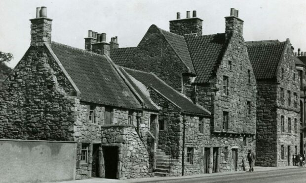
2 – Sailor’s Walk, Kirkcaldy
The Sailor’s Walk houses on Kirkcaldy High Street were first inspected for the register in 2010.
The four-storey building is thought to be the oldest building in Kirkcaldy; a house was first recorded on the site in 1460.
Sailor’s Walk possibly originated as two dwellings of wealthy merchants or shipowners.
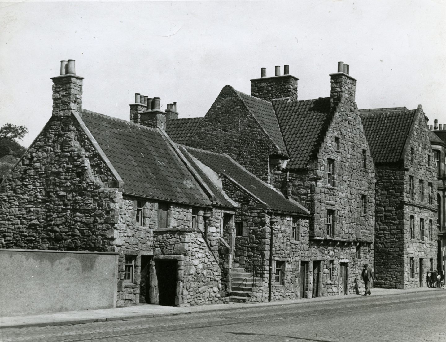
The building was first earmarked for demolition in the late 1940s, but was taken over by the National Trust for Scotland and restored in the 1950s.
It was converted into office space in the 1970s, and remained thus until a fire was started in 1994.
The fire resulted in severe charring and discoloration of the painted ceiling.

The building was successfully renovated and the bottom floors were used as office space until 2010.
Further inspections in subsequent years found that the property had been abandoned.
Posing a minimal risk to the public, the council hope tenants for the building’s bottom floor office space will be found once again.
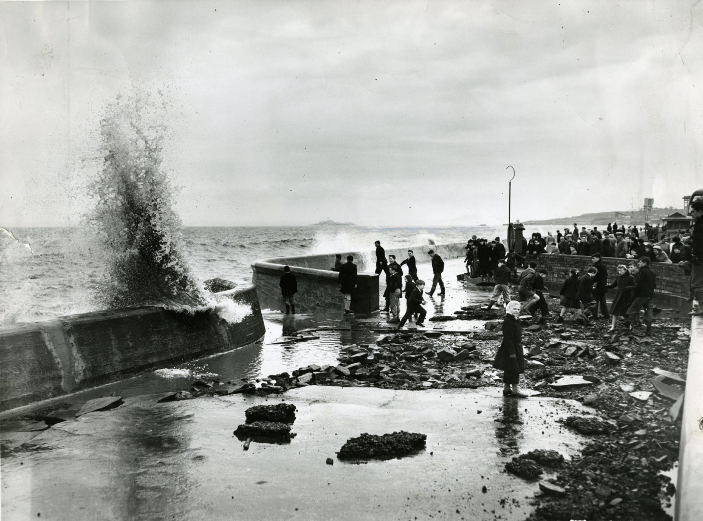
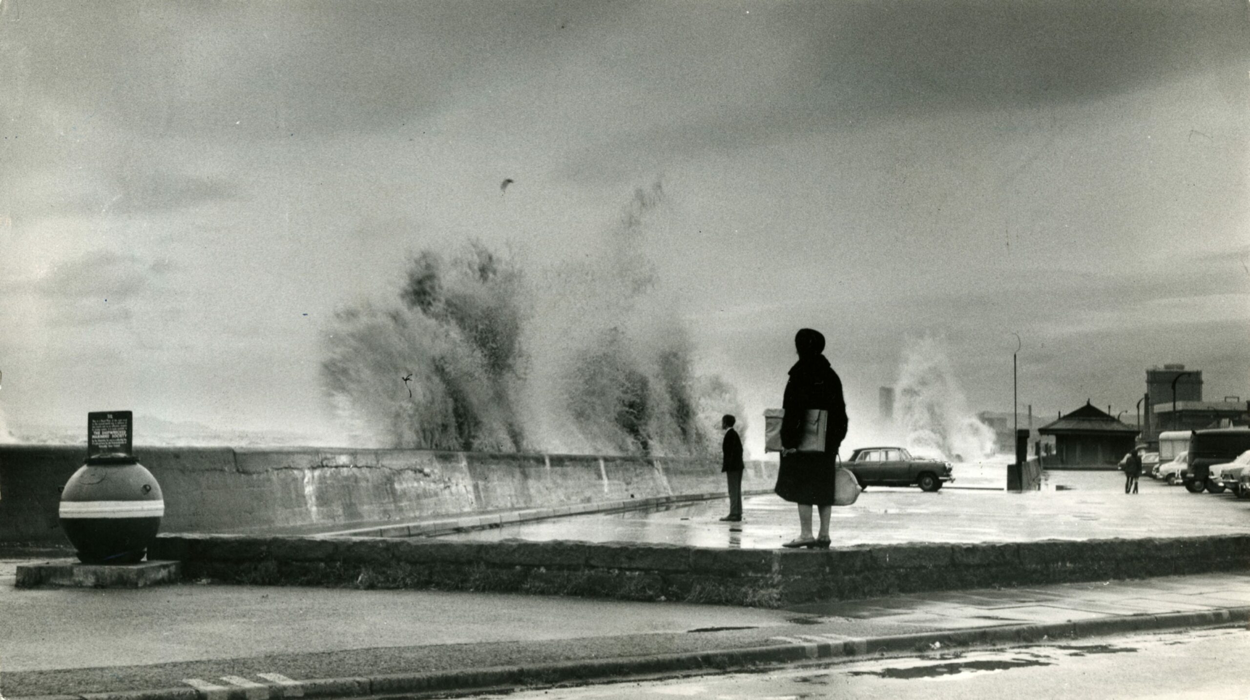
3 – Kirkcaldy Pier
The East and South Piers at Kirkcaldy have both been placed on the At Risk register.
The South Pier was built in the 17th century.
A railway connection was brought to the harbour in 1849, similar to the one at Perth Harbour.
Major planned improvements to extend the pier were drawn up Dundee civil engineer James Leslie.
From this new pier, the workers were able to more successfully complete their duties which brought a significant amount of income to the town.
Its exports included linoleum, paper, malt, grain and textiles.
During the First World War, the harbour and all its piers were taken over by the American Navy.
Kirkcaldy Harbour finally closed in 1929 and was abandoned.
The South Pier was first inspected for the register in the early 2000s.
It was found derelict and disused.
Things were not looking good for the old pier until 2011, when the Courier reported it would be welcoming cargo ships for the first time in 20 years.
The Scottish Government had funded a partnership between Forth Ports & Hutchison‘s Flour as part of a commitment to encourage the transfer of haulage off roads.
The government donated £829,000 to the project.
Construction work would begin to install new silos & conveyors to enable the fast delivery of wheat, and dredging work would also begin in the spring.
The harbour officially re-opened in October 2011 and operated until the mid 2000s.
An inspection in 2014 found that the harbour had been abandoned again.
In 2018, the harbour was badly damaged by extremely stormy weather.
It was never repaired.
4 – Doctor’s Row, Kirkcaldy
Doctor’s Row in Kirkcaldy is a short terrace of seven two-storey houses.
The exact date of their construction is not known, but Historic Environment Scotland believe it could be either the 18th or the 19th century.
Several of the houses in the row are on the register.

An external inspection in 2001 found that the whole of Doctor’s Row was vacant and disused except for number four, which was occupied and not at risk.
The vacant houses on the row continued to deteriorate throughout the 2000s and in 2010 were flagged as high risk.
The buildings are now recorded as being of moderate risk to the public, but their condition remains poor.
5 – 170 High Street, Leslie
The outbuildings at Leslie High Street date back to the 18th Century.
The single-storey harled cottage on the site had sash and case windows.
The building was first added to the register in 2007, and its first inspection found severe flooding and water damage.
It was urgently recommended that the building be made wind and water tight to prevent any further deterioration.
C LISTED, Leslie, Fife. Outbuilding of particular interest, good survival of URBAN VERNACULAR. The land originally belonged to the Bingartree House estate, and the outbuilding served as 3 dwellings. On the Buildings at Risk Register https://t.co/W8ghblGEmG pic.twitter.com/0xrMczrDGM
— Scottish Vernacular Buildings Working Group (@SVBWG) March 29, 2019
However a further visit in November 2010 found no change to its condition.
The property continued to deteriorate and in 2018 a final inspection found that the building had missing and broken panels, and increased damp.
No plans have been made to renovate the buildings.
6 – West Gate, Leslie House
The former entrance to Leslie House was placed on the At Risk register in the early 2000s when the tower was found to be unsecured and unmaintained.
The semicircular arched carriage entrance is now above a pedestrian walkway.
The tower stands next to the archway.

The gates first showed signs of damage in 2007.
In 2009, a member of public reported to the council that a number of roof tiles on the tower were missing or damaged.
While Leslie House has now been renovated, the gate remains abandoned.
7 – Leslie House
Fife’s own Leslie House was on the register until 2018.
Sir Norman Leslie first acquired the lands in 1282, renaming it after his family lands in Aberdeenshire.
The family would later become Earls of Rothes in 1457.
Earliest evidence of a house on the site is dated around 1667.
John, 7th Earl and only Duke of Rothes, built a house that was said to have been similar to Holyrood Palace.
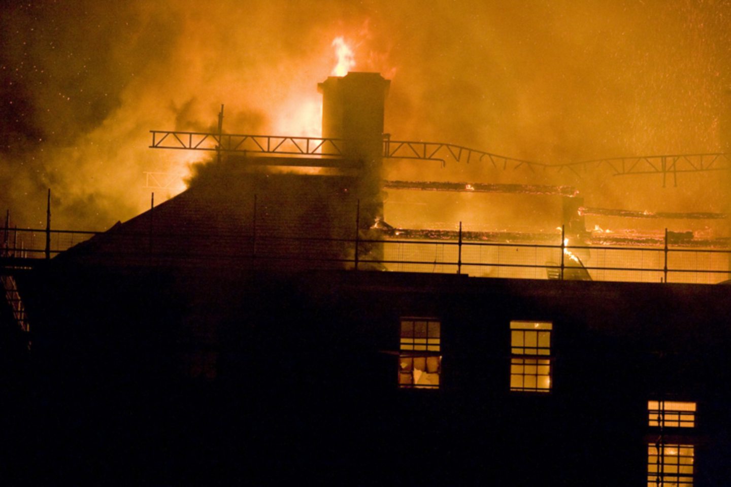
However, the property was destroyed by fire on December 28 1763.
It was a premonition for the building’s future.
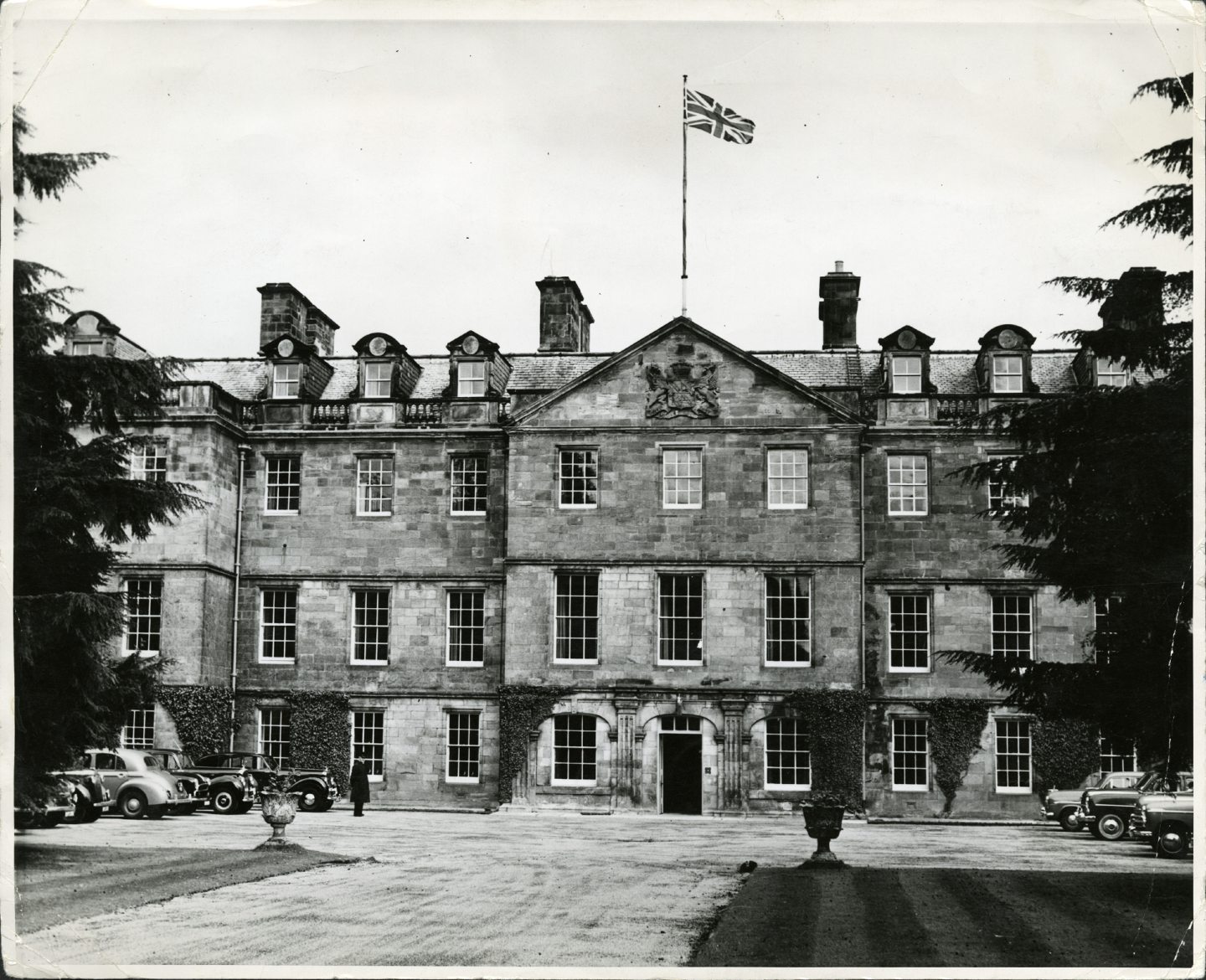
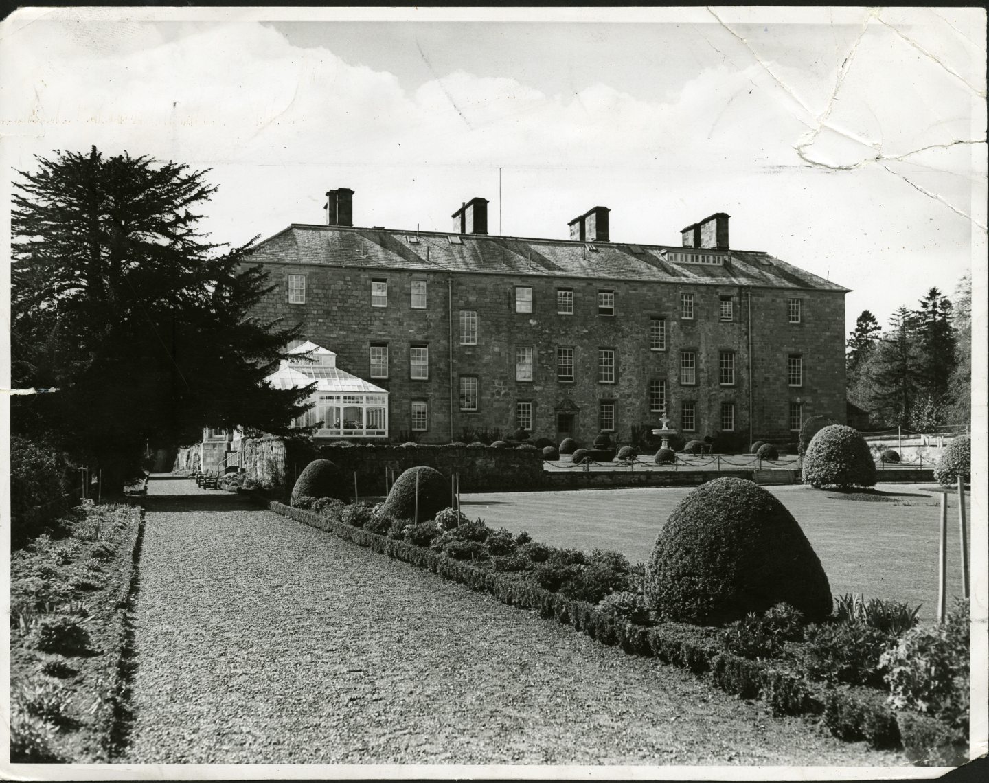
The three-storey classical house was rebuilt in 1919 and then converted into the house it is today in 1945.
Architect James Gillespie Graham drew up plans to add cavetto cornices and architraved windows to the property, along with several other modern design features of the time.
In 2005, Sundial Properties purchased the building and planned to convert it into 17 luxury flats.
12 detached homes would also be built within the grounds.
However, in 2008 an inspection from Historic Environment Scotland found that the property had been abandoned.
In 2009, an extreme fire caused significant damage to the building.
It was placed on the At Risk register shortly afterwards.
While many believed the old house would now be demolished, Byzantian Developments purchased the building from Sundial in 2017.
The company lodged new plans to restore the building and re-develop it into flats.
Fife Council approved the plans in 2018, and work began on the 28 flats in 2021.
The building was removed from the register.
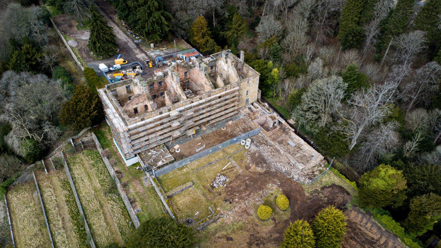
The restoration project at Leslie House gives us hope that perhaps some of Fife’s other at risk buildings can also be saved.


Conversation