New images have revealed plans for an “active freeway” that would link Dundee city centre to Lochee on some of the city’s busiest roads.
The freeway aims to provide people with a corridor for active travel such as cycling and walking.
It would see changes to busy thoroughfares including Lochee Road and Coupar Angus Road – running between Liff Road, near Lochee, and Bell Street in the city centre.
A total of six active freeways are planned across Dundee.
What is an active freeway?
According to Dundee City Council, an active freeway is designed to make walking, wheeling and cycling “more attractive for everyday journeys”.
They are designed to segregate normal traffic from those walking, cycling or using other travel methods such as wheelchairs, mobility scooters and pushchairs.
Active freeways also aim to give priority to active travel at junctions.
Dundee City Council’s concept images show how the new active freeway could look.
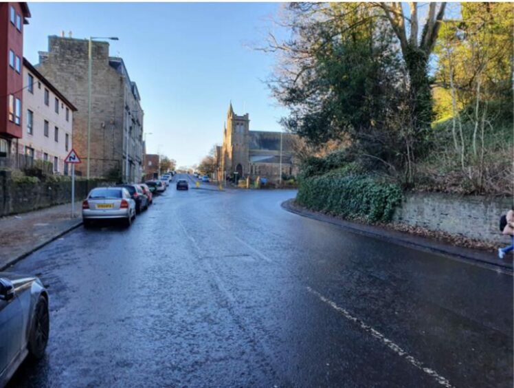
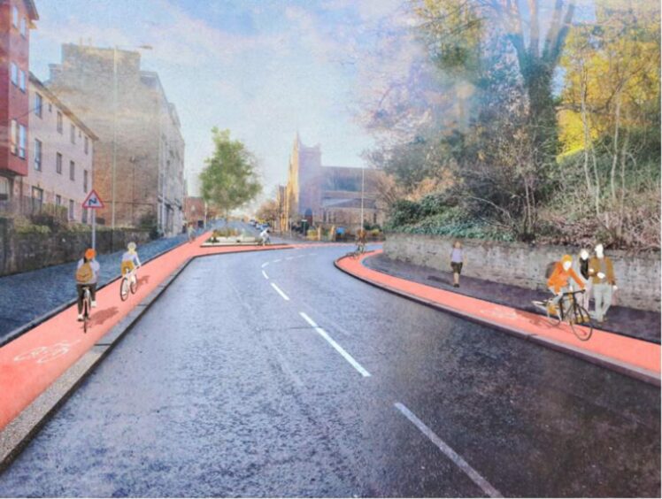
Lochee Road near Dudhope Park
Cycle lanes would be set up on either side of Lochee Road.
It would mean the existing road being narrower, however the proposals state the council may need to buy some land where the road is thinner to make room for the freeway.
BEFORE
AFTER

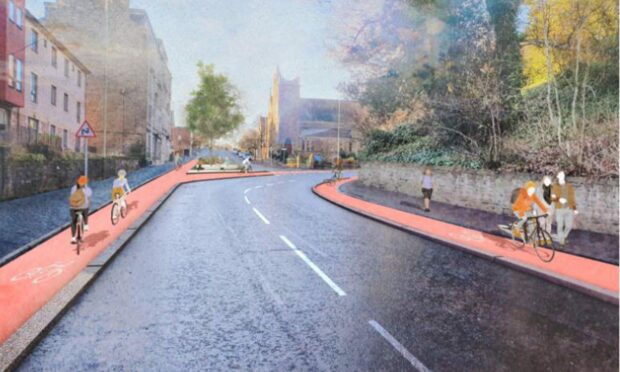
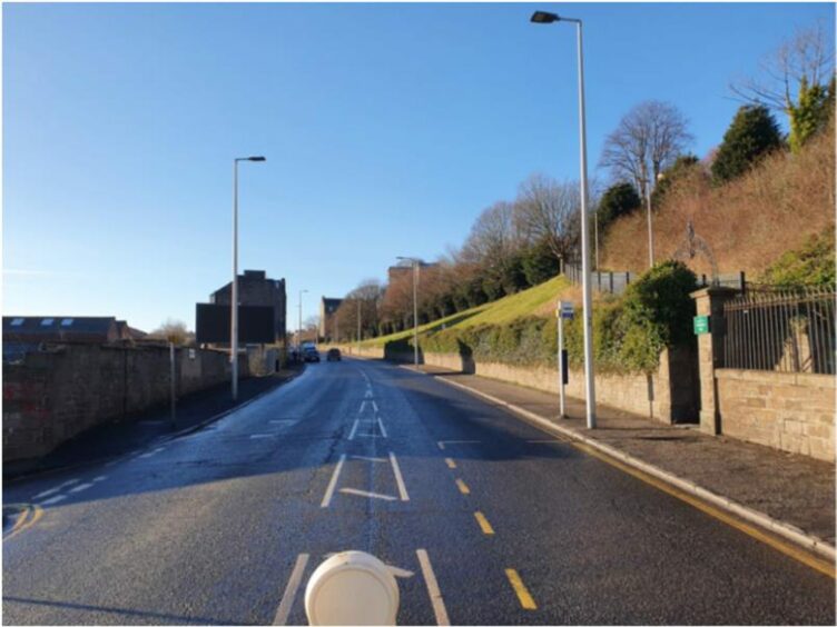
Lochee Road near Tullideph Road
A set of images shows how the scheme would look further up Lochee Road, near the junction with Tullideph Road.
Again, the road would be narrowed to make room for cycle lanes.
BEFORE
AFTER
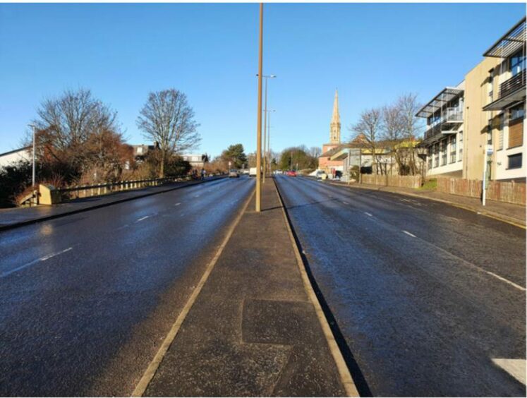
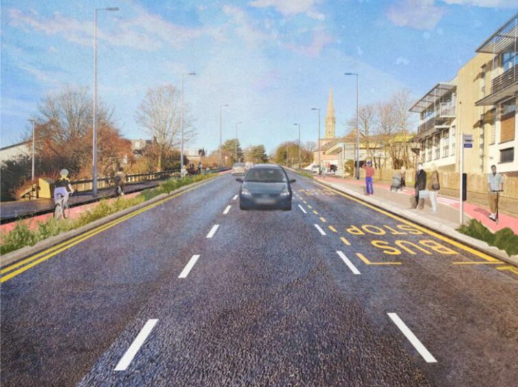
Coupar Angus Road
The existing four-lane dual carriageway on Coupar Angus Road would be reduced to three lanes for normal traffic.
Cycle lanes would be introduced on both sides of the road with the central reservation removed.
BEFORE
AFTER
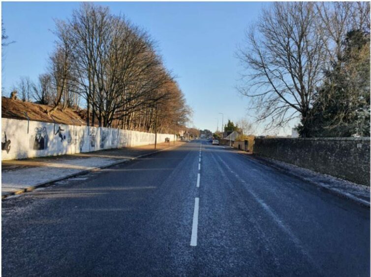
Liff Road
The final stretch on Liff Road – connecting the route to the Kingsway – would be classed as a “quiet street” where cars and bikes would share the same carriageway.
However, existing footpaths would be widened to create space for walkers and new seating areas would be added.
BEFORE
AFTER

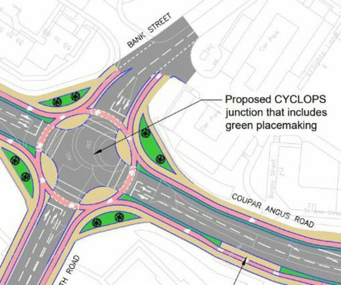
There would also be changes to junctions along the route.
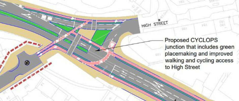
The council has released details of proposed cyclops (cycle optimised protected signals) junctions to allow for cyclists to pass safely.
One would be at the Coupar Angus Road/South Road/Bank Street roundabout:
The other cyclops junction would be at the Coupar Angus Road/Liff Road/Lochee High Street junction.
Dundee City Council is consulting on the active freeway until March 19.
Anyone wishing to contribute to the consultation can visit the scheme’s website and fill out the feedback survey.
-
What do you make of the proposals? Have your say in the comments below


Conversation