Calendar An icon of a desk calendar. Cancel An icon of a circle with a diagonal line across. Caret An icon of a block arrow pointing to the right. Email An icon of a paper envelope. Facebook An icon of the Facebook "f" mark. Google An icon of the Google "G" mark. Linked In An icon of the Linked In "in" mark. Logout An icon representing logout. Profile An icon that resembles human head and shoulders. Telephone An icon of a traditional telephone receiver. Tick An icon of a tick mark. Is Public An icon of a human eye and eyelashes. Is Not Public An icon of a human eye and eyelashes with a diagonal line through it. Pause Icon A two-lined pause icon for stopping interactions. Quote Mark A opening quote mark. Quote Mark A closing quote mark. Arrow An icon of an arrow. Folder An icon of a paper folder. Breaking An icon of an exclamation mark on a circular background. Camera An icon of a digital camera. Caret An icon of a caret arrow. Clock An icon of a clock face. Close An icon of the an X shape. Close Icon An icon used to represent where to interact to collapse or dismiss a component Comment An icon of a speech bubble. Comments An icon of a speech bubble, denoting user comments. Comments An icon of a speech bubble, denoting user comments. Ellipsis An icon of 3 horizontal dots. Envelope An icon of a paper envelope. Facebook An icon of a facebook f logo. Camera An icon of a digital camera. Home An icon of a house. Instagram An icon of the Instagram logo. LinkedIn An icon of the LinkedIn logo. Magnifying Glass An icon of a magnifying glass. Search Icon A magnifying glass icon that is used to represent the function of searching. Menu An icon of 3 horizontal lines. Hamburger Menu Icon An icon used to represent a collapsed menu. Next An icon of an arrow pointing to the right. Notice An explanation mark centred inside a circle. Previous An icon of an arrow pointing to the left. Rating An icon of a star. Tag An icon of a tag. Twitter An icon of the Twitter logo. Video Camera An icon of a video camera shape. Speech Bubble Icon A icon displaying a speech bubble WhatsApp An icon of the WhatsApp logo. Information An icon of an information logo. Plus A mathematical 'plus' symbol. Duration An icon indicating Time. Success Tick An icon of a green tick. Success Tick Timeout An icon of a greyed out success tick. Loading Spinner An icon of a loading spinner. Facebook Messenger An icon of the facebook messenger app logo. Facebook An icon of a facebook f logo. Facebook Messenger An icon of the Twitter app logo. LinkedIn An icon of the LinkedIn logo. WhatsApp Messenger An icon of the Whatsapp messenger app logo. Email An icon of an mail envelope. Copy link A decentered black square over a white square.

Forfar homes could flood once every two years, says study

A flash flood hit Forfar town centre in September.

Almost 200 Forfar homes are at risk of regular serious flooding – some as often as once every two years.

Engineers working on flood control measures in Forfar presented the findings of a study to the public on Tuesday in the Angus town’s Meffan Museum.

They presented a map showing surface water at a depth of a few centimetres running down from the hills and surrounding the town, before pooling in “hotspots” where there is a serious risk of flooding at potential depths of up to one and a half metres.

They called for houses in the danger areas to be fitted with waterproof doors, among other protection measures.

Mark McMillan, senior engineer with JBA consulting – commissioned by Angus Council to carry out the work – said: “The appraisal study has identified that some properties are at risk and could be flooded once every two years.”
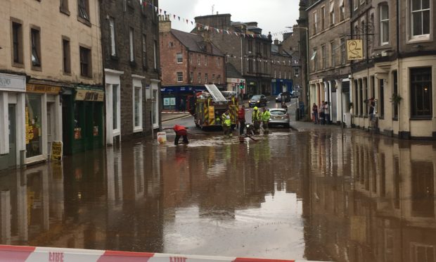
There was an example of flooding at the start of August. Water came off the hills, down the vennel and into the high street.”

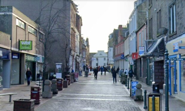
The risk was greatest in certain parts of the town, he added. South Street, East High Street, Academy Street, Queenswell Rd and Myre Rd were all included in the danger areas marked out on the project’s map.

Forfar currently does not have a flood protection scheme.

He said they were recommending “property level protection” measures on up to 192 houses to keep flood waters at bay, including waterproof doors.

“We looked at the cost of various options up against the damage they would prevent against. This led us to recommend property level protection be installed at the areas most likely to be affected.”

The team also suggested the construction of flood water basins at certain locations across the town. These are built under green space, such as football pitches, and collect floodwaters before slowly letting them drain away.

Flood basins at Lour Rd, Craig O’ Loch Rd, Arbroath Rd, Reid Park Rd and St James Rd were considered as part of the study.

“These came out more expensive that we thought but, if there is public support for those options, then we can look at these again,” he said.

The results of the public consultation exercise will be incorporated into the report, which is due to be delivered to the council early in November.

Georgia Kirtsi-Mathieson, Angus Council design engineer, said: “These are the options that have been identified, but more work will then need to be carried out on the final design that is chosen.”