Calendar An icon of a desk calendar. Cancel An icon of a circle with a diagonal line across. Caret An icon of a block arrow pointing to the right. Email An icon of a paper envelope. Facebook An icon of the Facebook "f" mark. Google An icon of the Google "G" mark. Linked In An icon of the Linked In "in" mark. Logout An icon representing logout. Profile An icon that resembles human head and shoulders. Telephone An icon of a traditional telephone receiver. Tick An icon of a tick mark. Is Public An icon of a human eye and eyelashes. Is Not Public An icon of a human eye and eyelashes with a diagonal line through it. Pause Icon A two-lined pause icon for stopping interactions. Quote Mark A opening quote mark. Quote Mark A closing quote mark. Arrow An icon of an arrow. Folder An icon of a paper folder. Breaking An icon of an exclamation mark on a circular background. Camera An icon of a digital camera. Caret An icon of a caret arrow. Clock An icon of a clock face. Close An icon of the an X shape. Close Icon An icon used to represent where to interact to collapse or dismiss a component Comment An icon of a speech bubble. Comments An icon of a speech bubble, denoting user comments. Comments An icon of a speech bubble, denoting user comments. Ellipsis An icon of 3 horizontal dots. Envelope An icon of a paper envelope. Facebook An icon of a facebook f logo. Camera An icon of a digital camera. Home An icon of a house. Instagram An icon of the Instagram logo. LinkedIn An icon of the LinkedIn logo. Magnifying Glass An icon of a magnifying glass. Search Icon A magnifying glass icon that is used to represent the function of searching. Menu An icon of 3 horizontal lines. Hamburger Menu Icon An icon used to represent a collapsed menu. Next An icon of an arrow pointing to the right. Notice An explanation mark centred inside a circle. Previous An icon of an arrow pointing to the left. Rating An icon of a star. Tag An icon of a tag. Twitter An icon of the Twitter logo. Video Camera An icon of a video camera shape. Speech Bubble Icon A icon displaying a speech bubble WhatsApp An icon of the WhatsApp logo. Information An icon of an information logo. Plus A mathematical 'plus' symbol. Duration An icon indicating Time. Success Tick An icon of a green tick. Success Tick Timeout An icon of a greyed out success tick. Loading Spinner An icon of a loading spinner. Facebook Messenger An icon of the facebook messenger app logo. Facebook An icon of a facebook f logo. Facebook Messenger An icon of the Twitter app logo. LinkedIn An icon of the LinkedIn logo. WhatsApp Messenger An icon of the Whatsapp messenger app logo. Email An icon of an mail envelope. Copy link A decentered black square over a white square.

Cross Tay Link Road signs set to change as Scone residents report MORE lorries than before

Perth and Kinross Council's deputy leader admitted signs around the new Cross Tay Link Road and Destiny Bridge 'could be better'.

Drone image of Destiny Bridge across River Tay
The Cross Tay Link Road and Destiny Bridge were built to divert traffic from Scone and Perth. Image: Kim Cessford / DC Thomson

Transport chiefs say they are looking to change road signs around Perth’s £150m Cross Tay Link Road.

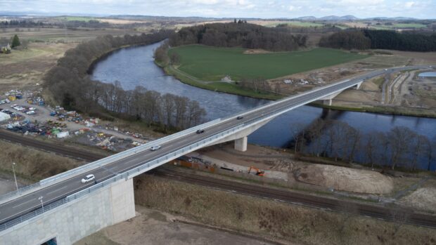
The 6km bypass and Destiny Bridge were built to take traffic away from Scone, Bridgend and Perth city centre.

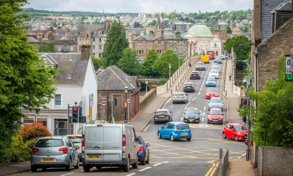
But Scone residents have complained they’re seeing more heavy lorries using their streets since it opened in March.

The council’s deputy leader is suggesting that could be down to road signs directing central belt traffic through the city.

And now the senior officer on the project has admitted it may need to alter signs on local and trunk roads.

Heavy traffic from West Bridge Street in Perth with city skyline in distance
The Cross Tay Link Road was built to reduce traffic around Scone, Bridgend and Perth city centre. Image: Steve MacDougall/DC Thomson

Cross Tay Link Road signs ‘could be better’

The alarm was raised at a Perth and Kinross Council meeting on Wednesday.

Strathmore councillor Colin Stewart asked what steps were being taken to monitor the Cross Tay Link Road‘s impact.

He said locals had expressed disappointment at a Scone Community Council session earlier in the week.

“Given there were reports of more heavy traffic coming through the village since the opening of the Cross Tay Link Road, I wondered whether we had any indication of the flow and volume of traffic,” asked Mr Stewart.

The council’s deputy leader Eric Drysdale said he had already raised concerns with officers.

Perth Councillor Eric Drysdale in suit and tie wearing yellow SNP rosette.
Councillor Eric Drysdale. Image: Steve MacDougall/DC Thomson

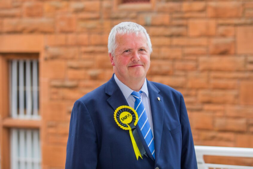
“The road signage could be better frankly,” he said.

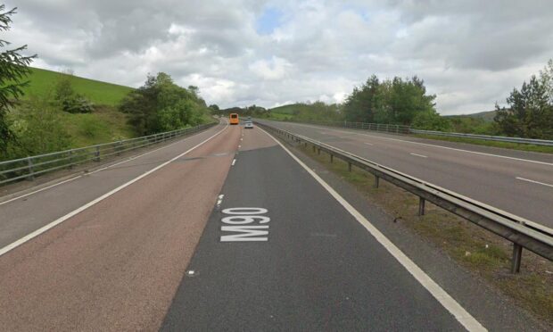
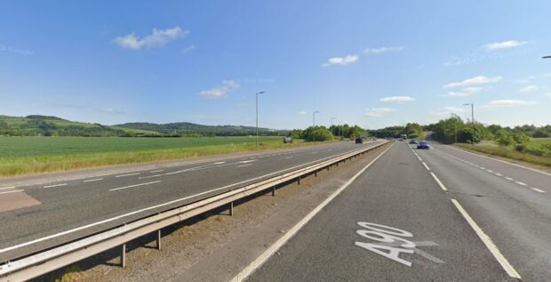
“Coming from Aberdeen and Forfar, when you approach Perth it’s suggested you use the Cross Tay Link Road if you’re heading towards Perth or Inverness.

“What’s missing is Edinburgh and Glasgow.”

Mr Drysdale added: “I think it needs to be made a lot clearer that if you’re heading through – not stopping in Perth but heading to the central belt – then the Cross Tay Link Road is for you.”

Council working to fix any Cross Tay Link Road signs issues

Fraser Crofts, the council’s Strategic Lead for Environment and Infrastructure, said  traffic levels were being monitored at various locations.

This is likely to continue into the autumn.

Drone image of Cross Tay Link Road stretching through Perthshire countryside
The New Kingsway section of the Cross Tay Link Road, north of Perth. Image: Cross Tay Link Road Project

But speaking later, Roads Infrastructure Manager Jillian Ferguson told The Courier the council is acting now on the road signs issue.

“We are working with the council’s traffic team to determine locations where there may be a need to alter the existing traffic signs on the local road network,” she said.

“Where necessary these will be amended to ensure drivers are provided with consistent information.

“The council is also liaising with Transport Scotland regarding existing signs on the trunk road network.”

Road opening is milestone for Perth and Kinross

The £150 million Cross Tay Link Road and Destiny Bridge were officially opened by First Minister John Swinney on March 31.

Procession walking across Destiny Bridge on opening day for Cross Tay Link Road
John Swinney and dignitaries led locals across Destiny Bridge to officially open the Cross Tay Link Road. Image: Kim Cessford/DC Thomson

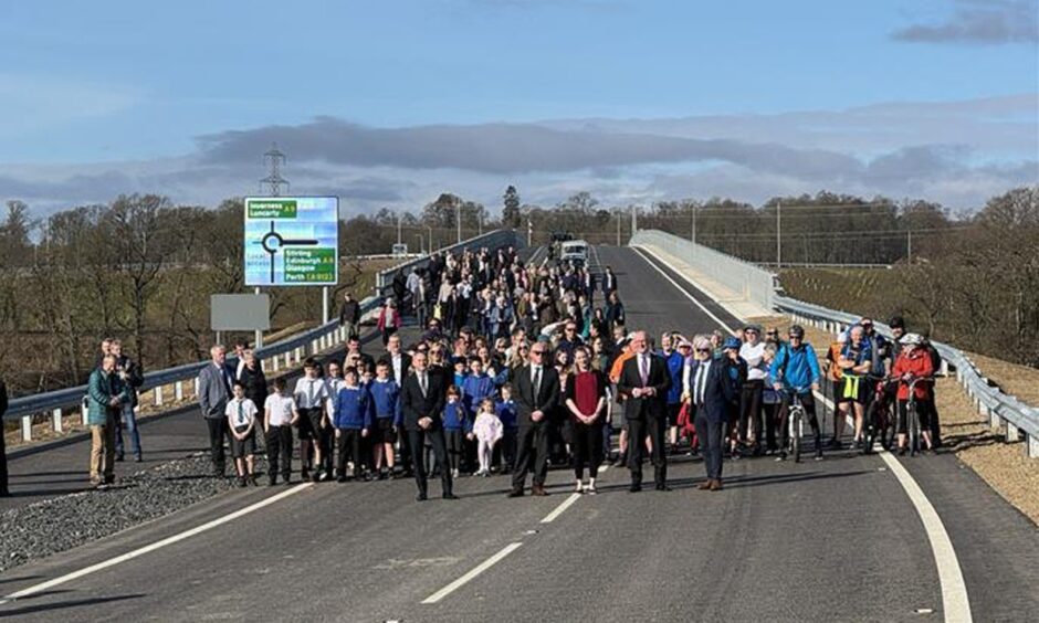
The 6km route connects the A9 Perth to Inverness road with the A93 (Blairgowrie) and A94 (Coupar Angus) roads north of Scone.

It is the biggest infrastructure project ever carried out in Perth and Kinross.

It was designed to reduce traffic and improve air quality in Perth, as well as speeding up journey times.

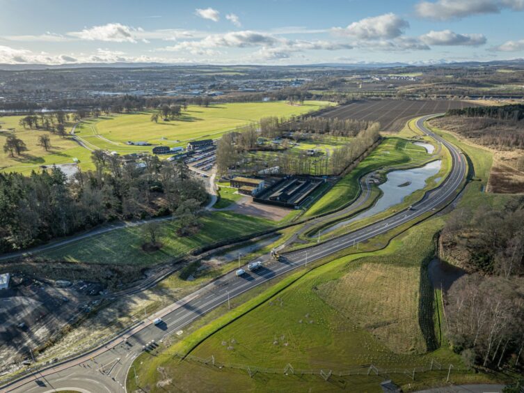
Work has now begun on the next stage in the Perth Transport Futures Project.

The £9m Bertha Park Link Road is intended to ease pressure on the Inveralmond roundabout.

Conversation