Calendar An icon of a desk calendar. Cancel An icon of a circle with a diagonal line across. Caret An icon of a block arrow pointing to the right. Email An icon of a paper envelope. Facebook An icon of the Facebook "f" mark. Google An icon of the Google "G" mark. Linked In An icon of the Linked In "in" mark. Logout An icon representing logout. Profile An icon that resembles human head and shoulders. Telephone An icon of a traditional telephone receiver. Tick An icon of a tick mark. Is Public An icon of a human eye and eyelashes. Is Not Public An icon of a human eye and eyelashes with a diagonal line through it. Pause Icon A two-lined pause icon for stopping interactions. Quote Mark A opening quote mark. Quote Mark A closing quote mark. Arrow An icon of an arrow. Folder An icon of a paper folder. Breaking An icon of an exclamation mark on a circular background. Camera An icon of a digital camera. Caret An icon of a caret arrow. Clock An icon of a clock face. Close An icon of the an X shape. Close Icon An icon used to represent where to interact to collapse or dismiss a component Comment An icon of a speech bubble. Comments An icon of a speech bubble, denoting user comments. Comments An icon of a speech bubble, denoting user comments. Ellipsis An icon of 3 horizontal dots. Envelope An icon of a paper envelope. Facebook An icon of a facebook f logo. Camera An icon of a digital camera. Home An icon of a house. Instagram An icon of the Instagram logo. LinkedIn An icon of the LinkedIn logo. Magnifying Glass An icon of a magnifying glass. Search Icon A magnifying glass icon that is used to represent the function of searching. Menu An icon of 3 horizontal lines. Hamburger Menu Icon An icon used to represent a collapsed menu. Next An icon of an arrow pointing to the right. Notice An explanation mark centred inside a circle. Previous An icon of an arrow pointing to the left. Rating An icon of a star. Tag An icon of a tag. Twitter An icon of the Twitter logo. Video Camera An icon of a video camera shape. Speech Bubble Icon A icon displaying a speech bubble WhatsApp An icon of the WhatsApp logo. Information An icon of an information logo. Plus A mathematical 'plus' symbol. Duration An icon indicating Time. Success Tick An icon of a green tick. Success Tick Timeout An icon of a greyed out success tick. Loading Spinner An icon of a loading spinner. Facebook Messenger An icon of the facebook messenger app logo. Facebook An icon of a facebook f logo. Facebook Messenger An icon of the Twitter app logo. LinkedIn An icon of the LinkedIn logo. WhatsApp Messenger An icon of the Whatsapp messenger app logo. Email An icon of an mail envelope. Copy link A decentered black square over a white square.

Revealed: How Dundee’s Low Emission Zone could look in 14 images

A series of artist's impressions by The Courier shows what Dundee's new clean air zone could look like once enforcement starts in May next year.

How signs showing the LEZ in Dock Street, beside Malmaison could look.
Dock Street, beside Malmaison. Image: Steve MacDougall/Michael McCosh/DC Thomson.

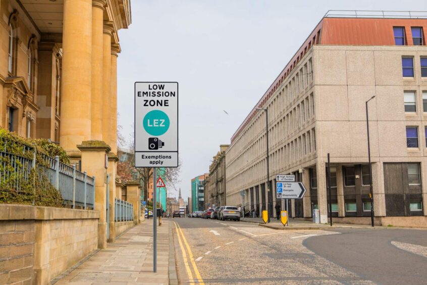
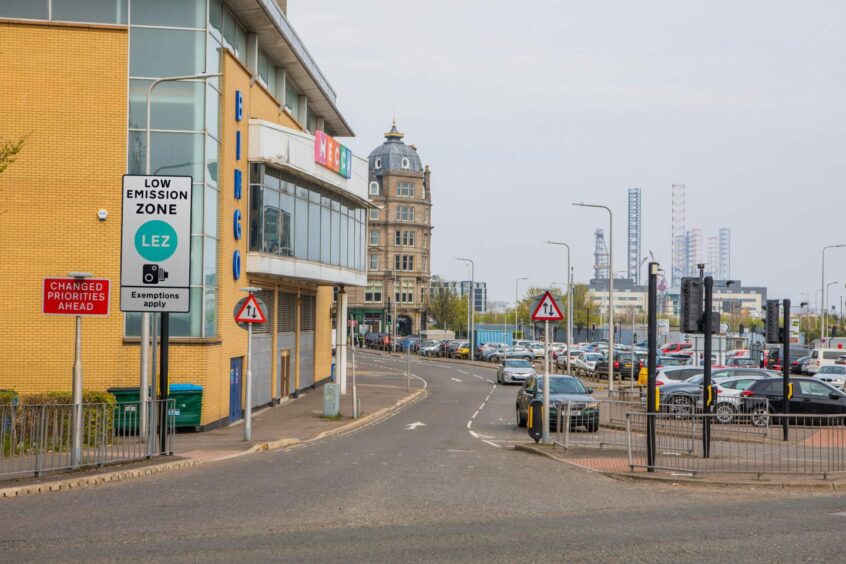
Enforcement of the Dundee Low Emission Zone (LEZ) will start in little more than a year’s time, but do you know where its boundaries start?

The city’s LEZ officially commenced May 2022, but enforcement isn’t due to begin until May 30 2024.

So far, no signs have been erected and no cameras are in place, despite there being just over 12 months until people in high-pollution vehicles can expect to start being fined.

In fact, there is nothing on the streets yet to indicate where the LEZ is in Dundee.

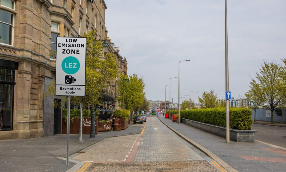
So to help you get ready, we’ve created 14 artist’s impressions of what the LEZ could actually look like once signage starts appearing in Dundee to show its boundaries.

Click the green dots on this map to see what Dundee could look like with Low Emission Zone signs in place

Scroll down for analysis on each area of the map to see which roads are in the Dundee Low Emission Zone…

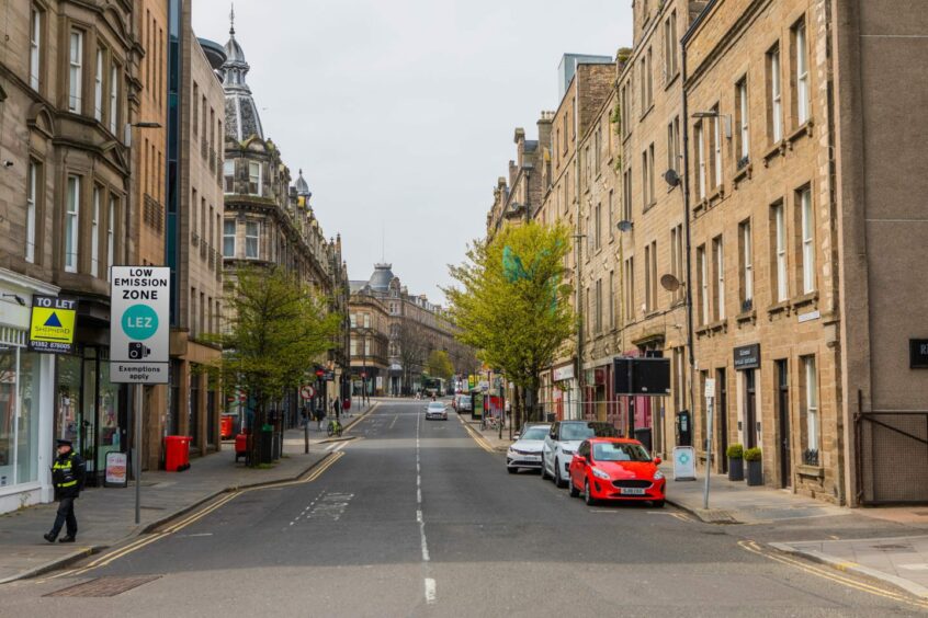
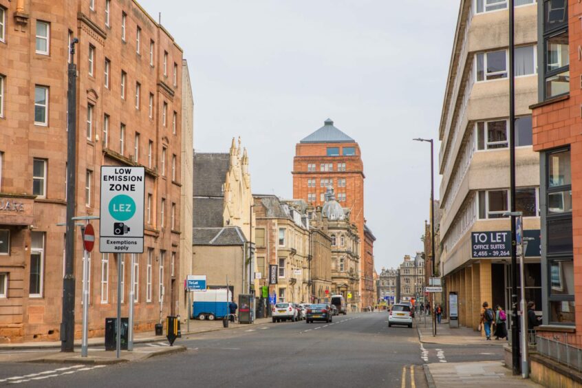
1. Commercial Street

What the Dundee Low Emission Zone could look like. A view of Commercial Street with a sign that reads "Low Emission Zone LEZ Exemptions apply".
Commercial Street after you turn in from Dock Street. Image: Steve MacDougall/Michael McCosh/DC Thomson.

Air pollution can cause diseases and exhaust fumes are a huge contributor to this. The LEZs (Low Emission Zones) have been called an “important tool” to keep people healthy.

A consultation in 2020 revealed that Dundonians were “largely in favour” of LEZs.

One of the streets on the boundary of the LEZ is Commercial Street. Drivers with banned vehicles won’t be able to use Commercial Street without being fined, come May next year.

2. Gellatly Street

A view of Gellatly Street with a sign advertising the LEZ.
Gellatly Street, after you turn left off of Dock Street. Image: Steve MacDougall/Michael McCosh/DC Thomson.

Once the enforcement begins next May, drivers in banned motors won’t be able to drive up Gellatly Street either.

That means they won’t be able to access the Gellatly Street Car Park from either the Dock Street or the Seagate side.
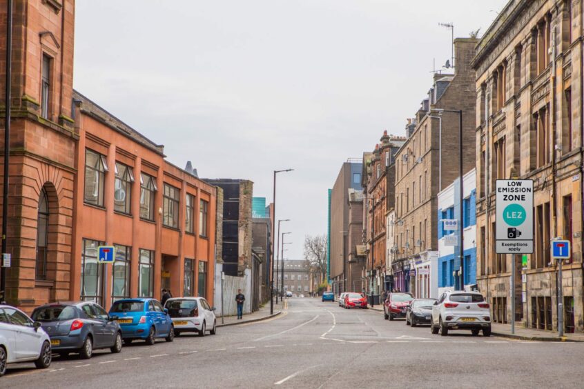
3. Trades Lane

What the Dundee Low Emission Zone could look like. A view of Trades Lane with a sign that reads "Low Emission Zone LEZ Exemptions apply".
Trades Lane, off of South Marketgait. Image: Steve MacDougall/Michael McCosh/DC Thomson.

Trades Lane, a partially one way stretch which links Dock Street and the Stagecoach Dundee bus station, is also included within the LEZ.

St Andrews Street is also in the zone.
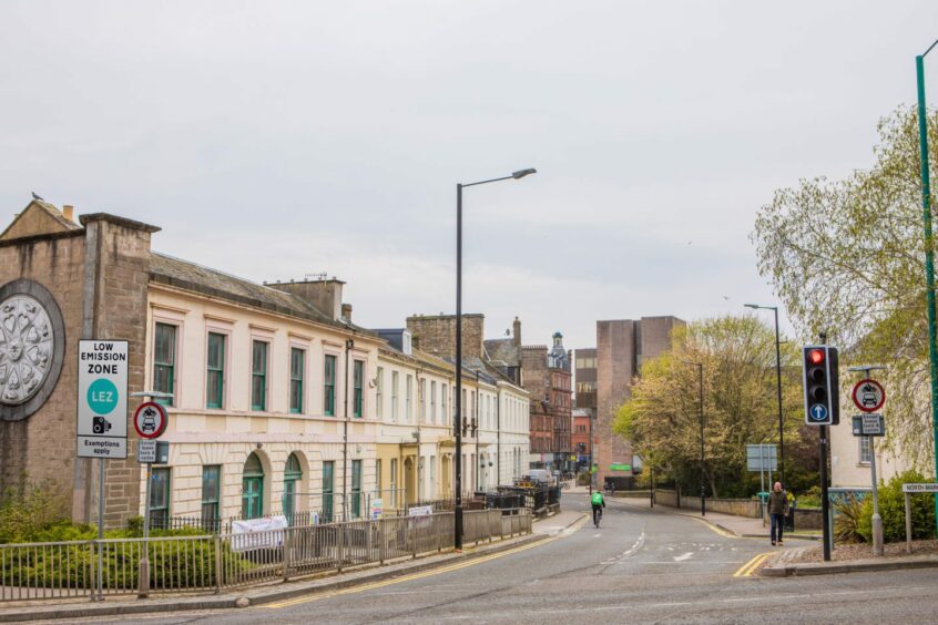
4. Seagate

What the Dundee Low Emission Zone could look like. A view of Seagate with a sign that reads "Low Emission Zone LEZ Exemptions apply".
Seagate, if you turn off from the East Port Roundabout. Image: Steve MacDougall/Michael McCosh/DC Thomson.

Seagate is within the zone, between Commercial Street and East Marketgait.

The stretch was named one of the most polluted in Scotland in 2020, coming in at number three, while Lochee Road was number five.

Lochee Road, one of the busiest routes through the city, is not included in the zone, much to the frustration of clean air campaigners.
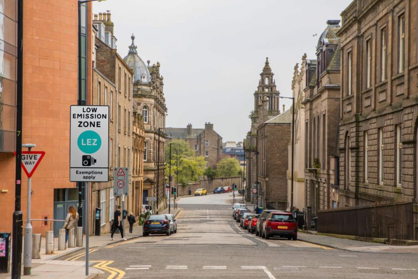
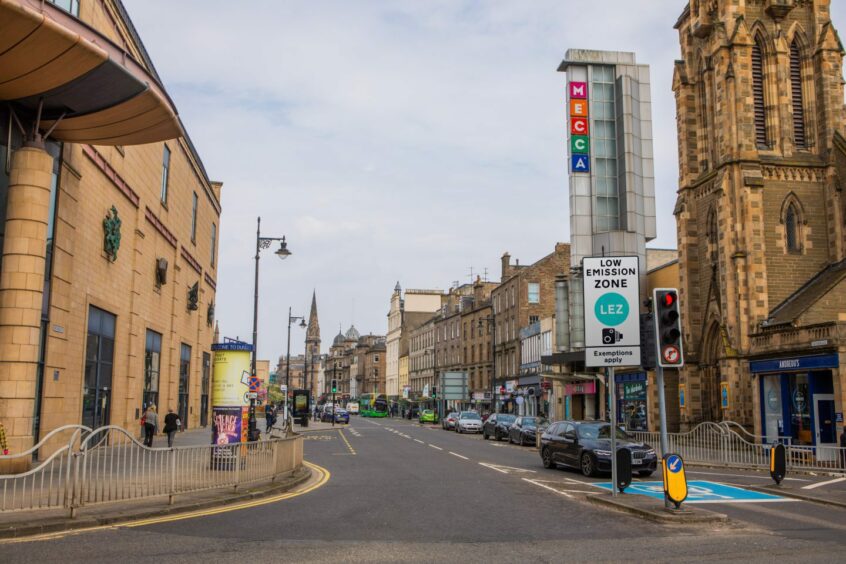
5. King Street

What the Dundee Low Emission Zone could look like. A view of King Street with a sign that reads "Low Emission Zone LEZ Exemptions apply".
King Street, if you turn off the A991. Image: Steve MacDougall/Michael McCosh/DC Thomson.

Banned vehicles will be fined for driving on King Street when enforcement begins in May 2024.

This is the stretch between St. Andrew’s Street and North Marketgait.

6. Bell Street

What the Dundee Low Emission Zone could look like. A view of Bell Street with a sign that reads "Low Emission Zone LEZ Exemptions apply".
Bell Street at the junction from Victoria Road. Image: Steve MacDougall/Michael McCosh/DC Thomson.

Bell Street will be closed to the banned drivers between Victoria Road and Constitution Road.

7. Constitution Road

What the Dundee Low Emission Zone could look like. A view of Constitution Road with a sign that reads "Low Emission Zone LEZ Exemptions apply".
Constitution Road, beside Abertay University. Image: Steve MacDougall/Michael McCosh/DC Thomson.

The entirety of Constitution Road falls in the LEZ (Low Emission Zone).

Drivers in the banned motors will face charges when enforcement begins next May.

8. West Bell Street

What the Dundee Low Emission Zone could look like. A view of West Bell Street with a sign that reads "Low Emission Zone LEZ Exemptions apply".
The view of West Bell Street if you’re coming from Marketgait/A991.  Image: Steve MacDougall/Michael McCosh/DC Thomson.

West Bell Street falls within Dundee’s LEZ. This passes the Dundee Sheriff Court and Justice of the Peace Court and links Marketgait to Constitution Road.

When enforcement begins in on May 30, drivers using highly-polluting vehicles will be charged for using this street.

9. Ward Road

What the Dundee Low Emission Zone could look like. A view of Ward Road Street with a sign that reads "Low Emission Zone LEZ Exemptions apply".
Ward Road is in the LEZ, but it is one way between Marketgait and Court House Square. Here is the view of a sign on the corner of Court House Square where you would access the stretch from the LEZ boundary. Image: Steve MacDougall/Michael McCosh/DC Thomson.

Ward Road is another on the boundary of the LEZ, and drivers using the stretch will be fined for using banned motors.

10. S Ward Road

How South Ward Road could look once the LEZ is in place.
South Ward Road, if you turn off from Marketgait/A991. Image: Steve MacDougall/Michael McCosh/DC Thomson.

South Ward Road, opposite the Travelodge on Marketgait, is also within the LEZ.

Drivers with banned cars won’t be able to access the NCP car park on North Lindsey street this way without facing fines.

11. Argyllgait

What the Dundee Low Emission Zone could look like. A view of Argyllgait with a sign that reads "Low Emission Zone LEZ Exemptions apply".
Approaching Argyllgait from the West Port roundabout. Image: Steve MacDougall/Michael McCosh/DC Thomson.

Argyllgait, situated between Lidl and the Hampton by Hilton in Dundee, is also within the zone.

This will also impact drivers in the banned vehicles trying to reach the NCP car park on North Lindsey street.

12. Nethergate

A view showing how the Nethergate could look when the LEZ is in place.
Nethergate, if you turn off from the A991. Image: Steve MacDougall/Michael McCosh/DC Thomson.

The Nethergate sits within the LEZ, but only between West Marketgait and Crichton Street (this is basically in line with the Overgate Shopping Centre).

This means pedestrians in the area won’t be subjected to as much air pollution when they are shopping.

13. Yeaman Shore

What the Dundee Low Emission Zone could look like. A view of Yeaman Shore with a sign that reads "Low Emission Zone LEZ Exemptions apply".
Yeaman Shore as accessed from the A991 (passing Mecca Bingo). Image: Steve MacDougall/Michael McCosh/DC Thomson.

Yeaman Shore, also off West Marketgait, is within the LEZ too.

That means drivers with the banned cars won’t be able to get to the Yeaman Shore car park without facing charges from May 30 next year.

14. Dock Street

What the Dundee Low Emission Zone could look like. A view of Dock Street with a sign that reads "Low Emission Zone LEZ Exemptions apply".
Dock Street, beside Malmaison. Image: Steve MacDougall/Michael McCosh/DC Thomson.

Those driving the banned vehicles will not be able to head along Dock Street between Whitehall Crescent and Commercial Street/A991 junction when the enforcement begins next May.

Dock Street runs parallel to the busy A991 which has not been included in the LEZ.

Find out if your car will be banned from the Dundee Low Emission Zone, if your street is inside the LEZ, and everything else you need to know.

You can find the council’s official LEZ page here.

Conversation