Calendar An icon of a desk calendar. Cancel An icon of a circle with a diagonal line across. Caret An icon of a block arrow pointing to the right. Email An icon of a paper envelope. Facebook An icon of the Facebook "f" mark. Google An icon of the Google "G" mark. Linked In An icon of the Linked In "in" mark. Logout An icon representing logout. Profile An icon that resembles human head and shoulders. Telephone An icon of a traditional telephone receiver. Tick An icon of a tick mark. Is Public An icon of a human eye and eyelashes. Is Not Public An icon of a human eye and eyelashes with a diagonal line through it. Pause Icon A two-lined pause icon for stopping interactions. Quote Mark A opening quote mark. Quote Mark A closing quote mark. Arrow An icon of an arrow. Folder An icon of a paper folder. Breaking An icon of an exclamation mark on a circular background. Camera An icon of a digital camera. Caret An icon of a caret arrow. Clock An icon of a clock face. Close An icon of the an X shape. Close Icon An icon used to represent where to interact to collapse or dismiss a component Comment An icon of a speech bubble. Comments An icon of a speech bubble, denoting user comments. Comments An icon of a speech bubble, denoting user comments. Ellipsis An icon of 3 horizontal dots. Envelope An icon of a paper envelope. Facebook An icon of a facebook f logo. Camera An icon of a digital camera. Home An icon of a house. Instagram An icon of the Instagram logo. LinkedIn An icon of the LinkedIn logo. Magnifying Glass An icon of a magnifying glass. Search Icon A magnifying glass icon that is used to represent the function of searching. Menu An icon of 3 horizontal lines. Hamburger Menu Icon An icon used to represent a collapsed menu. Next An icon of an arrow pointing to the right. Notice An explanation mark centred inside a circle. Previous An icon of an arrow pointing to the left. Rating An icon of a star. Tag An icon of a tag. Twitter An icon of the Twitter logo. Video Camera An icon of a video camera shape. Speech Bubble Icon A icon displaying a speech bubble WhatsApp An icon of the WhatsApp logo. Information An icon of an information logo. Plus A mathematical 'plus' symbol. Duration An icon indicating Time. Success Tick An icon of a green tick. Success Tick Timeout An icon of a greyed out success tick. Loading Spinner An icon of a loading spinner. Facebook Messenger An icon of the facebook messenger app logo. Facebook An icon of a facebook f logo. Facebook Messenger An icon of the Twitter app logo. LinkedIn An icon of the LinkedIn logo. WhatsApp Messenger An icon of the Whatsapp messenger app logo. Email An icon of an mail envelope. Copy link A decentered black square over a white square.

Storm Gareth: Perthshire flood warnings as downpour brings ‘rising river levels’

(Stock image)
(Stock image)

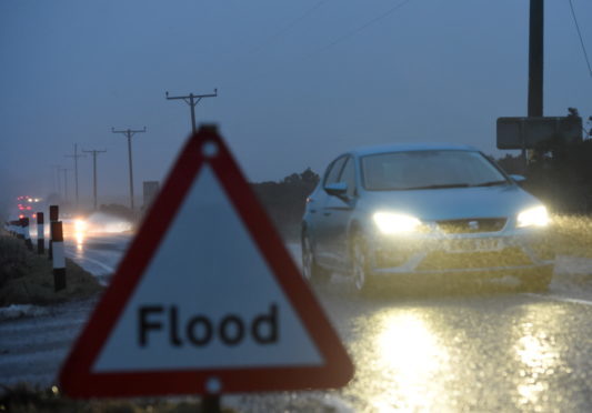
Flood warnings have been issued for parts of Perthshire following an overnight downpour associated with the arrival of Storm Gareth.

Though Tayside and Fife is expected to avoid the worst of the poor weather conditions, heavy overnight rainfall has led to the Scottish Environment Protection Agency (Sepa) highlighting rising water levels on the River Earn.

The organisation has flood warnings in force from Crieff to Innerpeffray and Bridge of Earn, and between Carse of Lennoch and Lochlane.

A Sepa statement reads: “River levels on the River Earn are high following overnight rain.

“River levels have been slowly dropping during Tuesday morning but there will likely remain some localised flooding of low lying agricultural areas during the next few hours.”

Met Office weather warnings covering England, Wales, Northern Ireland and parts of Scotland are in force for Tuesday and Wednesday after the forecaster warned that Storm Gareth could bring travel disruption and power cuts.

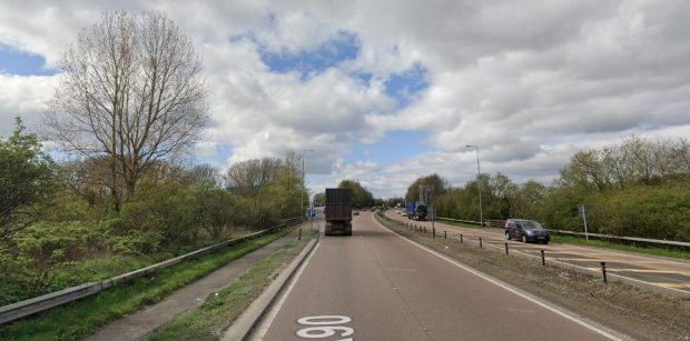
Tayside and Fife experienced heavy rainfall overnight, with windy conditions due to set in from Tuesday into Wednesday.

A Met Office spokesman said gusts of up to 55mph could batter the region.

However no Met Office warnings are yet in place for the local area.

The spokesman added: “Your area isn’t in the warning area but we’ll still see pretty strong winds in your neck of the woods and a spell of heavy rain. First thing on Tuesday the rain should have cleared away and there will be brightness and sunny spells.

“By Tuesday evening (there could be) overnight gusts of 55mph. It will stay strong into Wednesday morning as well. Tuesday night into Wednesday, with gusts of up to 50mph or so.

“The rest of the week will stay fairly unsettled. It will turn colder and then turn a bit more showery in nature.”

The weather is being caused by an area of low pressure moving in from the Atlantic.