Calendar An icon of a desk calendar. Cancel An icon of a circle with a diagonal line across. Caret An icon of a block arrow pointing to the right. Email An icon of a paper envelope. Facebook An icon of the Facebook "f" mark. Google An icon of the Google "G" mark. Linked In An icon of the Linked In "in" mark. Logout An icon representing logout. Profile An icon that resembles human head and shoulders. Telephone An icon of a traditional telephone receiver. Tick An icon of a tick mark. Is Public An icon of a human eye and eyelashes. Is Not Public An icon of a human eye and eyelashes with a diagonal line through it. Pause Icon A two-lined pause icon for stopping interactions. Quote Mark A opening quote mark. Quote Mark A closing quote mark. Arrow An icon of an arrow. Folder An icon of a paper folder. Breaking An icon of an exclamation mark on a circular background. Camera An icon of a digital camera. Caret An icon of a caret arrow. Clock An icon of a clock face. Close An icon of the an X shape. Close Icon An icon used to represent where to interact to collapse or dismiss a component Comment An icon of a speech bubble. Comments An icon of a speech bubble, denoting user comments. Comments An icon of a speech bubble, denoting user comments. Ellipsis An icon of 3 horizontal dots. Envelope An icon of a paper envelope. Facebook An icon of a facebook f logo. Camera An icon of a digital camera. Home An icon of a house. Instagram An icon of the Instagram logo. LinkedIn An icon of the LinkedIn logo. Magnifying Glass An icon of a magnifying glass. Search Icon A magnifying glass icon that is used to represent the function of searching. Menu An icon of 3 horizontal lines. Hamburger Menu Icon An icon used to represent a collapsed menu. Next An icon of an arrow pointing to the right. Notice An explanation mark centred inside a circle. Previous An icon of an arrow pointing to the left. Rating An icon of a star. Tag An icon of a tag. Twitter An icon of the Twitter logo. Video Camera An icon of a video camera shape. Speech Bubble Icon A icon displaying a speech bubble WhatsApp An icon of the WhatsApp logo. Information An icon of an information logo. Plus A mathematical 'plus' symbol. Duration An icon indicating Time. Success Tick An icon of a green tick. Success Tick Timeout An icon of a greyed out success tick. Loading Spinner An icon of a loading spinner. Facebook Messenger An icon of the facebook messenger app logo. Facebook An icon of a facebook f logo. Facebook Messenger An icon of the Twitter app logo. LinkedIn An icon of the LinkedIn logo. WhatsApp Messenger An icon of the Whatsapp messenger app logo. Email An icon of an mail envelope. Copy link A decentered black square over a white square.

THREE snow warnings in effect for almost all of Tayside and Fife until Wednesday

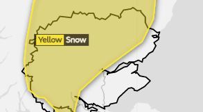
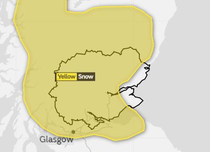
Winter weather warnings covering almost all of Tayside and Fife will be in effect until Wednesday afternoon.

The Met Office said snow is likely across much of Courier Country from Monday into Wednesday – most prominent in the hills, but still possible at lower levels.

Three warnings of the white stuff are in place across Tayside and Fife; one from 6am until midnight on Monday, another from midnight until 3pm on Tuesday and a third from midnight until 3pm on Wednesday.

Travel is likely to be effected as the cold conditions endure.

Monday’s Met Office warning
Tuesday’s Met Office warning

A weather system is moving in from the south of the UK into Scotland on Monday, mingling with cold air to bring rain and “heavy snow” to regions.

Up to 2in could land on higher ground with “wet snow” possible at lower levels, however Dundee and the Angus and Fife coast look likely to avoid the wintry showers.

The Monday warning adds: “The snow is likely to be affecting southern parts of the warning area in the morning spreading northwards to other parts later in the day. At present there is still some uncertainty in exact snow levels.”

On Tuesday as much as 5.9in of snow could land on the highest routes with between 2in – 3.9in landing possible on ground above 656ft.

Tuesday’s Met Office warning states: “Snow will be more persistent over higher ground with 5-10cm above 200m and a chance of locally 15cm across the highest routes.

“There is also the possibility of a few slushy centimetres gathering locally at low levels, but away from the immediate coast.

“As milder air pushes up from the south through the morning, snow across the south of the warning area and the Central Belt will become confined to hills, and slowly turn to rain again even on high ground here by late morning.”

The third weather warning claims the snow will “persist” – mostly on higher ground – until Wednesday afternoon.